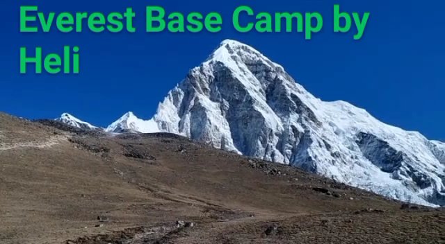
The Gokyo Lakes are among the most beautiful high-altitude lakes in the world. Sitting at over 4,700 metres in the Ngozumpa Glacier valley of the Khumbu region, the five main lakes of the Gokyo system glow with an extraordinary turquoise colour — a shade so vivid and so unexpected at altitude that most trekkers who see them for the first time refuse to believe they are real. Add the panoramic summit of Gokyo Ri (5,357m) directly above the lakes, the largest glacier in Nepal running at their edge, and views of four 8,000-metre peaks from a single vantage point, and you have one of the finest trekking destinations in the Himalaya — one that remains significantly less crowded than the Everest Base Camp corridor that runs parallel to it.
This guide covers the complete Gokyo Lakes trekking experience: the route from Lukla through the Dudh Koshi valley, the individual lakes and what makes each remarkable, the ascent of Gokyo Ri and its summit panorama, the Ngozumpa Glacier and how to approach it safely, the best time of year to visit, a full day-by-day itinerary, accommodation and food at Gokyo village, how the Gokyo route compares to the standard EBC route, combination itineraries that include both destinations, permits, costs, and preparation advice. Whether you plan this as a standalone trek or as part of a longer Khumbu adventure — such as the Three Passes circuit available through Everest Trek Company — the Gokyo Lakes will be among the most memorable landscapes you ever walk through.
The Five Gokyo Lakes: Overview and Altitude
The Gokyo Lakes are a series of six glacial lakes formed by the meltwater of the Ngozumpa Glacier. The five main lakes recognised in the trekking literature are Dudh Pokhari (Lake 1), Taboche Tsho (Lake 2), Dudh Pokhari / Gokyo Lake (Lake 3, the main lake beside Gokyo village), Thonak Tsho (Lake 4), and Ngozumpa Tsho (Lake 5). A sixth lake, Gyazumpa Tsho, sits further north and is visited only by trekkers who continue to the Cho Oyu base camp area.
| Lake | Local Name | Altitude | Distance from Gokyo Village | Key Feature |
|---|---|---|---|---|
| Lake 1 (Longponga Tsho) | Dudh Pokhari | 4,650m | 45 min south of Gokyo village | First lake encountered on the ascent from Machhermo; surrounded by moraine ridges |
| Lake 2 (Taboche Tsho) | Taboche Tsho | 4,690m | 20 min south of Gokyo village | Long narrow lake; excellent views of Taboche peak reflecting in still water |
| Lake 3 (Gokyo Lake) | Dudh Pokhari | 4,750m | Beside Gokyo village | The main lake; the vivid turquoise colour that appears in almost every Gokyo photograph; teahouses overlook it directly |
| Lake 4 (Thonak Tsho) | Thonak Tsho | 4,830m | 1.5 km north of Gokyo village | Largest of the five lakes by area; Ngozumpa Glacier terminus visible; sacred; less visited than Lake 3 |
| Lake 5 (Ngozumpa Tsho) | Ngozumpa Tsho | 4,990m | 3 km north of Gokyo village | Highest of the main lakes; dramatic position between glacier and moraine wall; superb Cho Oyu views |
The extraordinary turquoise colour of the Gokyo lakes results from the combination of glacial flour — ultra-fine rock particles suspended in the meltwater — and the angle at which high-altitude sunlight interacts with water of exceptional clarity. The Gokyo system is a Ramsar wetland site of international importance, designated for its ecological significance as a high-altitude lake ecosystem. Fishing is prohibited and the lakes are considered sacred by the Sherpa community; rituals are performed at the lakeside during festival seasons, and the cultural significance of the lakes is as profound as their visual beauty.
Planning Your Everest Trek?
Get local expert advice on cost, itinerary and the best time to go.
The Ngozumpa Glacier: Nepal’s Largest Glacier
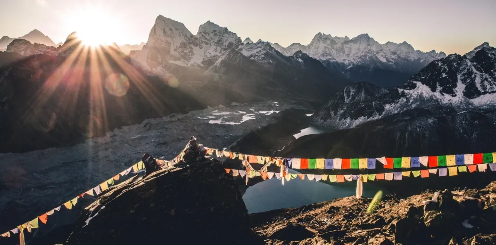
The Ngozumpa Glacier runs along the western edge of the Gokyo Lakes for the entire length of the valley. At approximately 36 kilometres in length, it is the largest glacier in Nepal and one of the largest in the Himalaya. Its surface is heavily debris-covered — blanketed by rock fall from the surrounding peaks — giving it a grey-brown appearance that contrasts sharply with the vivid turquoise of the lakes immediately alongside it. The glacier is melting rapidly as a result of climate change: it has lost significant volume over recent decades, and the moraines visible from the trekking trail mark the boundaries of its former extent, which was considerably larger as recently as the 1970s.
From the Gokyo valley floor, the Ngozumpa looks more like a rocky wasteland than a glacier — the surface debris cover completely hides the ice beneath. From Gokyo Ri summit above, the full scale of the glacier becomes comprehensible: a vast ice field stretching north toward Cho Oyu, flanked by the peaks of the Khumbu and filled with crevasse systems that are invisible from the valley but dramatic from above. Approaching the glacier surface is not recommended for trekkers without guide supervision — the heavily crevassed terrain under the debris cover can be unstable and dangerous.
Gokyo Ri: The Summit View
Gokyo Ri (5,357m) is the rocky peak that rises directly above Gokyo village. The ascent from Gokyo village takes 2 to 3 hours at a careful pace, and the summit delivers one of the most expansive mountain panoramas accessible to non-technical trekkers in the Himalaya. Unlike Kala Patthar, which is primarily a Everest viewpoint, Gokyo Ri offers a 360-degree panorama that includes four 8,000-metre peaks: Everest (8,848m), Lhotse (8,516m), Makalu (8,463m), and Cho Oyu (8,188m), plus the full length of the Ngozumpa Glacier and the five Gokyo Lakes spread below.
| Direction from Gokyo Ri Summit | Key Features Visible | 8,000m Peaks |
|---|---|---|
| East / Northeast | Mount Everest (distant but clear from right vantage); Lhotse south face; Nuptse ridge; Khumbu Icefall in the far distance | Everest 8,848m; Lhotse 8,516m |
| Southeast | Makalu pyramid — one of the most distinctive peak shapes in the Himalaya; Baruntse | Makalu 8,463m |
| Northwest | Cho Oyu — massive and broad; the closest 8,000m peak to the viewpoint; often showing its full north face | Cho Oyu 8,188m |
| West / Southwest | Gyachung Kang (7,952m); Kangchung; distant Tibet plateau ridges | Gyachung Kang sub-8000m |
| North | Upper Ngozumpa Glacier; Cho Oyu base camp area; remote high-altitude valleys extending toward Tibet | Cho Oyu approach face |
| Below (straight down) | The five Gokyo Lakes stretching south; Gokyo village beside Lake 3; the full debris surface of the Ngozumpa Glacier | Lakes from above — the defining view |
Gokyo Ri Ascent: Route and Timing
- Starting point: Gokyo village (4,790m), beside Lake 3. The trail begins at the northern end of the village and is clearly marked with cairns and prayer flags.
- Duration: 2–3 hours ascent at a careful pace; 1.5–2 hours descent. Total round trip 3.5–5 hours.
- Terrain: Steep trail on loose rock and scree for most of the ascent; the upper section involves boulder scrambling. No technical climbing required.
- Best timing: Pre-dawn departure (4:30–5:30am) for sunrise on the summit — the dawn light on four 8,000m peaks simultaneously is one of the finest sunrise experiences in the Himalaya. Early morning (by 8am departure) also excellent. Afternoon visibility typically poor due to cloud build-up.
- Altitude gain: Approximately 567 metres from village to summit (4,790m to 5,357m).
- Difficulty: Moderately demanding at altitude; the steep terrain and altitude combine to make it harder than it looks. Trekkers who have acclimatised well at Gokyo village (typically after 2 nights at altitude) manage it comfortably.
The Gokyo Trek Route: Day-by-Day Itinerary
The standard Gokyo Lakes trek follows the same route as the EBC trek from Lukla to Namche Bazaar, then diverges up the Dudh Koshi valley to Dole and Machhermo before reaching Gokyo. The classic route is 12–14 days for the round trip from Kathmandu including flights.
| Day | Route | Overnight Altitude | Walking Hours | Key Highlights |
|---|---|---|---|---|
| 1 | Fly Kathmandu to Lukla; trek to Phakding | 2,652m | 3–4h walking | Lukla landing (one of the world’s most dramatic airports); start of the trek; first suspension bridges over Dudh Koshi river |
| 2 | Phakding to Namche Bazaar | 3,440m | 5–6h | Sagarmatha National Park entrance; Hillary Suspension Bridge; steep climb to Namche; first Everest views on the ascent |
| 3 | Namche Bazaar (acclimatisation day) | 3,440m / 3,880m hike | 2–3h walk | Hike to Everest View Hotel; Namche market; Sherpa museum; first proper views of Everest, Lhotse, and Ama Dablam |
| 4 | Namche Bazaar to Dole | 4,110m | 5–6h | Diverge from main EBC trail at Sanasa; rhododendron forests (stunning in spring bloom); Mong La viewpoint; Phortse village visible across valley |
| 5 | Dole to Machhermo | 4,470m | 4–5h | Gradual ascent through increasingly barren high-altitude landscape; crossing 4,000m; first glimpses of the Cho Oyu massif ahead |
| 6 | Machhermo to Gokyo | 4,790m | 4–5h | First appearance of the Ngozumpa Glacier; crossing the lateral moraine; arrival at Lake 1, then Lake 2, then the extraordinary Lake 3 and Gokyo village |
| 7 | Gokyo (acclimatisation day) | 4,790m | 3–4h walk | Hike to Lake 4 and Lake 5; afternoon exploration of lakeside trail; Cho Oyu views; glacial moraine walk; preparation for Gokyo Ri summit attempt |
| 8 | Gokyo Ri ascent and descent; optional Lake 4 / 5 afternoon walk | 4,790m (Gokyo) | 4–5h | Pre-dawn summit of Gokyo Ri (5,357m); four 8,000m peaks simultaneously; Gokyo Lakes from above; descent to village for late breakfast |
| 9 | Gokyo to Dole (descent begins) | 4,110m | 4–5h | Rapid altitude loss; landscape transitions from glacial to alpine; legs feel the descent; improving air with lower altitude |
| 10 | Dole to Namche Bazaar | 3,440m | 5–6h | Long descent; rhododendron forests; welcome warmth at lower elevation; Namche restaurants and hot showers |
| 11 | Namche Bazaar to Lukla | 2,860m | 6–7h | Long but straightforward descent; suspension bridges; final views of Ama Dablam; Lukla celebration dinner |
| 12 | Fly Lukla to Kathmandu | 1,400m | Flight day | Build in 1–2 buffer days; Lukla weather delays common; celebrate the trek in Kathmandu |
Gokyo vs Everest Base Camp: Which Trek Should You Choose?
| Factor | Gokyo Lakes Trek | Everest Base Camp Trek |
|---|---|---|
| Maximum altitude | 5,357m (Gokyo Ri summit) | 5,645m (Kala Patthar); 5,364m (EBC) |
| Primary attraction | Spectacular turquoise lakes; Gokyo Ri panorama; Ngozumpa Glacier; relative solitude | Kala Patthar view of Everest; standing at the foot of the world’s highest mountain; Hillary history |
| Crowd level | Significantly fewer trekkers; peaceful teahouses; trail much quieter | Very high in peak season; Gorakshep can be crowded; Namche extremely busy |
| Scenery variety | Glacier, lakes, alpine meadows, rhododendron forests — very diverse | River gorges, forests, high moraine, glacial terrain — also very diverse but differently |
| Physical demand | Slightly less demanding overall (lower max altitude); comparable daily walking | Higher maximum altitude; more cumulative altitude exposure |
| Closest Everest view | Good from Gokyo Ri but Everest is 20km distant; less detailed than Kala Patthar | Outstanding from Kala Patthar; Everest fills the view at 7km distance |
| Best for | Photography; nature; those who want lakes and glacier variety; returning trekkers who have done EBC | Those specifically motivated by Everest history and wanting the closest possible view of the summit |
| Can be combined? | Yes — the Three Passes circuit includes both; or via Cho La Pass (5,420m) | Yes — Three Passes or via Renjo La |
The honest answer for most trekkers: both destinations are extraordinary, and if time and fitness allow, combining them is vastly more satisfying than choosing one. The Three Passes circuit — crossing the Renjo La (5,360m), Cho La (5,420m), and Kongma La (5,535m) — links Gokyo and EBC into a single 18–21 day loop that covers the best of the entire Khumbu region. For those limited to 12–14 days, the Gokyo route offers a quieter, equally beautiful alternative to the EBC corridor, particularly appealing to photographers and those who have already done EBC.
The Cho La Pass: Connecting Gokyo to Everest Base Camp
The Cho La Pass (5,420m) is a high glaciated pass that connects the Gokyo valley to the Khumbu valley, allowing trekkers to walk from Gokyo directly to Dzongla and Lobuche — from where the standard EBC route continues to Gorakshep. The Cho La crossing adds 2 days and significant challenge to a Gokyo itinerary but creates the most satisfying combination of both destinations without requiring a full Three Passes circuit.
- Technical difficulty: The Cho La involves a short section of glacier crossing that requires basic crampon skills and ideally a guide experienced with the route. The pass is not a technical climb, but the glaciated section requires careful footing. A guide is strongly recommended for this crossing.
- Typical timing: Start very early (4am departure from Thaknak or Dragnag) to cross before the snow softens in afternoon heat. Allow 5–6 hours to reach Dzongla on the eastern side.
- Season considerations: The Cho La can be blocked by snow from late November to March. In October and April (peak seasons), it is typically passable. Confirm conditions with your guide or teahouse owners the evening before.
- Gear required: Crampons and ice axe (your guide will advise on whether an axe is needed on the specific day depending on conditions). Trekking poles essential. Gaiters strongly recommended.
- Reward: Completing the Gokyo to EBC crossing via Cho La is one of the most satisfying multi-day trekking achievements available in the Himalaya — connecting two of the world’s most famous trekking destinations through a high mountain pass.
Accommodation and Food at Gokyo Village
Gokyo village (4,790m) is a small permanent settlement of teahouses and lodges built on the edge of Lake 3. There are approximately 8–12 teahouses operating during the main trekking seasons (October–November and March–May), ranging from basic rooms with shared facilities to somewhat more comfortable lodges with attached bathrooms. All are fundamentally similar in quality to high-altitude Khumbu teahouses generally — clean, simple, cold at night, with communal dining areas heated by yak-dung stoves.
| Category | Detail |
|---|---|
| Room cost | NPR 300–800 per person per night ($2.25–$6); rooms often subsidised if you eat at the lodge |
| Meal cost | NPR 400–800 per meal ($3–$6); dal bhat, pasta, noodles, rice dishes; Tibetan bread; soup options |
| Heating | Yak-dung stoves in common room; rooms unheated; temperature below 0°C at night |
| Electricity | Solar panels; charging available (NPR 400–700/device); intermittent in cloudy weather |
| WiFi | Everest Link WiFi available; cost NPR 400–800/day; slow but functional for text messaging |
| Water | Boiled water available; purification tablets or filter recommended; lake water not suitable untreated |
| Altitude acclimatisation advantage | Gokyo village is at 4,790m — requires good prior acclimatisation from Machhermo before arrival |
Best Time to Visit Gokyo Lakes
| Season | Months | Weather | Lake Colour | Trail Conditions | Crowds | Verdict |
|---|---|---|---|---|---|---|
| Spring | March, April, May | Cold at altitude; warming; rhododendron bloom in lower sections (March–April) | Outstanding turquoise when skies are clear | Good to excellent; minimal snow above 4,500m by mid-April | High in April–May | Excellent — rhododendron bloom adds colour to the lower trek; April is the sweet spot |
| Monsoon | June, July, August | Rain and cloud in lower sections; less precipitation above 4,500m than you might expect | Still vivid but often viewed through cloud | Leeches below 3,500m; wet trails; landslide risk on some sections | Low | Not recommended for Gokyo Ri views; possible for adventurous trekkers focused on lakes alone |
| Autumn | September, October, November | Post-monsoon clarity; best visibility of the year; increasingly cold through November | Most vivid of any season — the October sky makes the turquoise more intense | Excellent; dry and clear | Very high in October; moderate in September and November | October is arguably the finest month for Gokyo |
| Winter | December, January, February | Very cold; strong winds possible; excellent clarity on calm days | Lakes may partially freeze (Ice cover on Lake 5 common from December) | Snow above 4,000m; some sections require microspikes | Very low | For experienced cold-weather trekkers only; rewards those who attempt it with extraordinary solitude |
Permits Required for the Gokyo Trek
- TIMS Card (Trekkers’ Information Management System): Required for all trekkers; obtained through TAAN (Trekking Agencies’ Association of Nepal) or Nepal Tourism Board offices in Kathmandu; cost approximately NPR 2,000 ($15).
- Sagarmatha National Park Permit: Required for entry to the national park, which encompasses the entire Gokyo valley; cost NPR 3,000 ($23) for SAARC nationals, NPR 3,000 ($23) for others. Obtained at the park entrance in Monjo or in advance at the national park office in Kathmandu.
- Guide requirement (since 2023): The Government of Nepal’s 2023 regulation requires all trekkers in the Khumbu region to be accompanied by a licensed guide. Solo trekking is no longer officially permitted. Guides must be registered with the Nepal Tourism Board.
- No separate lake access fee: There is no additional fee specifically for the Gokyo Lakes beyond the national park permit. The lakes are within the national park boundary.
Wildlife and Ecology of the Gokyo Valley
The Gokyo valley is within Sagarmatha National Park and part of the Khumbu Biosphere Reserve, one of the world’s highest protected ecosystems. The biodiversity at these altitudes is limited by extreme conditions but includes some species found nowhere else and others that are rarely seen in more accessible locations.
| Species | Type | Where to Look | Best Season |
|---|---|---|---|
| Snow leopard | Mammal (elusive) | High rocky ridges; occasionally spotted near Gokyo Ri; signs visible on moraine | Winter (when prey comes to lower elevations) |
| Himalayan tahr | Mountain ungulate | Rocky slopes between Machhermo and Gokyo; common on ridge faces | Year round; most visible spring and autumn |
| Himalayan monal | Bird (Nepal’s national bird) | Forest sections between Dole and Machhermo; rhododendron areas | Spring (males display in breeding season) |
| Bar-headed goose | Bird (migratory) | Gokyo Lakes; rest stop on migration route over Himalaya | Autumn migration (October); spring migration (April–May) |
| Ruddy shelduck | Bird | Lake shores; particularly Lake 3 and Lake 4 | Year round; pairs nesting in spring |
| Himalayan wolf | Mammal (rare) | High meadows above Gokyo; occasionally spotted on Gokyo Ri trail | Autumn and winter |
| Bhutan glory butterfly | Insect (endemic) | Lower valley forest sections in spring | March–May |
The Gokyo Lakes themselves support a fragile aquatic ecosystem of algae, zooplankton, and cold-water invertebrates that forms the base of the food chain supporting the waterbirds that use the lakes as a migration waypoint. The bar-headed goose is particularly remarkable — one of the world’s highest-flying birds, capable of crossing the Himalayan range at altitudes that would incapacitate most other species. Watching a flight of bar-headed geese descend to the turquoise surface of Lake 3 at dawn is one of the more extraordinary wildlife experiences available on the Gokyo trek.
Photography at the Gokyo Lakes
The Gokyo Lakes are among the most photographed natural subjects in Nepal. The combination of the extraordinary lake colour, the dramatic mountain backdrop, and the human elements (yak caravans, prayer flags, teahouse smoke) creates conditions that reward almost any photographer. Some specific guidance for getting the most from the visual opportunities:
- Lake 3 at dawn: The morning light on the lake before the wind picks up produces mirror-like reflections of Cholatse and Taboche peaks. Arrive at the lakeside 30 minutes before sunrise. The stillness of the water is usually lost by 9am as the valley wind begins.
- Gokyo Ri summit at sunrise: The pre-dawn ascent delivers four 8,000m peaks in alpenglow simultaneously — a composition that is essentially impossible to replicate anywhere else on earth. Bring a wide-angle lens for this.
- Lake 4 and Lake 5 in afternoon light: The northern lakes receive dramatic side-lighting in late afternoon (3–5pm) from the westward sun. The Ngozumpa Glacier alongside Lake 4 in raking afternoon light creates extraordinary texture compositions.
- Yak caravans on the moraine: Yak trains cross the lateral moraine above the lakes regularly during the trekking season, transporting supplies to Gokyo village. The combination of yaks and glacier in the same frame is unique to this type of Himalayan valley.
- Polarising filter: A circular polarising filter deepens the lake colour significantly and reduces surface glare at midday. At altitude, the UV-rich light means the polariser’s effect is stronger than at sea level.
Physical Preparation and Fitness for Gokyo Lakes Trek
The Gokyo trek is slightly less physically demanding than the full EBC route in terms of maximum altitude (5,357m vs 5,645m), but is otherwise comparable in daily effort and trail conditions. The specific physical demands include sustained uphill walking on rocky trails for 5–7 hours daily, altitude exposure above 4,000m for 5–7 consecutive nights, the Gokyo Ri ascent which is steep and demanding at altitude, and the long descent days that stress knee joints and quadriceps.
| Fitness Element | Minimum Required Level | Training Recommendation | Timeline Before Trek |
|---|---|---|---|
| Cardiovascular base | Able to sustain 5–7 hours moderate aerobic activity | Run, cycle, or swim 4–5 days per week at moderate intensity; build to 60+ min continuous sessions | Start 12 weeks before trek |
| Uphill endurance | Able to climb 600–800m altitude gain in 4–5 hours | Hiking on steep terrain with a 5–8kg day pack; stair climbing sessions | At least 8 weeks before trek; weekly hill hikes essential |
| Downhill knee strength | Able to descend 1,000m+ on rough terrain without knee pain | Eccentric quad strengthening (slow downhill on steps); lunges; step-downs | 8–10 weeks before; most important for those over 50 |
| Ankle stability | Able to walk on uneven rocky terrain with confidence | Single-leg balance exercises; ankle strengthening on unstable surfaces; proper trail boot break-in | 8 weeks before; boot break-in must be complete before trek |
| Cold tolerance management | Able to sleep comfortably in 0°C to -5°C conditions | Test sleeping bag in cold conditions before departure; layer appropriately for sleeping | Test during pre-trek camping if possible |
Altitude Sickness Risk on the Gokyo Route
The Gokyo route has a slightly different altitude profile from the EBC route, which has important implications for acclimatisation management. The ascent from Namche (3,440m) to Gokyo (4,790m) via Dole and Machhermo gains altitude more steeply in fewer days than the EBC route, which traverses Tengboche and Dingboche more gradually. This means the acclimatisation day at Gokyo village is particularly important — do not skip it even if you feel good.
The acclimatisation hike to Lake 4 and Lake 5 on the rest day at Gokyo is the “climb high, sleep low” exercise that prepares your body for the Gokyo Ri attempt the following morning. Reaching Lake 5 (4,990m) and returning to sleep at Gokyo (4,790m) is a textbook high-altitude acclimatisation strategy. Some trekkers who feel particularly strong will continue beyond Lake 5 toward the Cho Oyu base camp area (5,300m+), but this should only be attempted by those with confirmed good acclimatisation and no AMS symptoms.
Planning Your Everest Trek?
Get local expert advice on cost, itinerary and the best time to go.
Packing List for the Gokyo Trek
| Category | Essential Items | Notes |
|---|---|---|
| Insulation | Down jacket (800+ fill); fleece mid-layer; thermal base layers (2 sets) | Nights at Gokyo reach -10°C in October; -15°C or below in November |
| Rain and wind protection | Hardshell jacket; waterproof trousers; pack cover | Monsoon shoulder seasons see afternoon rain in lower sections |
| Footwear | Waterproof trekking boots (ankle support); camp shoes or sandals; gaiters | Boot break-in essential; carry microspikes if trekking in November or early spring |
| Hands and head | Expedition mittens; thin glove liners; balaclava; warm hat; buff; glacier glasses (Cat 4) | All essential for Gokyo Ri summit attempt; keep mittens accessible not buried in pack |
| Navigation and safety | Offline maps (downloaded in Kathmandu); headlamp with spare batteries; personal first aid kit; diamox if prescribed | Satellite communicator (Garmin InReach) highly recommended, especially for solo or small groups |
| Health and altitude | Pulse oximeter; diamox (Acetazolamide) if prescribed; ibuprofen; oral rehydration salts; water purification | Buy diamox before departure from home — not reliably available on trail |
| Photography | Camera with wide-angle and telephoto options; 2–3 spare batteries kept warm; multiple SD cards; lens cloths; tripod | Download offline camera maps; charge everything fully in Namche (last reliable power before Gokyo) |
| Sleeping | Sleeping bag rated to -15°C (or -10°C plus liner); earplugs; eye mask | Sleeping bag critical at Gokyo altitude; teahouse blankets alone insufficient in peak cold season |
Cultural Significance of the Gokyo Valley for Sherpa People
The Gokyo valley has deep cultural and spiritual significance for the Sherpa people of the Khumbu. The lakes themselves are considered sacred in the Sherpa Tibetan Buddhist tradition — each lake is associated with protective deities, and rituals are performed at the lakeside during the annual Mani Rimdu festival and during other ceremonial occasions. The practice of circumambulating (walking clockwise around) the lakes is a traditional act of devotion still performed by Sherpa pilgrims.
The high pastures of the Gokyo valley have been used for summer grazing by Sherpa yak herders for centuries. The stone walls and yak herding shelters visible throughout the valley are evidence of this long pastoral tradition. In summer (June–August), when trekkers are fewer, the valley fills with yak herds and their herders camping in the upper pastures — one of the most authentic remaining expressions of the traditional Khumbu high-altitude pastoral economy.
Frequently Asked Questions About the Gokyo Lakes Trek
How many days does the Gokyo Lakes trek take?
The standard round-trip Gokyo trek from Lukla takes 10–12 trekking days, plus flights to and from Lukla (1 day each way, with weather buffer days recommended). Total time from Kathmandu including pre-trek preparation and post-trek recovery is typically 14–16 days. If combining with EBC via the Cho La pass, add 3–4 days. The full Three Passes circuit takes 18–21 days.
How does the Gokyo route differ from the EBC route in terms of difficulty?
Both routes share the same approach from Lukla to Namche. Above Namche, the Gokyo route diverges up the Dudh Koshi valley through Dole and Machhermo to Gokyo. The Gokyo route’s maximum altitude of 5,357m (Gokyo Ri) is approximately 290 metres lower than Kala Patthar (5,645m), making altitude exposure slightly less extreme. The daily trail conditions are comparable — rocky paths, significant ascent and descent daily, exposed high-altitude terrain above 4,500m. Overall physical demand is similar; altitude-related risk is modestly lower on the Gokyo route.
Can you see Mount Everest from the Gokyo Lakes?
Everest is not visible from the lake level — the surrounding ridges block the sightline. From the summit of Gokyo Ri (5,357m), Everest is visible to the northeast, approximately 20km distant. The view is clear and recognisable but less detailed and dramatic than the close view from Kala Patthar (7km from Everest). The Gokyo Ri panorama compensates for the greater Everest distance by offering three additional 8,000m peaks (Lhotse, Makalu, and the nearby Cho Oyu) plus the remarkable below-angle view of the five lakes and the full length of the Ngozumpa Glacier.
Is it safe to swim in the Gokyo Lakes?
Swimming is strongly discouraged for two reasons. First, the lakes are sacred to the Sherpa community, and bathing in them is considered disrespectful. Second, the water temperature is close to 0°C throughout the year — cold shock and hypothermia from swimming would be genuinely dangerous at altitude, far from any medical facility. Appreciate the lakes visually and culturally; leave them undisturbed.
What is the best single day on the Gokyo trek?
Almost universally: the Gokyo Ri sunrise ascent. Leaving Gokyo village by headlamp at 5am, watching the sky transition from black to deep blue to the first orange of dawn, reaching the summit as four of the world’s highest mountains simultaneously catch alpenglow — this is one of the finest experiences available to a non-technical hiker anywhere in the world. Close second: the day of arrival at Gokyo village itself, when the lakes first appear as you descend toward them from the moraine ridge above — the sudden appearance of that extraordinary turquoise colour against the grey rock and white snow is the classic Gokyo visual moment. Planning this Himalayan trekking adventure around the Gokyo route rewards trekkers with scenery that rivals anything in the world.
How long does it take to hike to Lake 5 from Gokyo village?
Lake 5 (Ngozumpa Tsho) is approximately 3 kilometres north of Gokyo village. On the well-marked trail along the lateral moraine, the walk to Lake 5 takes 1.5 to 2 hours at a comfortable pace. The altitude gain from Gokyo village (4,790m) to Lake 5 (4,990m) is around 200 metres, which feels significant at this elevation. Most trekkers visit Lakes 4 and 5 on the acclimatisation rest day, reaching Lake 5 by late morning and returning to Gokyo for lunch, leaving the afternoon free for rest and preparation for the next morning’s Gokyo Ri ascent.
Do you need crampons for the Gokyo trek?
For the standard Gokyo trek without the Cho La crossing, crampons are not normally required in October or April. In November or early spring (March), ice can form on the trail sections above 4,500m, and microspikes (a lighter crampon alternative) are useful. For the Cho La crossing specifically, crampons are required for the glacier section — your guide will advise based on current conditions. Never attempt the Cho La without proper footwear for the glaciated terrain.
Is there a medical facility at Gokyo?
There is no permanent medical facility at Gokyo village. The nearest Himalayan Rescue Association clinic is at Pheriche (4,371m), which is on the EBC route side of the valley — not directly accessible from Gokyo without crossing the Cho La or descending all the way to Namche. Machhermo (4,470m), one day below Gokyo, occasionally has a seasonal health post operating during peak trekking season, but this is not guaranteed. This medical isolation is one reason why carrying a pulse oximeter, recognising AMS symptoms early, and descending promptly when indicated are more important on the Gokyo route than on the EBC route (where Pheriche and its clinic are directly accessible).
Detailed Day-by-Day Description: What the Gokyo Trek Actually Feels Like
Lukla to Phakding (Day 1)
The Tenzing-Hillary Airport at Lukla (2,860m) is one of the most thrilling arrivals in the world. The runway is short, sloped, and ends at a cliff: the plane accelerates briefly downhill to gain speed and lands uphill to decelerate naturally. The airport sits at one end of a steep ridge; the town of Lukla is immediately below it. After collecting your kit and completing the initial formalities, the trail descends steeply to the Dudh Koshi river gorge and then follows the river upstream through a series of small villages and suspension bridges to Phakding (2,652m).
The walking on Day 1 is relatively gentle — descent from Lukla, flat walking along the river, some short climbs between villages. This is intentional: the first day should be easy to allow bodies to adjust to the beginning of altitude exposure and the physical reality of trekking after what may have been a long journey from home. The landscape is immediately dramatic: the Dudh Koshi gorge is deep and forested, prayer flags span the river at every suspension bridge, and the first views of distant snowy peaks appear above the gorge walls.
Phakding to Namche Bazaar (Day 2)
The approach to Namche from Phakding involves crossing multiple suspension bridges over the Dudh Koshi and making an extended steep climb of around 600 metres from the river level to Namche Bazaar (3,440m). This section includes the entry into Sagarmatha National Park at Monjo and the Hillary Suspension Bridge — the longest and highest of the many bridges on this section of trail. The first view of Everest and Lhotse typically appears from a viewpoint on the steep climb above the bridge, visible through the valley notch above Namche — many trekkers stop here for the first time seeing the highest mountain on earth, even if only the upper pyramid is visible.
Namche Bazaar itself is remarkable — a horseshoe-shaped market town built into an amphitheatre of hillside, with a Saturday market that brings Tibetan traders across the border, Sherpa farmers from surrounding villages, and trekkers from across the world together in an extraordinary weekly bazaar. The town has bakeries, coffee shops, gear shops, pharmacies, internet cafes, and restaurants serving everything from yak steak to wood-fired pizza. It feels civilised in a way that later stops on the trail do not, and many trekkers appreciate the last hot shower and comfortable bed they will have for the next 10 days.
Namche Acclimatisation Day (Day 3)
The acclimatisation day at Namche is not optional — it is a medical requirement for safe altitude gain. The recommended activity is to hike to a higher viewpoint (the Everest View Hotel at 3,880m is the classic destination) and then return to sleep at Namche. The Hotel Everest View is the highest hotel in the world permanently staffed and accessible by trekking trail. From its terrace, on a clear day, Everest, Lhotse, Ama Dablam, Nuptse, Thamserku, and Kongde Peak are all visible simultaneously. The Sherpa museum near the top of Namche provides excellent context on Sherpa culture and the history of Himalayan climbing.
Namche to Dole (Day 4): The Gokyo Divergence
Day 4 is where the Gokyo trek diverges from the standard EBC route. At Sanasa (3,600m), a junction above Namche, the EBC route continues east toward Tengboche while the Gokyo route turns north and west, climbing toward Mong La and then following the valley above the Dudh Koshi toward Dole. This section involves a significant uphill climb through rhododendron and juniper forest — at their absolute peak in March and April when the flowers colour the trail in red and pink. From the high point above Dole, the Cho Oyu massif appears to the northwest for the first time, giving a sense of the scale of what lies ahead.
Dole (4,110m) is a small settlement of teahouses beside a stream. The altitude here begins to feel noticeable — exertion produces more breathlessness than at similar effort levels at sea level. Sleep at Dole is typically lighter than below, with some trekkers experiencing mild headache that resolves overnight. This is normal acclimatisation response and not a cause for concern unless symptoms worsen through the night or include vomiting.
Dole to Machhermo (Day 5)
The trail from Dole to Machhermo follows the hillside above the Dudh Koshi valley, gaining altitude gradually through a landscape that transitions from scrubby juniper and dwarf rhododendron at Dole to more open alpine terrain by Machhermo. The valley opens up as you gain height, and the first views of the distant glaciated peaks that surround Gokyo begin to appear. Machhermo (4,470m) is another small teahouse settlement and sits at the altitude threshold where most trekkers begin to feel more significant effects of thin air — sleeping more slowly, appetite slightly reduced, slightly elevated resting breathing rate.
The Yeti attack memorial at Machhermo is a peculiar landmark: a stone erected by the villagers to commemorate an attack on a Sherpa woman and her yaks by what witnesses described as a large bipedal creature in the 1970s. Whether or not the Yeti exists, the memorial is an authentic piece of local history and reflects the genuine belief in such creatures among many Sherpa people.
Machhermo to Gokyo (Day 6): First View of the Lakes
This is one of the great approach days in all of trekking. The trail from Machhermo crosses increasingly rocky terrain, ascending a series of lateral moraine ridges left by the retreating Ngozumpa Glacier. The first view of the glacier itself — an enormous grey-brown expanse of debris-covered ice stretching north — arrives before the first lake appears. Then, descending slightly toward the valley floor from the last moraine ridge, Lake 1 appears below — the first of the turquoise lakes, smaller than the main lake but still vivid and unexpected against the grey rock.
The approach to Gokyo village then follows the western shore of Lake 2 before arriving at the shore of Lake 3 with the village beyond it. This arrival sequence — crossing the moraine, seeing the glacier, then the first lake, then the second lake, then the main lake with the village and Gokyo Ri rising directly behind it — is one of the most theatrically satisfying approaches in the Himalaya. Each element prepares you for the next, and the final reveal of Lake 3 in its full turquoise vividity with Cholatse and Taboche reflected in the water is a moment that almost every Gokyo trekker describes as the visual peak of the entire experience.
Gokyo Acclimatisation Day (Day 7): Lakes 4 and 5
The day at Gokyo provides the acclimatisation exercise needed before the Gokyo Ri summit attempt the following morning. The walk north from Gokyo village along the glacier’s lateral moraine to Lake 4 (Thonak Tsho, 4,830m) and then Lake 5 (Ngozumpa Tsho, 4,990m) is the recommended acclimatisation walk — gaining 200 metres of altitude before returning to sleep at the village.
Lake 4 is the largest of the five lakes and has a dramatic quality that is different from Lake 3’s postcard beauty. It is more austere, more remote-feeling, and the Ngozumpa Glacier terminus visible across the water gives it an end-of-the-world atmosphere. Lake 5 is the highest and most remote, with Cho Oyu filling the view to the north — from here the mountain appears immense, occupying the entire northern horizon, and the distance from this vantage point to the Cho Oyu summit is only about 7 kilometres. Sitting at Lake 5 at 4,990 metres with Cho Oyu filling the sky is a meditation on scale that rewards the effort of the walk from the village.
Gokyo Ri Summit Day (Day 8)
Departure from Gokyo village by headlamp at 5am. The first section of the Gokyo Ri trail rises steeply from the north end of the village up a rocky ridge marked by cairns and prayer flags. In the pre-dawn darkness, the headlamp beam picks up the pale stone of the trail and the occasional glint of frost on the surface. The cold at this hour at 4,790m is significant — temperatures typically between -10°C and -15°C, with any wind making the effective temperature lower.
As altitude is gained, the darkness below begins to separate into the black void of the glacier and the slightly lighter void of the lake surface. By about 5,300m, if conditions are clear, the eastern horizon begins to show the first lightening — a band of deep blue-grey above the distant Makalu massif. The pace slows dramatically in the final 200 metres of ascent, with deliberate breathing required for each section between rests. Then the summit — and the view opens in every direction simultaneously.
The Gokyo Ri summit experience at sunrise is best described as abundance: too much to take in, too many extraordinary things visible from a single point. Four of the fourteen 8,000m peaks. The five turquoise lakes far below. The full length of the Ngozumpa Glacier. The breadth of the Khumbu from Tibet to the southern hills. Cho Oyu so close it seems reachable. Most trekkers spend 30 to 60 minutes on the summit, trying to absorb and photograph all of it, invariably feeling that neither the time nor the photographs can capture what they are experiencing.
Responsible Trekking at the Gokyo Lakes
The Gokyo Lakes are among the most ecologically sensitive trekking destinations in Nepal. The Ramsar designation recognises their international ecological importance, and the Sherpa cultural significance of the lakes creates additional responsibilities for visiting trekkers. Specific guidelines for respectful and responsible behaviour at the lakes:
- Do not enter the lake water: Neither swimming nor wading is appropriate at any of the five lakes. The cultural prohibition is clear and the ecological fragility of the lake ecosystem means even minor physical disturbance to the shoreline and water column has measurable effects.
- Carry out all waste: The Sagarmatha Pollution Control Committee (SPCC) operates waste management systems in the Khumbu, but the Gokyo valley’s relative remoteness means that what you carry in, you must help carry out. Use the SPCC designated waste disposal points in Gokyo village. Do not bury or burn waste on the moraine.
- Stay on marked trails: The moraine and glacial terrain surrounding the lakes is fragile. Off-trail walking damages the thin soil crust and accelerates erosion on slopes that are already losing stability from glacier retreat. Stick to established paths.
- Minimise noise near the lakes: The bar-headed geese and other waterbirds that use the lakes are sensitive to disturbance. Approach the lakeshores quietly, especially in early morning when waterfowl are most active.
- Respect sacred sites: Small cairns, prayer flag poles, and offering sites around the lakes are active religious sites for Sherpa people. Do not move, add to, or disturb these sites without understanding their significance. Adding rocks to existing cairns is appropriate; creating new structures is not.
- Use teahouse facilities for washing: Do not wash clothes, cooking utensils, or yourself in or near the lake water. Use the facilities provided by teahouses, which use water drawn from safe sources away from the lake system.
Costs and Budget for the Gokyo Trek
| Cost Category | Budget Range (USD) | Notes |
|---|---|---|
| Kathmandu to Lukla flights (return) | $400–$600 | Price varies significantly with season and booking timing; book well ahead for October; budget airline options from Ramechhap reduce cost but add 4h drive each way |
| Licensed guide (required) | $25–$40 per day | 12–14 day trek = $300–$560 for guide fees; guide required by regulation since 2023; includes their food, accommodation, and insurance |
| Porter (optional but recommended) | $15–$25 per day | One porter per 2 trekkers typical; reduces daily pack weight from 12kg to 5–6kg; significantly improves trek enjoyment |
| Teahouse accommodation | $5–$15 per night | 14 nights = $70–$210; price rises with altitude; Namche most expensive; rooms often subsidised if eating at lodge |
| Meals on trail | $15–$30 per day | 14 days = $210–$420; prices double between Namche and Gokyo; 3 meals per day; dal bhat typically best value |
| Permits (TIMS + National Park) | $35–$40 total | TIMS approximately $15; Sagarmatha National Park approximately $23 |
| Gear and equipment | $200–$2,000+ | Wide range depending on whether gear is owned or rented; critical items (boots, sleeping bag, down jacket) worth buying quality |
| Travel insurance | $100–$300 | Essential; must cover helicopter evacuation from altitude; verify coverage explicitly |
| Total (excluding flights from home) | $1,200–$2,500 | Budget to comfortable mid-range; does not include gear purchase or Kathmandu costs |
The Gokyo Valley Through the Seasons: A Month-by-Month Overview
| Month | Temperature at Gokyo (Day / Night) | Lake Surface | Conditions | Trekker Numbers | Recommendation |
|---|---|---|---|---|---|
| January | -5°C / -18°C | Partially to fully frozen (Lake 5 almost always frozen) | Cold, dry, very clear; strong winds possible on Gokyo Ri | Very few | For cold-weather specialists only |
| February | -3°C / -15°C | Partially frozen; thawing toward month-end | Cold, clearing; occasional snow; pre-spring conditions | Few | Not generally recommended; better months ahead |
| March | 2°C / -8°C | Open and vivid; rhododendron bloom beginning below | Mix of clear days and occasional snowfall; warming rapidly by late March | Building | Good for early-season trekkers; rhododendron beginning by month’s end |
| April | 7°C / -5°C | Fully open; exceptional colour | Outstanding — stable weather windows, rhododendron in full bloom in lower valley | High | One of the two best months; spring bloom plus good mountain views |
| May | 10°C / -3°C | Fully open; cloud building more frequently by month’s end | Good early in month; pre-monsoon afternoon cloud increasing late May | High (Everest season) | Good but avoid late May as monsoon approaches; morning views best |
| June | 12°C / 0°C | Open; often viewed through cloud | Monsoon approaching; frequent afternoon cloud; leeches below 3,500m | Low | Not recommended for views |
| July | 12°C / 2°C | Open but frequently overcast | Full monsoon in lower elevations; wetter above 4,000m than many expect; trails slippery | Very low | Not recommended |
| August | 12°C / 2°C | Open; late monsoon | Similar to July but clearing beginning toward month-end | Very low | Not recommended for most trekkers |
| September | 8°C / -3°C | Vivid turquoise; post-monsoon clarity arriving | Post-monsoon views beginning; clearest skies arriving toward month-end; fresh snow on upper peaks | Building (late September) | Good especially from mid-September; lush green landscape post-monsoon |
| October | 5°C / -8°C | Most vivid of any month — the deep blue October sky intensifies the turquoise | Outstanding — the classic Gokyo season; stable weather, exceptional clarity, no cloud | Very high | The best month overall; book teahouses and guides well ahead |
| November | -2°C / -13°C | Vivid; Lake 5 may begin to ice at edges by month end | Excellent clarity; progressively colder; strong winds developing; quiet after October rush | Moderate and declining | Excellent for those prepared for cold; quieter and cheaper than October |
| December | -5°C / -16°C | Lake 5 icing; others open but cold | Cold and windy; very clear on good days; some routes may be snowed | Low | For cold-weather trekkers only; extraordinary solitude reward |
The Renjo La: An Alternative Approach to Gokyo
The Renjo La (5,360m) is a high mountain pass that connects the Gokyo valley to Thame in the west — a small Sherpa village accessible from Namche Bazaar. The Renjo La crossing provides an alternative approach to Gokyo that avoids retracing the standard ascent route from Namche via Dole and Machhermo. It is also one of the three passes in the Three Passes circuit, the complete loop of the Khumbu high passes that represents the most comprehensive trekking itinerary available in the region.
The view from the Renjo La summit is one of the finest high-pass views in the Himalaya — looking back east over the Gokyo Lakes from above, with all five lakes visible simultaneously in the valley below and the full panorama of the Gokyo Ri ridge and surrounding peaks stretching across the skyline. For trekkers who have already descended from Gokyo Ri and are leaving the valley, crossing the Renjo La westward creates the perfect final view of the lakes — seeing them from above one last time from a different high vantage point before descending to Thame and the return to Namche.
- Renjo La altitude: 5,360m
- From Gokyo to Renjo La: Approximately 4–5 hours; departs the main valley west, climbing steeply to the pass through rocky terrain
- From Renjo La to Lungden / Thame: 3–4 hours descent to Lungden (4,380m) or continuing to Thame (3,800m)
- Technical difficulty: Non-technical; steep in places but no glacier crossing required (unlike Cho La); accessible to trekkers with good acclimatisation
- Season: October–November and March–May; snow can close the pass in winter months
Guide and Porter Hiring: Why Local Knowledge Matters on the Gokyo Route
The requirement for a licensed guide on all Khumbu treks since 2023 has formalised what experienced trekkers have long understood: local knowledge significantly improves both the safety and the quality of the Gokyo trek. On the Gokyo route specifically, a knowledgeable guide provides value in ways that go beyond trail navigation:
The acclimatisation pace management that a good guide provides — slowing the group down when altitude gain is too fast, recommending an extra rest day when subtle symptoms appear, adjusting the route to avoid pushing through a bad weather window — is worth far more than the guide’s fee in terms of both health and experience quality. Many of the serious altitude incidents on the Gokyo route have involved groups who were moving too fast without adequate local guidance.
The Cho La crossing assessment is a specific area where guide expertise is critical. The pass conditions change rapidly, and the decision of whether the glacier section is safely passable on a given day requires assessment that combines current conditions, weather forecast, and the specific capabilities of the group — a judgment that an experienced local guide with regular experience on the pass can make far more reliably than a trekker approaching the pass for the first time.
The cultural interpretation that a Sherpa guide provides — explaining the significance of the lake rituals, identifying the specific peaks visible from Gokyo Ri by name, describing the history of the valley and its relationship to the Sherpa pastoral economy — transforms the visual experience of the lakes from aesthetic appreciation to genuine cultural understanding. The trekking professionals at Everest Trek Company source guides with deep Khumbu knowledge and the interpersonal skills to make that knowledge accessible to international trekkers.
Combining Gokyo with Everest Base Camp: The Three Passes Circuit
The Three Passes circuit is the premier trekking itinerary in the Khumbu and arguably in the Himalaya. It crosses all three major high passes in the region — Renjo La (5,360m), Cho La (5,420m), and Kongma La (5,535m) — and visits both Gokyo and Everest Base Camp on a single 18–21 day loop from Lukla. The standard circuit goes: Lukla to Namche, west to Thame, over the Renjo La to Gokyo, summit Gokyo Ri, over the Cho La to Lobuche, EBC, Gorakshep, summit Kala Patthar, over the Kongma La to Chukhung, Island Peak base camp area if desired, then return to Namche and Lukla.
| Pass | Altitude | Connects | Difficulty | Key Challenge |
|---|---|---|---|---|
| Renjo La | 5,360m | Thame (west) to Gokyo (east) | Moderate at altitude | Steep loose scree on eastern descent to Gokyo; non-glaciated but demanding |
| Cho La | 5,420m | Gokyo valley (Thaknak) to Khumbu valley (Dzongla) | Moderate to serious | Short glacier crossing requires crampons; can be icy; most technical of three passes |
| Kongma La | 5,535m | Chukhung (east) to Lobuche (west) | Moderate at altitude | Highest of the three passes; long ridge traverse at altitude; no glacier but sustained high-altitude effort |
The Three Passes circuit requires a minimum of 18 days from Lukla plus buffer days for weather. It demands a solid base of fitness and altitude experience — it is not suitable for first-time trekkers or those who struggled with altitude on the lower sections of the approach. The reward is the most comprehensive immersion in the Khumbu landscape available: crossing between the major valleys, seeing the landscape from the passes rather than only from the valley floors, and completing what is genuinely one of the great multi-day trek challenges in the world.
Acclimatisation Strategy for the Gokyo Route
The Gokyo route’s acclimatisation profile differs from the EBC route in one important respect: the altitude gain above Namche is somewhat more compressed. On the EBC route, trekkers gain altitude through Tengboche (3,860m) and then Dingboche (4,410m) with acclimatisation days at both. On the Gokyo route, the equivalent stops are Dole (4,110m) and Machhermo (4,470m) with the main acclimatisation rest only at Gokyo (4,790m). The net effect is that the Gokyo acclimatisation day at the village is particularly critical — it is the primary adaptation day before the high-point ascent of Gokyo Ri.
- Never skip the Gokyo acclimatisation day: Even if you feel completely fine after arriving at Gokyo, the rest and hike-high-sleep-low exercise to Lakes 4 and 5 is not optional from an acclimatisation perspective. Bodies that feel good at 4,790m on arrival may respond to Gokyo Ri (5,357m) very differently 24 hours later if they have not completed the intermediate altitude exposure.
- Use the pulse oximeter regularly: SpO2 readings at Gokyo should ideally remain above 75–80%. Readings below 70% or readings that are declining rather than stable suggest the body is not acclimatising adequately and the altitude gain should be paused.
- Hydrate aggressively: At altitude, respiratory water loss (breathing dry cold air rapidly expels moisture) accelerates dehydration. Aim for 3–4 litres of fluid daily, primarily as boiled or filtered water, herbal tea, or broth. Avoid alcohol above 3,500m — it suppresses the respiratory drive and accelerates altitude sickness risk.
- Descend promptly if warranted: The rule is absolute: if symptoms of moderate or severe AMS appear (severe headache unresponsive to ibuprofen, vomiting, difficulty walking, confusion), descend immediately, regardless of time of day or weather. Descending 300–500m typically produces dramatic symptom improvement within hours. Do not wait to see if symptoms improve at altitude.
Practical Summary: Key Facts for Planning Your Gokyo Trek
| Detail | Specification |
|---|---|
| Trek name | Gokyo Lakes Trek (standalone) or Gokyo Lakes and Cho La Trek (with EBC connection) |
| Maximum altitude (standard route) | 5,357m (Gokyo Ri summit) |
| Maximum altitude (Cho La crossing option) | 5,420m (Cho La Pass) |
| Duration (round trip Lukla) | 10–12 trekking days; 14–16 days total from Kathmandu with flights and buffer |
| Start and end point | Lukla (fly from Kathmandu, 45 minutes) |
| Best months | October, November (autumn); April, May (spring) |
| Daily walking distance | 12–20km per day; 4–7 hours walking |
| Difficulty | Moderate to challenging; no technical mountaineering but sustained high-altitude trekking |
| Permits required | TIMS Card + Sagarmatha National Park Entry Permit |
| Guide requirement | Licensed guide mandatory since 2023 regulation |
| Accommodation | Teahouses throughout; private rooms with shared facilities standard |
| Gokyo village teahouses | 8–12 operational in peak season |
| Medical facility | No clinic at Gokyo; nearest HRA clinic at Pheriche (EBC side) |
| Communication | Everest Link WiFi at Gokyo village; Ncell and NTC mobile signal intermittent above 4,000m |
| Currency | Nepalese Rupee (NPR) only above Namche; carry sufficient cash from Namche or Kathmandu |
Planning Your Everest Trek?
Get local expert advice on cost, itinerary and the best time to go.