- Season: Spring 2026 (March to May) and Autumn 2026 (September to November)
- Price: From USD 1,750 per person (includes jeep transfer Kathmandu to Jiri)
- Maximum group size: 12 trekkers
- Route start: Jiri at 1,905m, Hillary and Tenzing’s original 1953 starting point
- Advantage: 4 extra low-altitude days for acclimatisation, far fewer trekkers on trail
- Lead guide: Nakul Khadka, Trek Guide, 20 plus EBC completions
- Permits included: Sagarmatha National Park, Khumbu Pasang Lhamu fee, TIMS card
- Book or enquire: Contact our Kathmandu office
When Tenzing Norgay and the 1953 British expedition team set out for Everest, they walked from Jiri. There was no airport at Lukla. There were no helicopters. There was only this trail through the Solu Khumbu hills, the rhododendron forests, the Sherpa villages of Junbesi and Nunthala, and the long ridge crossings that eventually deposited climbers at the doorstep of the Khumbu. Sixty years later, most trekkers on the standard Everest Base Camp Trek fly over all of it in 35 minutes. We think that is a significant loss. The EBC Trek from Jiri with Jeep covers 20 days and follows the original approach route, starting with a 4.5-hour jeep drive from Kathmandu to Jiri at 1,905 m and then walking the same trail that carried every major Everest expedition before 1964. The payoff is substantial: better acclimatization, fewer crowds below Namche, and a complete picture of the Khumbu that the Lukla route simply cannot provide.
Why Start from Jiri Instead of Flying to Lukla?
The standard fly-to-Lukla route places trekkers at 2,860 m in 35 minutes. Within 72 hours they are pushing toward Namche at 3,440 m. The altitude gain is fast, and we routinely see trekkers struggling at Namche who had no symptoms below because they had no time to develop them. The Jiri route solves this structurally. By Day 8, when you reach Namche, you have walked through elevations ranging from 1,905 m to 3,530 m (Lamjura Pass) and back down multiple times. Your body has had seven walking days to adapt before hitting the serious altitude of the Khumbu. Our guide Susam Suywal, who has been leading this route since 2012, notes that in his experience trekkers arriving via Jiri have a measurably smoother acclimatization above Namche than those who flew in. He has observed that the repetitive ascend-descend pattern of the Jiri section, crossing three major ridges before reaching the Khumbu, acts as natural altitude training.
There is also the question of what you see. The lower Solu Khumbu region, the stretch between Jiri and Phakding, is populated by a mix of Rai, Sherpa, Magar, and Tamang communities and bears almost no resemblance to the busy teahouse corridor above Namche. The terraced farmland is farmed with buckwheat and millet. Yak cheese is produced at small cooperatives in Junbesi. Thubten Choling Monastery, founded in 1959 by the Tibetan Buddhist master Chatral Rinpoche and housing over 500 monks and nuns, sits above the valley at 3,040 m and is one of the largest active monasteries in the Khumbu region. None of this is accessible on the standard Lukla route.
The Solu Khumbu Section: Jiri to Phakding
The first six walking days of this trip are unlike anything on the standard EBC route. From Jiri you climb through deciduous forest to the ridge at Deurali (2,705 m) on Day 3, then descend to Sete at 2,575 m, a small village with basic teahouses and a population accustomed to seeing the occasional trekker who is willing to walk the old route. Day 4 is the most demanding of the Jiri section: the ascent of Lamjura Pass at 3,530 m. This is the highest point of the entire pre-Khumbu approach and the first time on the trip you are above 3,500 m. The view from the pass is extensive, south toward the hills of the Solu district, north toward what will eventually become the white giants of the Khumbu. The descent from Lamjura to Junbesi at 2,675 m takes about three hours through dense rhododendron forest.
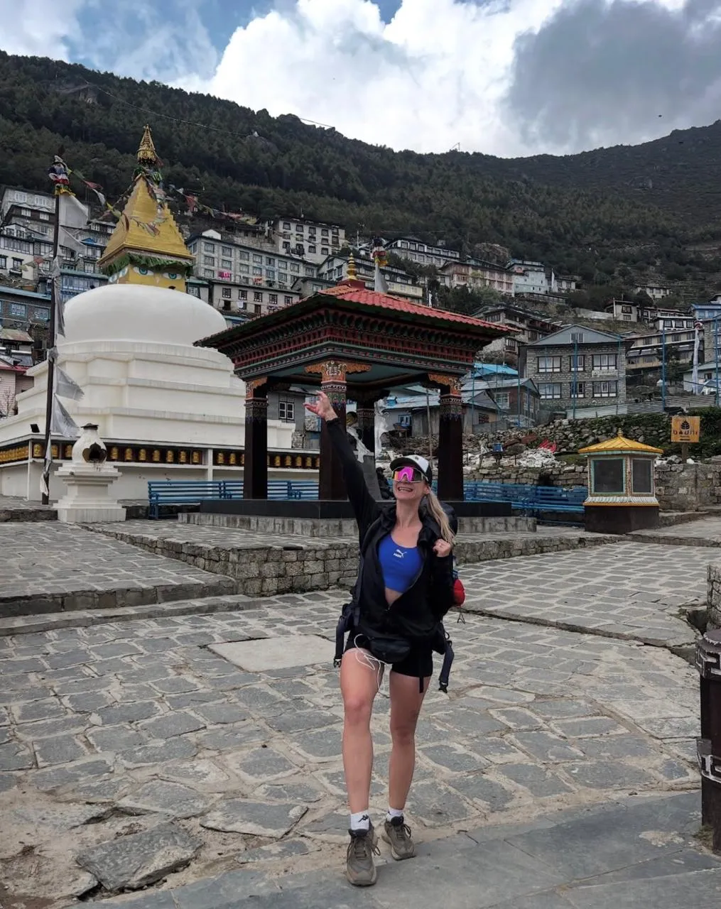
Junbesi is one of the most significant Sherpa villages outside the Khumbu proper. It is the birthplace of Ang Rita Sherpa, who summited Everest 10 times between 1983 and 1996 without supplemental oxygen. The village has a central monastery, a cheese cooperative, and teahouses that are noticeably warmer and more welcoming than the high-altitude lodges above Namche simply because they are built for a different climate. Days 5 and 6 continue through Sallung, Ringmo, Nunthala, and Khari Khola, descending and reascending river valleys and ridge systems that leave no doubt about why this section of the trail was considered the hardest part of the approach in the pre-Lukla era. By Day 7 you arrive at Phakding at 2,610 m, where you join the standard Lukla-to-EBC trail, and the character of the trek changes: the teahouses get bigger, the trail gets busier, and the mountains begin to appear in earnest.
The Khumbu Section: Namche to Everest Base Camp
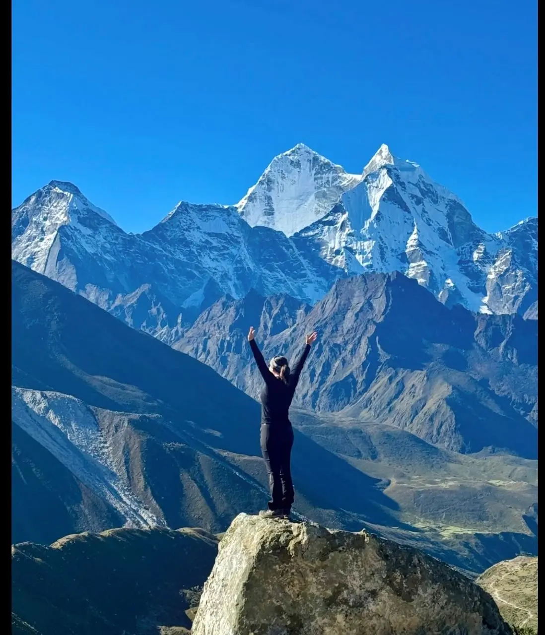
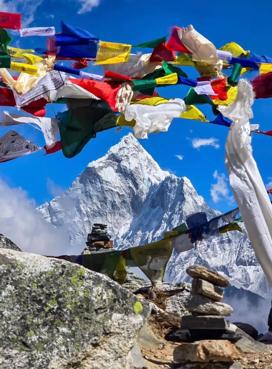
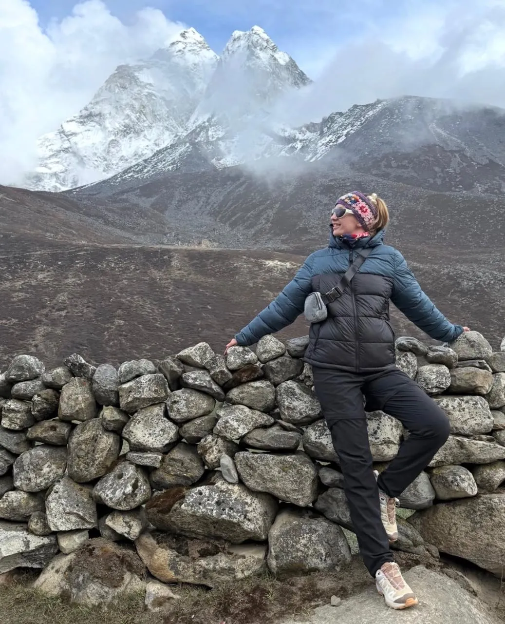
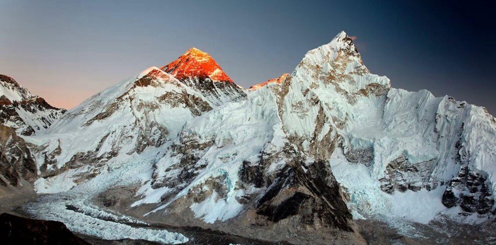
From Namche Bazaar at 3,440 m the route follows the standard EBC trail through Tengboche, Dingboche, Lobuche, and Gorak Shep to Everest Base Camp at 5,364 m. We include a full acclimatization day at Namche with a hike to the Everest View Hotel at 3,880 m, and a second acclimatization day at Dingboche with a hike to Nangkartshang Peak at 5,083 m. This is the highest acclimatization hike on the route and puts you briefly above 5,000 m three days before you visit EBC. The Khumbu Icefall comes into view on the approach to Gorak Shep: a tumbling cascade of seracs and ice blocks that has been the technical crux of every Everest expedition since 1953. EBC itself sits at the base of the icefall, a field of prayer flags and stone cairns at 5,364 m, with the sound of the glacier moving beneath the rock.
We schedule Kala Patthar at 5,545 m for the morning of Day 15, departing Gorak Shep at 4:30 a.m. to reach the summit for sunrise. Kala Patthar is the highest point of this trek and gives the most complete view of the South Face and Southwest Ridge of Everest (8,849 m) available without a climbing permit. Lhotse (8,516 m), Nuptse (7,861 m), Changtse (7,583 m), and the full sweep of the upper Khumbu glacier are visible from the summit rock on a clear October or April morning. We descend from Kala Patthar to Pheriche the same day and begin the return to Lukla over the following three days, flying back to Kathmandu on Day 19.
Best Season and What to Expect
October is the best month for this trip. Post-monsoon conditions deliver stable weather, clear skies, and firm trail surfaces between Jiri and the Khumbu that make the lower-altitude forest sections genuinely enjoyable rather than muddy. The October temperature in Junbesi at 2,675 m is typically 8 to 15°C in the day, dropping to 2 to 4°C at night. At Gorak Shep it will be minus 5 to minus 15°C at night in mid-October. April is the second season: warmer in the lower sections, with rhododendron flowers in bloom on the Lamjura Pass slopes, but with more cloud buildup in the afternoons at high altitude.
Accommodation on the Jiri section is simpler than on the standard EBC route. Teahouses in Sete and Nunthala have basic rooms with shared outdoor facilities. Hot water for washing is available on request at most places. Above Namche, accommodation returns to the standard Khumbu teahouse quality: heated common rooms, relatively comfortable beds, and improving food quality at Namche and Dingboche. We recommend budgeting NPR 200 to 400 per hot shower and NPR 100 to 300 per device charge above Namche.
Permits, Fees, and Logistics
This trek requires two permits: the Sagarmatha National Park entry permit (USD 30, issued at the park gate at Monjo) and the TIMS card (USD 10, issued in Kathmandu). The Khumbu Pasang Lhamu Rural Municipality entry fee (NPR 2,000) is collected at a checkpoint near Monjo. All three are included in our package price. There are no additional permits required for the Jiri section of the route. TIMS registration must be done in Kathmandu before departure, which we handle on Day 1 during the pre-trip briefing.
The jeep from Kathmandu to Jiri departs at approximately 6:00 a.m. The road to Jiri is a mountain highway that was built with Swiss development funding in 1985. It is paved in sections and unpaved in others. Journey time is 4 to 5 hours depending on road conditions. Jiri sits at 1,905 m in Dolakha District and has several basic guesthouses, a weekly market, and a government hospital. We spend the first night in Jiri and begin walking on Day 3.
About Our Team on This Route
Susam Suywal has been leading the Jiri to EBC route since 2012 and has completed it 18 times. He grew up in Solu Khumbu and has personal connections in several of the villages on the lower section of the trail, which means our groups get genuine hospitality rather than transactional teahouse stays. He holds a government-issued senior trekking guide license, wilderness first-aid certification, and speaks fluent English and Nepali. On this specific route, Susam’s knowledge of the lower Solu Khumbu trail conditions is a genuine logistical asset: the path between Khari Khola and Surke has two seasonal bridge crossings that require route adjustments depending on water levels, and he knows the alternative crossings from direct experience rather than map reading.
All Everest Trekking Company staff on this route are registered with the Nepal Tourism Board, insured under Nepal government regulations, and paid at rates that meet or exceed the Trekking Agencies Association of Nepal (TAAN) recommended minimums. We do not use unlicensed guides or unregistered porters on any itinerary.
2026 Update: Lukla Flights and Permit Fees
Trekkers joining Everest Trekking Company in spring 2026 (March to May) should note that Lukla flights during the peak spring season often depart from Ramechhap airport rather than Kathmandu’s Tribhuvan International Airport. Ramechhap is approximately 3 hours by road from Kathmandu. We arrange shared jeep transfers for all groups departing from Ramechhap. Autumn departures (September to November) typically fly directly from Kathmandu.
Permit fees for 2026 remain: Sagarmatha National Park entry at NPR 3,000 (approximately USD 22) per person, and the Khumbu Pasang Lhamu Rural Municipality fee at NPR 3,000 (approximately USD 22) per person. Both are included in your Everest Trekking Company package price. A TIMS card (Trekkers Information Management System) is also included at NPR 2,000 (approximately USD 15).
Highlights
- Trek the original 1953 Hillary expedition approach route from Jiri (1,905 m) to Everest Base Camp (5,364 m)
- Cross Lamjura Pass at 3,530 m on Day 4, the highest crossing on the Jiri section and the gateway to Solu Khumbu
- Visit Junbesi village (2,675 m), birthplace of Ang Rita Sherpa who summited Everest 10 times without supplemental oxygen
- Reach Kala Patthar (5,545 m) at sunrise for the most complete view of Everest (8,849 m) available without a climbing permit
- Stand at Everest Base Camp (5,364 m) at the foot of the Khumbu Icefall, the technical crux of every Everest expedition since 1953
- Superior acclimatization profile: seven walking days from 1,905 m to 3,530 m and back before entering the serious Khumbu altitude
- Walk through Solu Khumbu villages, Sete, Junbesi, Nunthala, Khari Khola, that see fewer than 200 trekkers per season
- Acclimatization hike to Nangkartshang Peak (5,083 m) above Dingboche, your first time above 5,000 m before EBC approach
- Tengboche Monastery (3,860 m) with unobstructed views of Ama Dablam (6,812 m) from the courtyard
- 20 days including two dedicated acclimatization days and a Kala Patthar sunrise, the most thorough EBC itinerary we offer
Write a Review