Sagarmatha National Park is one of the most extraordinary protected landscapes on Earth. Established in 1976 and designated a UNESCO World Heritage Site in 1979, this 1,148 square kilometre park in northeastern Nepal encompasses the world’s highest peaks, the legendary Khumbu glacier system, rare Himalayan wildlife, and the living culture of the Sherpa people who have called this vertical landscape home for centuries. The park spans altitudes from 2,845 metres at its lowest point near Monjo to 8,849 metres at the summit of Mount Everest, giving it one of the broadest elevation ranges of any national park in the world. Every trekker who walks the Everest Base Camp route passes through it; understanding what Sagarmatha is, what it protects, and how to move through it respectfully transforms the experience from a walk toward a famous view into a genuine engagement with one of the planet’s most significant landscapes.
This guide covers everything a trekker needs to know about Sagarmatha National Park: its geography and ecosystems, the wildlife and plant communities that survive at extreme altitude, the cultural and archaeological significance of Sherpa settlements within the park, the permit system and entry requirements, conservation challenges and ongoing efforts, and practical guidance for trekking responsibly through a UNESCO heritage site. Whether you are planning the classic Everest Base Camp trek or a longer circuit including Gokyo Lakes and the Three Passes, the park is the context within which every day of your Khumbu journey unfolds.
Sagarmatha National Park: Essential Facts at a Glance
| Feature | Detail |
|---|---|
| Official name | Sagarmatha National Park (सगरमाथा राष्ट्रिय निकुञ्ज) |
| Established | 1976 |
| UNESCO World Heritage designation | 1979 (natural criteria) |
| Total area | 1,148 square kilometres (buffer zone adds approximately 275 sq km) |
| Location | Solukhumbu District, Koshi Province, northeastern Nepal |
| Elevation range | 2,845m (Monjo entrance) to 8,849m (Everest summit) |
| Peak season | March to May (spring) and September to November (autumn) |
| Park entry fee | NPR 3,000 per person (approximately USD 22–25); additional fees for non-SAARC nationals |
| Governing body | Department of National Parks and Wildlife Conservation (DNPWC), Nepal |
| Peaks within park | 8 peaks above 7,000m including Everest (8,849m), Lhotse (8,516m), Cho Oyu (8,188m), Makalu (8,481m partially) |
| Glaciers | Over 300 glaciers including Khumbu (longest in Nepal at 17km) |
| Permanent settlements inside park | Namche Bazaar, Khumjung, Thame, Dingboche, Pangboche, Phortse, Tengboche |
| Park headquarters | Namche Bazaar |
Geography and Landscape: Understanding the Khumbu Region
The landscape of Sagarmatha National Park is the product of tectonic collision on a scale that the human imagination struggles to comprehend. When the Indian subcontinent collided with the Eurasian plate approximately 50 million years ago, the resulting compression and uplift created the Himalayan range, including the highest peaks on the planet. The park sits directly on this geological frontier, and the evidence is visible everywhere: sheer rock faces that expose millions of years of sedimentary layers, moraines built by glaciers that have advanced and retreated across centuries, and the continuing uplift that adds millimetres to Everest’s height each year as the plates continue their slow collision.
Planning Your Everest Trek?
Get local expert advice on cost, itinerary and the best time to go.
River Systems and Watersheds
The park is drained by the Dudh Koshi River system, one of the major tributaries of the Sapta Koshi that eventually flows into the Ganges. The Dudh Koshi (which means “milk river,” named for its glacially turbid appearance) originates from the Khumbu and Ngozumpa glaciers and carries meltwater from the park’s 300-plus glaciers through progressively lower valleys. The Imja Khola drains the eastern valleys near Island Peak and Chhukung; the Bhote Koshi comes from the northwest near Cho Oyu and the Tibetan border; the main Dudh Koshi collects these tributaries and flows south through the Namche gorge and out of the park at Monjo.
These river systems are critical to the broader ecology of Nepal. The glacial meltwater they carry sustains agricultural systems and human settlements far downstream in the lowlands. As climate change accelerates glacial retreat in the Khumbu, the long-term implications for these downstream water systems are serious and are actively monitored by Nepali and international researchers who work within the park.
The Glacial System
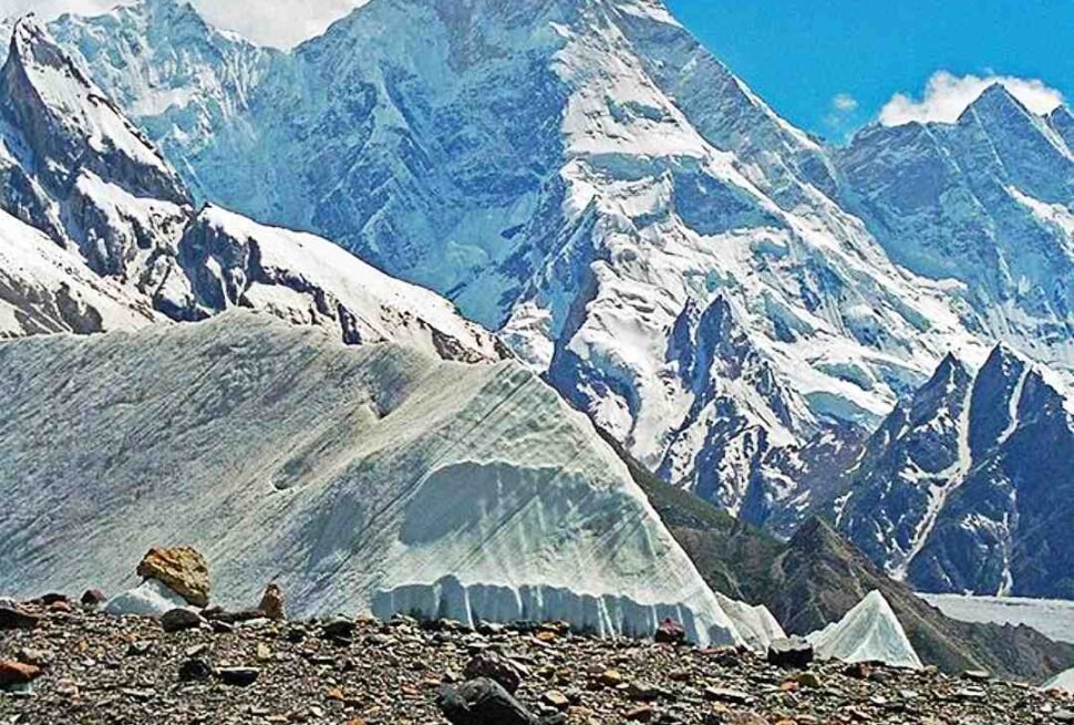
The Khumbu glacier, originating from the Western Cwm above 7,000 metres, descends to approximately 4,900 metres at its terminus near Gorakshep. At 17 kilometres long, it is the longest glacier in Nepal and one of the most studied glaciers in the world. The famous Khumbu Icefall, which Everest expeditions must traverse to reach Camp I, is the rapidly moving upper section of this glacier where the ice passes over a dramatic step in the underlying rock, causing it to fracture into an unstable jumble of seracs, crevasses, and ice towers.
The Ngozumpa glacier in the Gokyo valley is the largest glacier in Nepal by volume. At approximately 36 kilometres long, it descends from the flanks of Cho Oyu and feeds the chain of Gokyo Lakes. The glacier’s surface is heavily covered with glacial moraine (rock debris), which insulates the ice beneath and slows surface melting while the glacier loses mass from its interior. The Gokyo Lakes are proglacial lakes, meaning they have formed in depressions created by the glacier’s retreat and are dammed by morainal debris.
Valley Systems and Passes
The park’s topography is defined by a series of deeply incised valleys running roughly north-south, separated by high ridges and connected by passes that have served as trade routes and migration corridors for centuries. The main valley system follows the Dudh Koshi north from Monjo through Namche Bazaar to the Khumbu basin. The Gokyo valley branches northwest from Dole. The Imja valley branches east from Dingboche toward Chhukung and Island Peak base camp. These valleys converge and are connected by high passes:
| Pass | Elevation | Connects | Season | Difficulty |
|---|---|---|---|---|
| Cho La Pass | 5,420m | Gokyo valley to Lobuche/Khumbu valley | Oct-Nov, Mar-May | Moderate to difficult; glacier crossing required |
| Renjo La Pass | 5,360m | Thame valley to Gokyo Lakes | Oct-Nov, Mar-May | Moderate; rocky ascent |
| Kongma La Pass | 5,535m | Chhukung to Lobuche | Oct-Nov, Mar-May | Difficult; high altitude crossing |
| Nangpa La | 5,716m | Khumbu to Tibet | Restricted; traditional trade route | Very difficult; glacier crossing; permit required |
Ecosystems and Vegetation Zones
Sagarmatha National Park contains several distinct vegetation zones stacked vertically from the park entrance to the permanent snowline. Each zone has its own characteristic plant communities, adapted to the specific combination of temperature, precipitation, wind exposure, and soil conditions at that altitude band. Understanding these zones helps trekkers appreciate why the landscape changes so dramatically over the course of a few days’ walking.
| Vegetation Zone | Altitude Range | Key Species | Characteristics |
|---|---|---|---|
| Subalpine forest | 2,845m – 3,500m | Blue pine (Pinus wallichiana), Silver fir (Abies spectabilis), Himalayan hemlock, rhododendron species | Dense coniferous forest; highest remaining tree cover in the park; severely depleted by historic fuelwood cutting |
| Upper forest and scrub | 3,500m – 4,000m | Birch (Betula utilis), juniper (Juniperus recurva), rhododendron (Rhododendron campanulatum and others) | Transitional zone; birch trees become dominant; rhododendron blooms spectacularly in April and May |
| Alpine scrub and meadow | 4,000m – 5,000m | Juniper scrub, dwarf rhododendron, sedges (Carex spp.), Himalayan grasses, alpine herbs | Open terrain with scattered vegetation; critical yak grazing zone; wildflowers in summer monsoon |
| Subniveal/alpine desert | 5,000m – 5,500m | Cushion plants (Arenaria, Thylacospermum), lichens, mosses | Sparse, low-growing plants adapted to extreme conditions; soil thin and unstable; high UV radiation |
| Nival zone | Above 5,500m | Lichens on exposed rocks; no vascular plants | Permanent snow and ice; rock faces; no significant plant life |
Forest Depletion and Reforestation Efforts
When Sagarmatha National Park was established in 1976, the forests below Namche Bazaar were in a severely degraded state. Decades of fuelwood cutting to supply teahouses, lodges, and local homes had stripped much of the original subalpine forest cover from the lower valleys. One of the park’s first and most significant conservation achievements was addressing this deforestation. The introduction of kerosene subsidies, the gradual transition to gas and hydroelectric cooking in teahouses, and active reforestation programs have produced visible forest recovery in the valleys below Namche over the past four decades. Trekkers today walk through forests that were barren hillsides within living memory of the older Sherpa residents.
The reforestation effort has been aided by the park’s rule requiring all expedition and trekking groups above certain sizes to carry kerosene rather than use local wood for cooking fuel. Teahouses at higher altitudes now use yak dung, solar panels, and imported gas rather than the forest wood that was once the only available fuel above treeline. These changes, incremental and often contested by local communities who depended on wood fuel, have nonetheless produced measurable improvements in forest cover and quality.
Wildlife of Sagarmatha National Park
The wildlife of Sagarmatha National Park is adapted to extreme altitude, cold, and limited food availability. The species that survive within the park boundaries represent some of the most remarkable evolutionary achievements in the animal kingdom, and encounters with wildlife on the EBC trek are among the most memorable experiences the route offers. The park is home to several endangered or protected species, and conservation of these populations is one of the park’s primary mandates.
| Species | Conservation Status | Habitat within Park | Best Viewing Opportunity | Notes |
|---|---|---|---|---|
| Snow leopard (Panthera uncia) | Vulnerable (IUCN) | Rocky slopes 3,000m – 5,400m; hunts in yak grazing areas | Very rare; most likely above Namche in winter; camera traps document presence | Estimated fewer than 30 individuals within the park; shy and cryptic; primary prey is blue sheep (bharal) |
| Red panda (Ailurus fulgens) | Endangered (IUCN) | Temperate forest below 3,500m; bamboo and rhododendron zones | Lower valleys below Namche; dawn and dusk | Small, distinctive reddish mammal; critically threatened across its range by habitat loss and trapping |
| Himalayan tahr (Hemitragus jemlahicus) | Near Threatened (IUCN) | Steep rocky slopes 2,500m – 5,000m | Namche area cliffs; Tengboche slopes; Dingboche surrounds | Wild ungulate related to goats; herds of 10–20 animals common on cliff faces; males have impressive mane |
| Musk deer (Moschus chrysogaster) | Endangered (IUCN) | Forest and scrub 2,500m – 4,500m | Forested areas below Namche; secretive and nocturnal | Sought for musk gland used in traditional medicine; heavily poached historically; numbers recovering under park protection |
| Himalayan black bear (Ursus thibetanus) | Vulnerable (IUCN) | Lower forests 2,500m – 3,500m | Below Namche; rare sightings near Phakding and Monjo | Omnivore; occasionally raids agricultural crops at forest edge |
| Blue sheep / Bharal (Pseudois nayaur) | Least Concern (IUCN) | Open alpine terrain 3,500m – 5,500m | Slopes above Namche, Khumjung valley, Gokyo area | Primary prey of snow leopard; large herds often visible on open slopes |
| Wolf (Canis lupus chanco) | Least Concern but locally rare | High-altitude terrain above 4,000m | Upper Khumbu; extremely rare encounters | Himalayan wolf; genetic research indicates it may be a distinct subspecies |
| Pika (Ochotona spp.) | Least Concern | Rocky slopes 3,500m – 5,500m | Rock piles around Namche, Dingboche, Gorakshep | Small lagomorphs (relatives of rabbits) that store hay piles for winter; often seen sunning on rocks |
Birds of Sagarmatha National Park
The park’s bird life is rich, varied, and includes several species found nowhere else in the world or only at extreme altitude. The diversity of bird species within Sagarmatha reflects the range of habitats from subtropical forest edges to permanent snowfields, and birding on the EBC route rewards those who pay attention.
| Species | Habitat | Distinctive Features | Where to See |
|---|---|---|---|
| Himalayan monal (Lophophorus impejanus) | Subalpine forest and scrub 3,000m – 5,000m | Nepal’s national bird; male has spectacularly iridescent plumage; female brownish | Tengboche slopes; Khumjung area; forested hillsides above Namche |
| Blood pheasant (Ithaginis cruentus) | Alpine scrub 3,500m – 4,500m | Red streaking on male; found in groups; distinctive call | Above Namche toward Tengboche |
| Yellow-billed chough (Pyrrhocorax graculus) | Cliffs and open terrain up to 8,200m (highest recorded bird) | Black bird with yellow bill and red legs; highly acrobatic in flight; follows trekkers for food | Everywhere from Namche upward; particularly at Gorakshep and EBC |
| Lammergeier / Bearded vulture (Gypaetus barbatus) | Open terrain throughout the park | Huge wingspan (2.8m); distinctive bearded face; orange-stained underparts from iron-rich mud bathing | Above Namche; updrafts on ridge lines |
| Himalayan griffon vulture (Gyps himalayensis) | Cliffs and open terrain | Enormous; pale body, dark flight feathers; circles high above valleys | Visible throughout the park; often in thermals above Namche |
| Grandala (Grandala coelicolor) | Rocky alpine terrain 3,500m – 5,500m | Male brilliant blue; female brown with white streaking; often in large flocks | Tengboche to Dingboche corridor |
| Red-billed chough (Pyrrhocorax pyrrhocorax) | Cliffs and pasture up to 4,500m | Black with red bill and legs; similar to yellow-billed but bill colour distinguishes | Lower altitude than yellow-billed; Namche area |
| Snow pigeon (Columba leuconota) | Rocky cliffs 3,000m – 5,000m | White body, grey wing patches; nests on cliff ledges | Namche cliff faces; Tengboche area |
The yellow-billed chough deserves special mention as perhaps the most visible wildlife species on the entire EBC route. These highly intelligent, acrobatic birds are encountered from Namche all the way to Everest Base Camp and beyond. They have learned that trekkers and mountaineers carry food and will follow groups for considerable distances, performing acrobatic manoeuvres to intercept any offered scraps. Feeding them is discouraged by park authorities as it habituates wild birds to human food and creates dependence, but their presence as companions through the high-altitude sections of the route is one of the trek’s consistent pleasures.
The Sherpa People and Cultural Heritage Within the Park
Sagarmatha National Park is unusual among the world’s protected areas in that it contains living, active communities of indigenous people who have inhabited the landscape for centuries. The Sherpa people, who migrated from the Kham region of eastern Tibet approximately 500 years ago, are not merely a cultural feature of the park’s tourism industry but are the original and continuing stewards of this landscape. Their presence within the park’s boundaries raises important questions about protected area management, indigenous land rights, and the relationship between conservation and cultural continuity that the park administration has been grappling with since its establishment.
Sherpa History and Origins
The Sherpa (the name means “eastern people” in Tibetan, referring to their origin in the eastern Tibetan region of Kham) arrived in the Khumbu region in the late 15th or early 16th century, crossing through the Nangpa La pass from Tibet. They brought with them Tibetan Buddhist traditions, a pastoral lifestyle based on yak herding and potato cultivation (potatoes arrived in the Khumbu from Europe via lowland Nepal in the 19th century and transformed local agriculture), and a social structure of clans (rü) that continues to define family identity in Sherpa communities today.
The Sherpa relationship with the mountaineering economy began with the British Everest expeditions of the 1920s and accelerated dramatically after the 1953 first ascent of Everest by Tenzing Norgay Sherpa and Edmund Hillary. The global attention that followed the first ascent transformed the Khumbu from an isolated subsistence community into one of the most visited trekking destinations on Earth within a generation. The economic benefits of trekking and expedition support have been transformative for Sherpa communities; the cultural and environmental costs are more complex and are still being navigated.
Monasteries and Religious Sites Within the Park
The religious landscape of the Khumbu is inseparable from its physical landscape. Sherpa Buddhist culture treats the mountains, rivers, and passes as sacred entities, and this cosmological worldview is expressed in the monasteries, shrines, prayer walls, and ritual objects distributed throughout the park. Trekkers encounter these religious sites at every stage of the route; understanding their significance transforms them from picturesque photo opportunities into windows onto a living spiritual tradition.
| Site | Altitude | Significance | Notes for Trekkers |
|---|---|---|---|
| Tengboche Monastery (Thyangboche) | 3,867m | Largest monastery in the Khumbu; Kagyu-Nyingma tradition; rebuilt after 1989 fire | Morning and evening puja open to respectful visitors; remove shoes; no photography inside without permission; Mani Rimdu festival held here in autumn |
| Pangboche Monastery | 3,930m | Oldest monastery in the Khumbu (est. circa 1,600s); Nyingma tradition; contains relics including a purported yeti skull | Small donation expected for entry; ask before photographing |
| Dingboche chortens | 4,410m | Several ancient chortens at the valley entrance; traditional spirit boundary markers | Walk clockwise around chortens; do not touch or move prayer stones |
| Lobuche memorials | 4,940m | Stone memorial chortens for climbers killed on Everest and Lhotse; deeply moving site | Read memorials respectfully; walk clockwise; a contemplative stop on the route to EBC |
| Gorakshep Tibetan shrine | 5,164m | Small prayer flags and stone cairn at the highest permanently inhabited (seasonal) settlement | Respectful observation; do not disturb |
| Khumbu Glacier Buddhist stones | Throughout glacier approach | Prayer stones left by expedition teams and trekkers at traditional points | Traditional to leave a stone at the Everest puja cairn at base camp |
| Namche Bazaar Gompa | 3,440m | Active monastery in Namche; serves the local Sherpa community | Saturday market day draws local communities; morning puja usually audible |
| Thame Monastery | 3,800m | Off the main EBC route but important historically; associated with the legendary lama Lama Sangwa Dorje | Worth the side trip; Mani Rimdu festival held here in spring |
Mani Walls, Prayer Flags, and Ritual Objects
Throughout the trek, the trail passes between, beside, and over mani walls: long stone walls constructed from flat rocks carved with the Buddhist mantra Om Mani Padme Hum and other sacred texts. These walls are built over generations by local communities and serve both religious and practical functions, marking the boundaries of sacred zones and providing a focus for merit-generating circumambulation. The correct and respectful practice is to pass to the left of a mani wall, keeping the wall to your right. This clockwise orientation mirrors the direction of Buddhist circumambulation at all sacred sites.
Prayer flags (Tibetan: lungta) appear at every pass, ridgeline, teahouse, and monastery throughout the park. The five colours represent the five elements: blue for sky, white for air, red for fire, green for water, yellow for earth. The prayers printed on the flags are carried by the wind to all corners of the world, generating merit for those who erected them and for all beings. Old prayer flags are not waste; they are sacred objects and are never casually disposed of. New flags are added at significant moments, and the faded remnants of decades of flags testify to the continuity of this practice.
Sagarmatha National Park Entry Requirements and Permits
Every trekker entering Sagarmatha National Park must hold the correct permits before reaching the park entrance at Monjo. The permit system funds park operations, conservation programs, infrastructure maintenance, and the park administration that manages one of Nepal’s most complex protected landscapes. Understanding the permit requirements before departure prevents delays and complications at the checkpoint.
| Permit Type | Cost (2024–2025) | Where to Obtain | Who Needs It | Notes |
|---|---|---|---|---|
| Sagarmatha National Park Entry Permit | NPR 3,000 (approximately USD 22–25) for non-SAARC nationals; NPR 1,500 for SAARC nationals | Nepal Tourism Board office in Kathmandu; Monjo checkpoint (less reliable) | All trekkers entering the park | Passport required; keep permit on person throughout trek; checked at multiple points |
| TIMS (Trekkers Information Management System) Card | USD 20 for individual trekkers; USD 10 for group trekkers through a registered agency | Nepal Tourism Board, Kathmandu (Bhrikutimandap); Pokhara NTB office | All trekkers on designated trekking routes in Nepal | Both individual TIMS (green) and group TIMS (blue) accepted on EBC route |
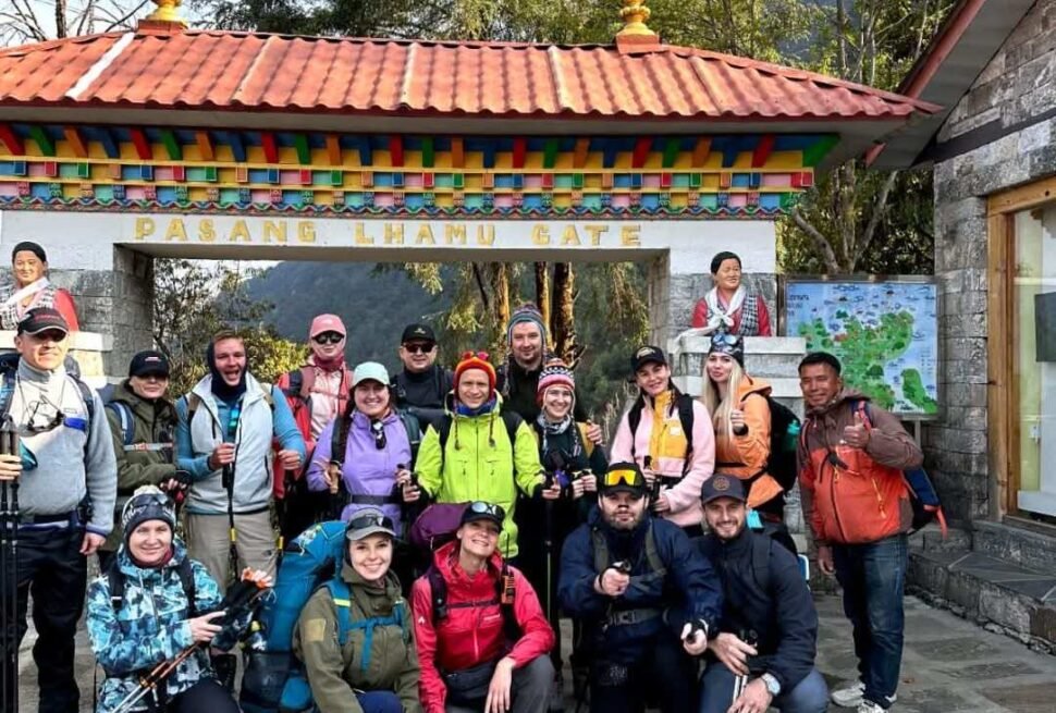
| Khumbu Pasang Lhamu Rural Municipality Entry Fee | NPR 2,000 per person (approximately USD 15) | Lukla checkpoint on arrival; some agencies collect in Kathmandu | All trekkers entering Lukla and the Khumbu valley | Relatively new fee introduced by the local municipality; separate from the national park permit |
| Peak Climbing Permit (if applicable) | Varies by peak: Island Peak USD 250–350; Mera Peak USD 250–350 | Nepal Mountaineering Association (NMA), Kathmandu | Trekkers adding a trekking peak to the itinerary | Requires licensed climbing guide; separate from trekking permits |
Permit Checkpoints on the EBC Route
Permit checks occur at multiple points along the EBC route. Trekkers should carry all permits and their passport at all times rather than leaving documents in a duffle bag carried by a porter. The primary checkpoint is at Monjo (2,835m), where park rangers check the national park entry permit and TIMS card before allowing access into the park. Additional checks occur at Namche Bazaar, where the TIMS card is scanned. Further checks at Tengboche and Lobuche are less formal but do occur. Trekkers who cannot produce permits at any of these checkpoints face delays and potential fines.
Planning Your Everest Trek?
Get local expert advice on cost, itinerary and the best time to go.
Climate and Weather Patterns in Sagarmatha National Park
The weather within Sagarmatha National Park is governed by the interaction between the South Asian monsoon and the extreme altitude of the Himalayan range. Understanding the seasonal patterns allows trekkers to choose the best time for their visit and to manage daily weather expectations on the trail.
| Season | Months | Weather Conditions | Trekking Conditions | Crowding Level |
|---|---|---|---|---|
| Pre-monsoon (spring) | March, April, May | Warming temperatures; clear mornings; afternoon cloud buildup; April and May bring rhododendron bloom in lower valleys; May can see pre-monsoon storms | Excellent; trails firm; visibility good; mountain views clear in mornings; warmest conditions of year at altitude | Very high; peak season with significant trail crowding |
| Monsoon | June, July, August | Heavy rainfall in lower elevations; significant precipitation even at altitude; trail sections above 5,000m receive snow; clouds persistent; leech season below 3,000m | Challenging; trails muddy; leeches common below Namche; visibility poor; bridges occasionally washed out; some trekkers complete the route in monsoon for solitude | Very low; route largely empty |
| Post-monsoon (autumn) | September, October, November | Clear and stable after September monsoon withdrawal; October is driest and clearest month of year; temperatures drop sharply by November; first winter snowfalls in November | Best conditions of year; October offers crystal visibility; October-November is premier season; cold in mornings and evenings by November | Very high in October; moderate in September and November |
| Winter | December, January, February | Cold and dry; temperatures at Gorakshep drop to -20C or below at night; passes may be snow-blocked; Cho La and Renjo La impassable in heavy snow winters | Challenging but possible on main EBC route; high passes closed; low trails firm and clear; extreme cold requires serious gear | Very low |
Daily Weather Patterns on Trail
Within each season, the daily weather pattern on the EBC route follows a recognisable cycle. Mornings are typically clear and cold, with the best mountain visibility from approximately 6am to 10am. By mid-morning, solar heating at lower altitudes begins to generate convective cloud that builds through the afternoon. By 1pm to 2pm in post-monsoon season (and earlier in spring), significant cloud cover is common above 5,000m, obscuring mountain views and occasionally producing brief afternoon snow showers at high altitude. By evening, temperatures drop rapidly and skies often clear again.
This daily cycle has practical implications for trek planning. The pre-dawn start for Kala Patthar (typically departing Gorakshep at 4am to 5am) is designed to reach the summit before cloud buildup obscures the Everest view. The afternoon sections of each day’s walk are often in cloud, but this typically does not affect trail safety. The clearest days of the entire trek tend to occur in the first week of October, when the post-monsoon stability has fully established and before the increasing frequency of winter weather systems in November.
Conservation Challenges in Sagarmatha National Park
Managing a UNESCO World Heritage Site that hosts tens of thousands of trekkers annually, supports permanent indigenous communities, and faces the accelerating effects of climate change presents conservation challenges of extraordinary complexity. The park administration, in partnership with Sherpa communities and international conservation organisations, has made significant progress on several of the most pressing issues while others remain unresolved.
Waste Management
Waste management is perhaps the most visible conservation challenge within the park. The combination of tens of thousands of trekkers annually, remote location with no road access, and the physical impossibility of helicopter waste removal at scale creates a waste accumulation problem that the park has struggled to address adequately. Progress has been made:
- The Sagarmatha Pollution Control Committee (SPCC), established with the involvement of the park administration and local communities, manages waste collection from teahouses along the main route and runs waste carried by porters down to Lukla for disposal.
- The Nepal government has introduced bonded waste policies for climbing expeditions, requiring expeditions to bring down all non-biodegradable waste and human waste from above Base Camp under a cash bond forfeiture system.
- Some teahouse operators have introduced anaerobic biogas digesters that convert organic waste (kitchen scraps, human waste) into cooking fuel, reducing both waste volume and fuelwood demand.
- Plastic bottle sales at high altitude (above Namche) are regulated and expensive, encouraging trekkers to carry reusable bottles and use iodine tablets or portable filters rather than purchasing disposable plastic.
Despite these efforts, plastic waste, human waste above the sanitation system’s capacity, discarded expedition equipment on glaciers, and the general output of tens of thousands of visitors annually continue to challenge the park’s management capacity. The most problematic waste concentration is on and around the Khumbu glacier and at Everest Base Camp, where expedition camps generate significant waste loads that are only partially removed.
Climate Change and Glacial Retreat
The Himalayan glaciers are among the most climate-sensitive environments on Earth, and Sagarmatha National Park provides some of the most visible and extensively documented evidence of accelerating glacial retreat. The Khumbu glacier has retreated by several hundred metres over the past century, with retreat rates accelerating in recent decades. The Ngozumpa glacier, while still massive, is losing volume from its interior even where surface melting is partially insulated by morainal debris.
The ecological implications of glacial retreat within the park include: reduction in dry-season river flows that irrigate both park vegetation and downstream agricultural systems; expansion of glacial lake areas with associated risk of Glacial Lake Outburst Floods (GLOFs); changes to the altitudinal distribution of plant communities as temperature zones shift upward; and disruption of the hydrological systems that sustain the unique wetland ecology of the Gokyo Lakes. The Imja Glacial Lake, formed by the retreat of the Imja glacier above Chhukung, has been specifically identified as a high-priority GLOF risk and has been the subject of drainage works to reduce its volume.
Tourism Impact Management
The sheer volume of visitors to the EBC route creates ecological and cultural pressure that park management must balance against the economic importance of trekking to Khumbu communities. Trail erosion, vegetation damage from campsite use, noise and cultural disruption in Sherpa villages, and the social effects of economic inequality between successful tourism entrepreneurs and wage workers within the community are all documented challenges.
The park has responded with a combination of infrastructure investment (trail improvements, bridge maintenance, toilet facilities at key stops), regulatory enforcement (camping restrictions, fuelwood bans, waste requirements), and community-based conservation programs that give Sherpa communities direct roles in park management and direct economic stakes in conservation outcomes. The Sagarmatha Pollution Control Committee (SPCC) is one model of this approach, operating as a community-based organisation with park authority to enforce waste regulations and collect fees for waste management services.
Trekking Responsibly in Sagarmatha National Park
Every trekker who enters Sagarmatha National Park has a direct impact on the landscape, the wildlife, and the communities within it. Responsible trekking is not merely an ethical aspiration; it is a practical contribution to the long-term sustainability of the park and the trekking industry that supports Khumbu communities. The following practices reflect both the park’s official guidelines and the considered recommendations of conservation organisations working in the region.
Waste and Plastic
- Carry a reusable water bottle and purification method (iodine tablets, SteriPen, Sawyer filter). Boiled water is available at teahouses for a small fee. Avoiding single-use plastic bottles throughout the trek eliminates one of the most significant individual waste contributions.
- Pack out all non-biodegradable waste. If you carry it in (wrappers, batteries, blister pack packaging), carry it out. Do not leave waste at teahouses in the expectation that it will be disposed of appropriately; most teahouse waste disposal is inadequate above Namche.
- Use designated toilet facilities at teahouses rather than open defecation on the trail. Above the teahouse infrastructure (above Gorakshep on the approach to EBC), use biodegradable waste bags if your expedition provides them; burying human waste at altitude is insufficient given the density of use.
Wildlife Interaction
- Do not feed any wildlife. The choughs (black birds with yellow bills) that follow trekkers on the upper route are habituated to begging but are better served by maintaining their natural foraging behaviour. Feeding birds habituates them to human presence and creates unhealthy dependency on non-natural food sources.
- Maintain distance from musk deer, tahr, and other wildlife. The 50-metre guideline used in most protected areas is appropriate. Wildlife that is comfortable at 50 metres is wild and well; wildlife that must retreat before trekkers is being disturbed.
- Report any wildlife sightings to park rangers or your guide, particularly sightings of snow leopard (extremely rare) or evidence of poaching or snare placement.
- Do not collect insects, plants, rocks, or fossils from within the park. Everything within the park boundary is protected.
Cultural Respect
- Always pass to the left of mani walls, keeping the wall on your right. This is not a minor preference; it reflects a Buddhist practice with deep significance to the Sherpa community.
- Ask permission before photographing people, especially at religious sites, markets, or during ceremonies. The Tengboche Mani Rimdu festival and other religious events attract photographers, but participants are performing sacred practices, not putting on a show.
- Remove shoes before entering any monastery or gompa. The significance of this practice is equivalent to removing shoes before entering a mosque or bowing before entering a Japanese temple.
- Do not enter areas of monasteries marked as restricted to visitors. The inner sanctum of most Khumbu gompas is for practitioners, not tourists.
- Purchase goods, meals, and services from local providers rather than international chains or agencies based outside the Khumbu. Economic leakage from the trekking industry (money flowing to Kathmandu-based operators rather than remaining in Khumbu communities) is a documented challenge; choosing local services directly counters it.
Altitude and Trail Etiquette
- Yield to yak and dzopkhio (hybrid yak-cow) trains on narrow trail sections. These animals are large, sometimes unpredictable, and carry significant loads on precarious paths. Step to the uphill side of the trail and remain still while they pass. Being knocked off a narrow trail by a yak is a documented cause of trekking injuries and fatalities.
- Do not shortcut switchbacks. Cutting across the outside of a turn erodes the slope and creates parallel tracks that expand into erosion channels. Follow the established trail even when a shortcut looks shorter.
- Do not play loud music on the trail. The sounds of the Khumbu valley are part of the experience; other trekkers and local communities have as much right to the silence as you have to your playlist.
Altitude Sickness in Sagarmatha National Park: A Medical Perspective
Altitude sickness is the primary medical risk for every trekker entering Sagarmatha National Park. The park’s elevation range means that every trekker on the EBC route will spend significant time above the altitude at which altitude sickness becomes a realistic concern. Understanding the physiology and recognising the symptoms is not supplementary preparation; it is a core requirement for safe travel within the park.
| Altitude Sickness Type | Altitude Onset | Key Symptoms | Severity | Treatment |
|---|---|---|---|---|
| Acute Mountain Sickness (AMS) | Typically above 2,500m; most common above 3,500m on EBC route | Headache (main symptom) plus any of: nausea, fatigue, dizziness, poor sleep, reduced appetite | Mild to moderate; can progress if ignored | Rest at same altitude; hydration; ibuprofen for headache; Diamox if prescribed; descend if not improving within 24 hours |
| High Altitude Cerebral Edema (HACE) | Typically above 4,000m | Severe headache unresponsive to pain relief; confusion; ataxia (inability to walk straight); loss of coordination; altered consciousness | Life-threatening emergency | Immediate descent; supplemental oxygen if available; Dexamethasone; helicopter evacuation |
| High Altitude Pulmonary Edema (HAPE) | Typically above 4,000m; risk increases above 5,000m | Breathlessness at rest (not just on exertion); persistent cough; pink or frothy sputum; reduced SpO2 disproportionate to altitude; crackling sounds in lungs | Life-threatening emergency; often fatal without treatment | Immediate descent; supplemental oxygen; Nifedipine (if available); helicopter evacuation |
The Lake Louise Score is the standard clinical tool for assessing AMS severity. Trekkers who understand the Lake Louise criteria can self-monitor more effectively. A score of 3 or higher on the scale (based on headache severity, gastrointestinal symptoms, fatigue, and dizziness) indicates AMS that should not be ignored. The golden rule of altitude medicine applies throughout the park: never ascend with symptoms; always descend if symptoms are worsening.
Accommodation Within the Park: Teahouses and Lodges
The teahouse system of Sagarmatha National Park is one of the most developed in Nepal and makes the EBC route accessible to trekkers without expedition-level logistics. Teahouses (also called lodges or guesthouses) provide accommodation, meals, and a social hub at each major stopping point along the route. The quality and character of teahouses varies considerably across the altitude range.
| Location | Altitude | Accommodation Standard | Price Range per Night | Notable Features |
|---|---|---|---|---|
| Phakding | 2,652m | Good; multiple lodges with hot showers | NPR 200–500 per room | First night of most EBC treks; warm temperatures; good food |
| Namche Bazaar | 3,440m | Excellent; some lodges with private rooms and attached bathrooms; WiFi widely available | NPR 500–2,000 per room | Largest settlement in the park; best food selection; bakeries, coffee shops, gear shops; Saturday market |
| Tengboche | 3,860m | Good; several lodges near the monastery; dramatic setting | NPR 300–800 per room | Monastery setting makes this one of the most atmospheric stops on the route |
| Dingboche | 4,410m | Good; multiple lodges; quality variable | NPR 300–600 per room | Popular acclimatisation rest day location; views of Ama Dablam and Island Peak |
| Lobuche | 4,940m | Basic; heating limited; cold nights | NPR 300–500 per room | First stop above 4,900m; near the climber memorial site |
| Gorakshep | 5,164m | Very basic; often overcrowded in peak season; cold; expensive food | NPR 400–600 per room | Last teahouse before EBC; rooms often shared; altitude means minimal amenities |
| Gokyo | 4,790m | Good; several well-run lodges; spectacular lakeside setting | NPR 300–600 per room | Alternative to Gorakshep for those doing Gokyo route; excellent views from Gokyo Ri |
The price of accommodation at teahouses is generally linked to the expectation that guests eat meals at the same establishment. This is not a formal rule but is a strong norm: a lodge that provides a room at NPR 300 expects that the guest will spend NPR 800 to 1,500 on meals during their stay, generating the majority of the establishment’s revenue. Guests who book the cheapest room and then eat meals elsewhere create friction with teahouse owners; understanding this unspoken economic model leads to more harmonious interactions.
The Sagarmatha National Park Buffer Zone
The buffer zone surrounding the core protected area of Sagarmatha National Park covers approximately 275 square kilometres and was established to address the conservation challenges that don’t stop at park boundary lines. Wildlife, particularly species like snow leopard and Himalayan black bear, range across park boundaries and require protection in the areas they inhabit outside the core zone. The buffer zone designation extends some management authority and conservation protections to the surrounding landscape while allowing greater human use than the core park permits.
Trekkers on the approach to Lukla (by foot from Salleri or Phaplu for those who avoid the flight) pass through the buffer zone before entering the core park. The communities within the buffer zone, while not part of the UNESCO heritage site, are connected to it economically and ecologically. Buffer zone management funds collected from trekking permits in the core zone are partially redistributed to communities within the buffer zone through the park’s community development programs.
Sagarmatha National Park and the Broader Himalayan Conservation Landscape
Sagarmatha does not exist as an isolated protected area but as part of a broader Himalayan conservation landscape that includes several adjacent protected areas in Nepal and across the border in Tibet and India. The Makalu-Barun National Park, which abuts Sagarmatha to the east, was established partly in response to the demonstrated success of the Sagarmatha model. Together, these parks protect a contiguous high-altitude ecosystem of global significance.
The snow leopard population that ranges across Sagarmatha and Makalu-Barun is connected to populations in Tibet and forms part of a regional meta-population that can only be sustained through transboundary conservation cooperation. Similarly, the migratory pathways of Himalayan bird species pass through multiple countries and protected areas. Sagarmatha’s UNESCO designation gives it an international platform that has been used to advocate for these broader regional conservation goals.
Planning Your Visit to Sagarmatha National Park
Practical planning for a trek through Sagarmatha National Park involves decisions that are more complex than simply booking flights and accommodation. The choices trekkers make about timing, route, pace, operator selection, and gear directly affect both the quality of their experience and their impact on the park.
Essential Gear for the Park Environment
| Gear Category | Essential Items | Why It Matters in Sagarmatha |
|---|---|---|
| Layering system | Moisture-wicking base layer, insulating mid-layer (down or synthetic), waterproof shell | Temperature range from 15C at Phakding to -20C at Gorakshep overnight requires full layering capability |
| Footwear | Waterproof trekking boots broken in before departure; gaiters for snow sections | Rocky terrain; stream crossings; potential snow above 5,000m; blisters are a serious issue above 4,000m |
| Altitude safety | Personal pulse oximeter; prescribed Diamox if recommended by doctor; comprehensive first aid kit | Critical safety equipment at altitude; SpO2 monitoring provides objective acclimatisation data |
| Sun protection | High-SPF sunscreen; UV-blocking sunglasses; sun hat; lip balm | UV radiation at 5,000m is approximately 50% higher than at sea level; snow reflection doubles exposure; snow blindness risk on open snowfields |
| Water management | Reusable 1–2 litre bottles; purification method (iodine tabs, filter, or SteriPen) | Dehydration is a major altitude sickness contributor; drinking 3–4 litres daily essential above 4,000m |
| Warm sleep system | Sleeping bag rated to -10C or lower; sleeping bag liner | Teahouse rooms above 4,000m are unheated; temperature at Gorakshep drops well below -10C in October-November nights |
| Communication | Offline GPS maps (Gaia GPS, Maps.me, or AllTrails); satellite communicator (Garmin InReach) if solo | Mobile coverage absent above Tengboche; offline maps essential for route management; satellite communicator allows emergency contact anywhere in park |
Recommended Itinerary Duration
The minimum recommended itinerary for the standard EBC trek through Sagarmatha National Park is 12 to 14 days from Lukla. This allows two rest days (at Namche and Dingboche) for acclimatisation, a realistic pace that does not push altitude gain beyond 300 to 500 metres per day above 3,500 metres, and a summit day on Kala Patthar with EBC visit. Trekkers who attempt the route in fewer than 12 days risk inadequate acclimatisation; the rate of altitude sickness incidents is measurably higher among those on accelerated itineraries.
Extending the itinerary to 16 to 21 days to include the Gokyo Lakes, the Three Passes circuit, or side trips to Chhukung and Island Peak base camp dramatically enriches the park experience. These extensions take trekkers into valleys and landscapes that the main EBC route never reaches and provide perspectives on the park’s ecosystem diversity that the standard route cannot offer. The Everest Trek Company offers itineraries covering these extended routes with appropriate acclimatisation profiles built in.
Frequently Asked Questions About Sagarmatha National Park
Do I need a special permit to trek in Sagarmatha National Park?
Yes. Every trekker requires a Sagarmatha National Park Entry Permit, which costs NPR 3,000 for non-SAARC nationals. You also need a TIMS card (USD 20 for independent trekkers) and the Khumbu Pasang Lhamu Rural Municipality entry fee (NPR 2,000). These should be obtained in Kathmandu before flying to Lukla; obtaining them at the Monjo checkpoint is possible but less reliable. Keep all permits with you throughout the trek as they are checked at multiple points.
What are the chances of seeing a snow leopard in Sagarmatha National Park?
Extremely low for a standard EBC trekker. Snow leopards are naturally rare (fewer than 30 estimated in the park), cryptically patterned against rocky terrain, and predominantly active at dawn and dusk or at night. The rocky slopes above Namche Bazaar and in the upper Gokyo valley are areas where camera trap records confirm snow leopard presence, but actual visual sightings by trekkers are uncommon enough to be genuinely notable. Signs of snow leopard (scrapes, scat, pugmarks in snow) are more commonly encountered than the animals themselves. If a snow leopard sighting is a primary objective, a multi-week wildlife-focused expedition to the remote high valleys would be required rather than a standard EBC trek.
Is Sagarmatha National Park open year-round?
The park is technically open year-round, but practical trekking conditions vary dramatically by season. The best trekking conditions are in October and November (post-monsoon) and March through May (pre-monsoon). June through August (monsoon) brings heavy rain, trail difficulties, and poor visibility; the route is walkable but challenging and significantly less rewarding in terms of mountain views. December through February (winter) is cold and dry with excellent visibility but extreme temperatures above 4,500 metres and potential trail closures due to heavy snowfall, particularly on the high passes.
Can I camp within Sagarmatha National Park instead of using teahouses?
Camping is permitted in designated areas within the park. However, given the excellent teahouse infrastructure, camping on the main EBC route offers no practical advantage and creates additional waste and environmental impact challenges. Camping is the appropriate choice for trekkers on extended routes in more remote areas of the park where teahouses are absent (the upper Gokyo valley above the lakes, or remote approaches via the Mera La or Amphu Labsta) or for those doing peak climbing that requires base camp and high camp setups. If camping, use only established sites; camp stoves must use gas or kerosene fuel, not wood; and all waste must be carried out.
What is the UNESCO World Heritage significance of Sagarmatha National Park?
Sagarmatha was inscribed on the UNESCO World Heritage List in 1979 under natural criteria. The inscription recognises the park’s outstanding universal value in terms of natural beauty and aesthetic importance (the highest mountains on Earth, dramatic glacial landscapes, exceptional visual phenomena), significant ongoing geological processes (active uplift, glacial action, evidence of Himalayan orogeny), and the presence of threatened species requiring conservation (snow leopard, red panda, Himalayan musk deer). The cultural significance of the Sherpa community is recognised as an associated value but the primary inscription basis is natural heritage.
How does visiting Sagarmatha National Park contribute to conservation?
Park entry fees directly fund park operations, ranger salaries, trail maintenance, conservation programs, and community development initiatives within the park. The Sagarmatha Pollution Control Committee (SPCC), funded partly through entry fee revenue, manages waste collection and disposal on the main route. Trekkers who choose reputable local operators (based in Khumbu or with strong local employment practices) ensure that tourism spending circulates within the Sherpa community rather than leaking to Kathmandu-based or international operators. Responsible behaviour within the park (minimal waste, wildlife respect, cultural sensitivity) reduces the negative impacts that accompany high visitor volumes in a fragile ecosystem.
Are there any restricted zones within Sagarmatha National Park?
Yes. The area above Everest Base Camp (beyond the trekking permit zone) requires a full climbing permit issued by the Ministry of Tourism. The Nangpa La area near the Tibetan border is sensitive and trekking toward the border requires specific authorization. Certain areas around active monastery compounds may be restricted to practitioners during religious periods. The park administration can provide current information on restricted zones at the Namche park headquarters.
What is the Sagarmatha Pollution Control Committee and what does it do?
The Sagarmatha Pollution Control Committee (SPCC) is a community-based organisation established in 1991 with authority from the Sagarmatha National Park administration to manage waste, environmental monitoring, and conservation activities within the park. The SPCC operates waste collection depots at key points on the main EBC route, coordinates waste transport from high altitude to Lukla for proper disposal, monitors environmental indicators including water quality and waste accumulation levels, and enforces park regulations regarding waste and fuel use. The SPCC is widely regarded as one of the more successful examples of community-based conservation management in Nepal and has been studied as a model for other protected areas facing similar challenges.
The Future of Sagarmatha National Park
Sagarmatha National Park faces a future shaped by two large and partially conflicting forces: the accelerating effects of climate change on the Himalayan environment, and the continuing growth of adventure tourism as global interest in Himalayan trekking reaches new highs each decade. The park’s management faces the challenge of maintaining the ecological integrity that justifies its UNESCO status while accommodating the economic realities of a community whose livelihoods depend almost entirely on the trekking industry.
Climate change scenarios for the Khumbu project continued glacial retreat through the 21st century, with the possibility of the Khumbu glacier retreating significantly upvalley within decades. The loss of glacier volume affects not only the park’s iconic landscape but the water systems that sustain communities far downstream. The park administration, in partnership with international research institutions including the Ev-K2-CNR Pyramid Research Station near Lobuche, monitors these changes and contributes to the scientific understanding that informs both national and international climate policy.
Tourism growth brings resources (permit fee revenue, employment, infrastructure investment) but also pressure on trails, waste systems, and cultural communities. The debate about visitor caps, pricing mechanisms, and infrastructure expansion is ongoing within the park administration and within the Sherpa community. Trekkers who engage with the park thoughtfully, who spend money with local providers, who respect the environment and culture, and who take the time to understand what they are walking through, contribute to the argument that high-quality, low-impact tourism is compatible with UNESCO World Heritage protection. Those who treat the park as a backdrop for personal achievement photos and discard their waste accordingly make the opposite argument.
The mountains of Sagarmatha have existed for millions of years. The Sherpa people have lived within this landscape for five centuries. The trekking industry is less than 75 years old. The choices made in the next few decades about how this extraordinary place is managed and visited will determine whether it retains the qualities that make it outstanding and universal, or whether it becomes simply a famous name attached to an overused trail. Those who walk through it today are participants in that choice, whether they know it or not.
Planning Your Everest Trek?
Get local expert advice on cost, itinerary and the best time to go.