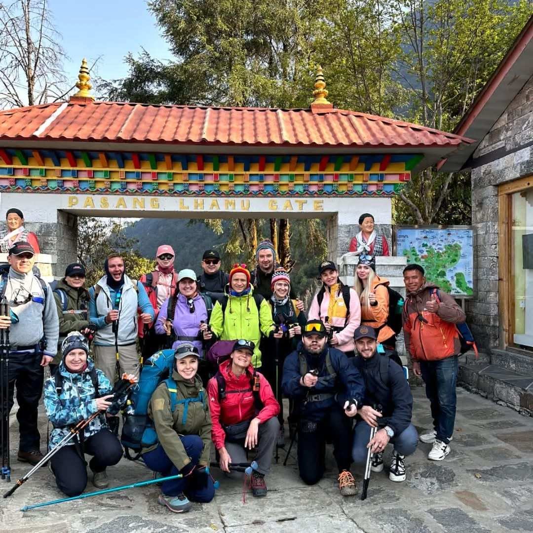
The Three Passes Trek is Nepal’s most complete Khumbu experience and the natural next step for trekkers who have completed Everest Base Camp and want to go deeper into the region. Where the EBC route follows a single valley from Lukla to Gorakshep and back, the Three Passes Trek creates a circuit that crosses three high mountain passes above 5,000 metres and visits virtually every major valley in the Khumbu, including the Gokyo Lakes, the Cho La, the Renjo La, and the full approach to Everest Base Camp via the Kongma La. The result is a 16 to 21 day journey that is both more physically demanding and incomparably more varied than the standard EBC route, visiting landscapes and viewpoints that relatively few trekkers ever see.
This guide covers the Three Passes Trek in full detail: the three passes themselves, the complete route options, day-by-day itinerary planning, physical requirements, acclimatisation strategy, permits, costs, and the specific gear and preparation that the higher and more remote sections of this trek demand. For trekkers considering whether to attempt it, the honest assessment is that the Three Passes Trek rewards commitment with an experience that the EBC route alone cannot provide.
What Are the Three Passes?
The three passes that give the trek its name are the Kongma La, the Cho La, and the Renjo La. Each crosses a different mountain ridge in the Khumbu and each provides a completely different perspective on the surrounding peaks. Understanding what each pass involves is the starting point for planning the trek.
| Pass | Altitude | Crossing Direction | Technical Difficulty | Key Views |
|---|---|---|---|---|
| Kongma La | 5,535m | Dingboche to Lobuche (or reverse) | Moderate; steep scree on descent side; possible ice | Makalu, Lhotse, Nuptse, Island Peak; Khumbu glacier from above |
| Cho La | 5,420m | Dzongla to Gokyo (or reverse) | Moderate to challenging; glacier section with possible crevasses; often icy | Cho Oyu, Cholatse, Taboche; Ngozumpa glacier panorama |
| Renjo La | 5,360m | Lungden to Gokyo (or reverse) | Moderate; steep rocky ascent; no glacier crossing | Everest, Lhotse, Makalu from classic angle; Gokyo Lakes below |
The passes are typically crossed in the order Kongma La, Cho La, Renjo La when trekking in a clockwise direction (which is the most common direction), or in reverse for a counter-clockwise circuit. The clockwise direction is generally preferred because it crosses the most technically demanding pass (Kongma La) early when the body is fresher, and the Renjo La descent to Gokyo at the end provides the most dramatic arrival into the lakes area.
Planning Your Everest Trek?
Get local expert advice on cost, itinerary and the best time to go.
Three Passes Trek Overview: Key Facts
| Factor | Details |
|---|---|
| Total distance | 160 to 190km depending on route variant and side trips |
| Duration | 16 to 21 days from Lukla |
| Maximum altitude | 5,535m (Kongma La); 5,644m (Kala Patthar, optional) |
| Total ascent | Approximately 10,000m cumulative over the full circuit |
| Best seasons | October to November; March to May |
| Difficulty | Demanding; significant experience recommended |
| Permits required | TIMS card; Sagarmatha National Park permit; Khumbu Pasang Lhamu fee |
| Guide requirement | Not legally mandatory but strongly recommended for passes |
| Teahouse availability | Full teahouse route; no camping required |
| Maximum single-day altitude gain | Kongma La crossing: approximately 900m ascent from Dingboche |
Physical Requirements for the Three Passes Trek
The Three Passes Trek is a serious undertaking that requires more preparation than the standard EBC trek. The combination of greater total distance, three high-altitude pass crossings, longer days above 5,000 metres, and a longer overall duration creates a cumulative physical demand that is significantly higher than any single-valley trek in the Khumbu.
Who Should Attempt This Trek?
The Three Passes Trek is most appropriate for trekkers who have already completed at least one multi-day mountain trek above 4,000 metres, are comfortable with walking six to eight hours per day for multiple consecutive days, can navigate by map and compass in poor visibility (relevant for the pass crossings in deteriorating weather), and understand altitude illness symptoms and management. Previous EBC experience is the ideal preparation: it familiarises the trekker with the teahouse system, the specific demands of the Khumbu terrain, and the acclimatisation process, while the Three Passes circuit then adds the pass crossings as the additional technical dimension.
The trek is not suitable for first-time high-altitude trekkers, those with cardiovascular or pulmonary conditions that are exacerbated by altitude, or trekkers who are not prepared to turn around and descend if conditions or health require it. The remoter sections of the route (particularly the Renjo La and the Lungden valley) are less travelled and further from helicopter evacuation access than the main EBC route, which increases the consequences of an altitude-related emergency.
Physical Training Preparation
The training that makes the biggest difference for the Three Passes Trek is sustained cardiovascular endurance training combined with loaded pack hiking on steep terrain. Specific recommendations:
- Base endurance (4 to 6 months before): Build to 45 to 60 minutes of sustained aerobic exercise (running, cycling, swimming) five days per week. The goal is a base aerobic capacity that allows six to eight hours of sustained effort at altitude without complete exhaustion.
- Loaded hiking (2 to 4 months before): Weekly day hikes of 20 to 30km with a 10 to 12kg pack on varied terrain. The cumulative load training conditions the back, hips, and knees for the specific demands of loaded downhill walking, which is where most knee injuries occur on the descent sections of the passes.
- Stair climbing with pack (8 to 12 weeks before): Stair climbing machines at the gym, or actual building stairwells climbed multiple times with a loaded pack, closely simulate the calf-burning, breath-demanding ascent of the pass approaches. Twenty to thirty minutes of stair climbing with a 10kg pack three times per week produces measurable improvements in pass-crossing performance.
- Test overnight or multi-day hike (4 to 8 weeks before): A two or three night hike with full kit serves as both a fitness test and a gear shakedown. Any equipment failures (blisters from boots, chafing from the pack, inadequacy of sleeping bag warmth) discovered on a weekend hike are fixable before departure; discovering them on Day 3 of the Three Passes Trek is significantly more difficult.
Detailed Route Description: The Three Passes Circuit
The following describes the clockwise Three Passes circuit beginning from Lukla, which is the most commonly trekked direction. The itinerary allows for appropriate acclimatisation and includes the most dramatic viewpoints in their optimal sequence.
Phase 1: Lukla to Dingboche (Days 1 to 5)
The opening phase of the Three Passes Trek is identical to the beginning of the standard EBC route. From Lukla (2,846m), the trail descends to the Dudh Koshi valley and follows the river north through Phakding (2,652m) to the foot of the Namche climb. The Hillary Suspension Bridge crossing and the steep climb to Namche Bazaar (3,438m) are the defining features of Day 2. An acclimatisation day at Namche (Day 3) is non-negotiable for the Three Passes circuit; the additional altitude demands of the passes make the acclimatisation foundation more critical than on the standard EBC route. Days 4 and 5 continue to Tengboche (3,867m) and onward to Dingboche (4,410m) via Pangboche.
Phase 2: Dingboche Acclimatisation and the Kongma La Crossing (Days 6 to 8)
Day 6 is a critical acclimatisation rest day at Dingboche. The standard acclimatisation hike to Chukhung (4,730m) provides an excellent preview of the Island Peak and Lhotse south face views that will accompany the Kongma La crossing. On this day, look north from Chukhung toward the Kongma La saddle; the route is visible as a notch in the ridge above. The scale of the ascent from Dingboche helps in mentally preparing for the following day.
Day 7 is the Kongma La crossing (5,535m), the highest of the three passes and the most physically demanding day of the entire circuit. From Dingboche, the route initially follows the Imja Khola valley northeast toward Chukhung before branching right (north) up a steep rocky slope toward the pass. The ascent from Dingboche to the Kongma La summit takes four to six hours depending on pace and conditions. The views from the summit are among the finest in the entire Khumbu: Makalu (8,485m), the Lhotse south face, Island Peak, and the upper Khumbu glacier all visible simultaneously. The descent on the western side is steep scree and loose rock that drops onto the Khumbu glacier moraine above Lobuche (4,940m). The total day is long (6 to 9 hours) and demanding; allow sufficient time for the descent.
Day 8 provides a needed rest at Lobuche before the circuit continues. Many trekkers use this day for the walk to Gorakshep and Everest Base Camp if they have not visited before, returning to Lobuche to sleep. This is an additional 8 to 10 hour day and should only be added if health and energy are strong after the Kongma La crossing.
Phase 3: Dzongla and the Cho La Crossing (Days 9 to 11)
From Lobuche (4,940m), the trail diverges from the standard EBC route by heading west toward Dzongla (4,830m) rather than north toward Gorakshep. Dzongla is a small settlement at the base of the Cho La approach, with a handful of teahouses serving the trekkers who come specifically for the pass crossing. It sits below the dramatic south faces of Cholatse (6,440m) and Taboche (6,542m), both of which provide spectacular evening photography.
The Cho La crossing (5,420m) on Day 10 is the most technically demanding of the three passes. The upper section involves a glacier crossing that may include areas of bare ice, and the use of crampons (light trail crampons rather than full mountaineering crampons are usually sufficient) is strongly recommended. The glacier is not heavily crevassed but there are slots that require attention, particularly in early morning when the surface is icy. An early start (4:00am to 5:00am) is important: the ice is more stable in cold morning temperatures than in the afternoon when solar radiation softens the surface. From the summit of the Cho La, the Gokyo valley opens below with the turquoise Gokyo Lakes visible in the valley floor. The descent on the western side is steep but on rock rather than glacier and is typically faster than the ascent.
Gokyo (4,790m) is reached in the early afternoon of Day 10 or 11 depending on start time and pace. The village sits at the edge of the third Gokyo Lake, the largest of the five, and the views across the lake to the Ngozumpa glacier and the surrounding peaks are immediately striking. After the moraine landscape of the upper Khumbu, the turquoise water and green shores of the Gokyo valley feel like a completely different world.
Phase 4: Gokyo, Gokyo Ri, and the Upper Lakes (Days 11 to 13)
Gokyo merits at least two nights for three reasons: acclimatisation recovery after the Cho La crossing, the Gokyo Ri climb, and the opportunity to explore the upper lakes.
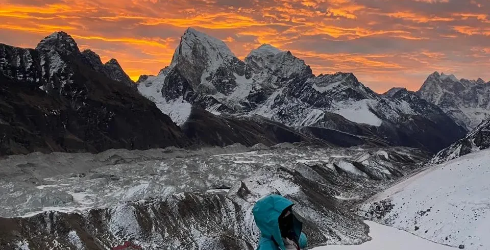
Gokyo Ri (5,357m) is the viewpoint above the village and one of the finest panoramic viewpoints in the entire Himalaya. The view from the summit encompasses Everest (8,849m), Cho Oyu (8,188m), Lhotse (8,516m), and Makalu (8,485m) simultaneously, all appearing in one 180-degree arc of mountain panorama. Gokyo Ri also provides the best view of the Ngozumpa glacier, the longest glacier in the Himalayas at approximately 36km, spread below in a dramatic river of ice and moraine. Many experienced Himalayan trekkers rate the Gokyo Ri view above Kala Patthar for its wider panoramic scope; others prefer Kala Patthar for its proximity to Everest’s summit pyramid. The Three Passes Trek, uniquely, provides both.
| Gokyo Lake | Altitude | Name | Notes |
|---|---|---|---|
| First lake (Longponga Tsho) | 4,650m | Longponga Tsho | Below Gokyo village; reached on the approach from Machhermo |
| Second lake (Taujung Tsho) | 4,690m | Taujung Tsho | Below Gokyo village; more visible from approach trail |
| Third lake (Dudh Pokhari) | 4,750m | Dudh Pokhari | The main Gokyo lake; village sits at its edge; largest of the five |
| Fourth lake (Thonak Tsho) | 4,830m | Thonak Tsho | 40-minute walk above Gokyo; deeper colour; quieter than third lake |
| Fifth lake (Ngozumpa Tsho) | 4,980m | Ngozumpa Tsho | 1.5 to 2 hours above Gokyo; most remote; rarely visited by casual trekkers |
The walk to the fourth and fifth Gokyo lakes is one of the most rewarding and least crowded days of the entire circuit. Most trekkers at Gokyo go up Gokyo Ri and move on; the minority who walk to the upper lakes discover an increasingly remote and wild landscape that feels a world away from the teahouse circuit. The fifth lake sits below the hanging glaciers of Cho Oyu and the silence (relative to Gokyo village) is profound. Allow a full day for the fourth and fifth lakes and return to Gokyo for the second night.
Phase 5: Renjo La Crossing and Return (Days 13 to 16)
From Gokyo, the route north leads to Lungden (4,380m), a small settlement at the base of the Renjo La approach. The walk from Gokyo to Lungden (3 to 4 hours) is a pleasant descent through the Dudh Koshi valley with increasingly dramatic views of Cho Oyu as the valley head opens. Lungden has basic teahouse accommodation and is primarily used as a staging point for the Renjo La crossing.
The Renjo La (5,360m) crossing is the most straightforward of the three passes in terms of technical difficulty: there is no glacier to cross, the path is well-marked, and the ascent is steep but on stable rock rather than ice. The summit provides one of the classic Everest views: the peak appears perfectly framed between closer ridgelines from this western angle in a way that differs completely from the southern Kala Patthar view. The descent on the eastern side leads to the Lumde valley and Thame (3,820m), one of the most culturally significant Sherpa villages in the Khumbu and home to the Thame Monastery, known for its association with the legendary lama Lama Sanga Dorji.
From Thame, the return to Namche Bazaar (3,438m) is a comfortable three to four hour walk through the Bhote Kosi valley, passing several chortens and mani walls that are among the oldest religious monuments in the Khumbu. The arrival back in Namche, with its teahouses, bakeries, and relative amenities, after the austerity of the upper circuit, is a pleasure that returning trekkers universally appreciate.
Phase 6: Namche to Lukla (Days 16 to 17)
The final phase of the Three Passes circuit retraces the approach trail from Namche to Lukla via Phakding. This section (approximately 8 hours of walking spread over one or two days depending on fitness and preference) is relatively straightforward and feels noticeably easier than the outward journey thanks to the accumulated fitness of the preceding two weeks. Most trekkers complete it in one long day or split it into two shorter days at Phakding.
Recommended Itinerary: 18-Day Three Passes Trek
| Day | Route | Altitude | Hours Walking |
|---|---|---|---|
| 1 | Fly Kathmandu to Lukla; trek to Phakding | 2,846m to 2,652m | 3 to 4 |
| 2 | Phakding to Namche Bazaar | 2,652m to 3,438m | 5 to 6 |
| 3 | Acclimatisation at Namche; hike to Everest View Hotel | 3,438m (hike to 3,880m and back) | 3 to 4 (hike) |
| 4 | Namche to Tengboche | 3,438m to 3,867m | 4 to 5 |
| 5 | Tengboche to Dingboche | 3,867m to 4,410m | 5 to 6 |
| 6 | Acclimatisation at Dingboche; hike to Chukhung | 4,410m (hike to 4,730m and back) | 4 to 5 (hike) |
| 7 | Dingboche to Lobuche via Kongma La (5,535m) | 4,410m to 4,940m; summit at 5,535m | 7 to 9 |
| 8 | Rest day at Lobuche; optional EBC visit | 4,940m | Optional 8 to 10 for EBC |
| 9 | Lobuche to Dzongla | 4,940m to 4,830m | 3 to 4 |
| 10 | Dzongla to Gokyo via Cho La (5,420m) | 4,830m to 4,790m; summit at 5,420m | 7 to 9 |
| 11 | Rest and acclimatisation at Gokyo | 4,790m | Optional upper lakes walk |
| 12 | Gokyo Ri (5,357m) and upper lakes | 4,790m base; summit 5,357m | 5 to 7 |
| 13 | Gokyo to Lungden | 4,790m to 4,380m | 3 to 4 |
| 14 | Lungden to Thame via Renjo La (5,360m) | 4,380m to 3,820m; summit at 5,360m | 7 to 8 |
| 15 | Thame to Namche Bazaar | 3,820m to 3,438m | 3 to 4 |
| 16 | Rest day in Namche; explore village | 3,438m | Optional walks |
| 17 | Namche to Lukla | 3,438m to 2,846m | 5 to 6 |
| 18 | Fly Lukla to Kathmandu | N/A | N/A (allow buffer day) |
The Cho La Pass: Technical Information for Trekkers
The Cho La deserves expanded attention because it is the pass that most commonly causes difficulty for trekkers on this circuit, and the difference between a safe crossing and a dangerous one often comes down to preparation and timing decisions made the evening before.
Conditions and Seasonal Variation
The Cho La glacier section changes significantly between seasons and even between years as the glacier recedes. In October, the glacier surface is typically firm ice in the early morning and softens to slushy snow by mid-afternoon. In April, snow coverage is often deeper and the conditions can be more forgiving for trekkers without crampons, but crevasse risk can be higher. After significant snowfall, the pass may be impassable for one to several days; always ask teahouse owners in Dzongla about recent pass conditions before committing to a crossing day.
Planning Your Everest Trek?
Get local expert advice on cost, itinerary and the best time to go.
Equipment for the Cho La
- Crampons: Light trail crampons (microspikes or C1-style crampons) are sufficient for normal conditions. Full 12-point mountaineering crampons are not necessary unless reports indicate the glacier is heavily iced. Crampons can be rented in Namche and in Gokyo for approximately NPR 500 to 800 per day.
- Trekking poles: Essential for balance on the icy sections and for the steep scree descent toward Gokyo. Set them short for the ascent and long for the descent.
- Warm layers: The Cho La summit is exposed to wind and the wait for other trekkers to cross can be cold. Full down jacket, waterproof shell, warm gloves, and a balaclava should all be accessible without removing the pack.
- Headlamp: An early start means the first hour of the approach is in darkness. Ensure the headlamp is accessible at the top of the pack rather than buried inside.
- Emergency bivouac layer: A lightweight emergency blanket or bivouac bag is worth carrying on the pass crossing days. The consequences of an injury that prevents walking on the glacier are serious; the ability to maintain warmth while waiting for help can be life-saving.
Timing the Cho La Crossing
Leave Dzongla no later than 5:00am. The glacier section is best crossed in cold, firm conditions, typically 6:00am to 8:00am. Trekkers who leave at 7:00am or later are crossing as the ice softens, which increases slip risk and makes the footing less predictable. After 10:00am, the glacier surface in warm conditions can become dangerously soft. Plan to be on the descent side of the summit by 9:00am at the latest.
The Kongma La Pass: What to Expect
The Kongma La is the highest pass of the three at 5,535m and is crossed early in the circuit, on Day 7 from Lukla. This timing means the body has had only five days to acclimatise to altitude, which is why the Day 6 rest at Dingboche and the acclimatisation hike to Chukhung are so important. Do not attempt the Kongma La if you are experiencing AMS symptoms; the pass crosses at an altitude that is close to the altitude ceiling beyond which severe AMS becomes significantly more likely.
The ascent from Dingboche follows a long glacial valley northeast before climbing steeply through scree and loose rock to the saddle. Fixed ropes are present on some sections but they are not always in good condition; do not rely on them as primary safety systems. The descent toward Lobuche on the western side is loose scree that requires careful foot placement. In wet or icy conditions, this descent can be treacherous; if conditions are poor, waiting a day in Dingboche is far preferable to a forced descent in dangerous conditions.
The Renjo La Pass: The Scenic Finale
The Renjo La is the easiest of the three passes technically and is often described as the most scenic. The view from the summit toward Everest, Lhotse, and Makalu is one of the classic Himalayan panoramas, made more dramatic by the contrast with the Gokyo Lakes visible in the valley below to the east. Unlike the Cho La, there is no glacier crossing; the ascent is steep but on solid rock and the path is well-defined. Trekkers who have completed the Kongma La and the Cho La will find the Renjo La technically non-threatening by comparison.
The descent from the Renjo La into the Bhote Kosi valley toward Thame passes through a different landscape than any other section of the circuit: the lower, more sheltered valleys of the western Khumbu have a greener, less barren character than the high moraine above Lobuche or the glacially scoured Gokyo basin. The Thame valley is home to significant Sherpa history: Edmund Hillary and Tenzing Norgay both had connections to this valley, and the Thame Monastery is among the most important religious sites in the Khumbu.
Gokyo Lakes: One of the Highlights of the Circuit
The Gokyo Lakes are among the most visually striking natural features in the entire Himalayan region and are a major reason why experienced trekkers choose the Three Passes Trek over the standard EBC route. The five glacially dammed lakes at altitudes between 4,650m and 4,980m are coloured a remarkable turquoise-emerald by the glacial minerals suspended in the meltwater from the Ngozumpa glacier. The colour is most intense in the early morning and late afternoon when the low-angle light saturates the water against the dark moraine banks.
The Ngozumpa Glacier
The Ngozumpa glacier, which the Gokyo Lakes dam, is the longest glacier in the Himalayas. It flows from the high cwm between Cho Oyu and Gyachung Kang southward for approximately 36km before terminating above Dole in the lower Gokyo valley. Viewed from Gokyo Ri, the full length of the glacier fills the valley below in a chaotic jumble of ice pinnacles, moraine debris, and glacial ponds that is unlike anything visible from the main EBC route. The glacier is retreating at a measurable rate due to climate change; the moraine-dammed lakes are growing in area as the ice recedes, which paradoxically makes the landscape more dramatically water-rich even as the glacier itself diminishes.
Gokyo Ri: The Best View in the Khumbu?
The debate between Kala Patthar and Gokyo Ri for the title of best viewpoint in the Khumbu is one of the enjoyable arguments of the trekking community. Kala Patthar provides the closer and more dramatic view of Everest’s south face and the Khumbu glacier; Gokyo Ri provides a wider panorama that takes in four of the world’s fourteen eight-thousanders in a single view (Everest, Lhotse, Cho Oyu, Makalu). The Three Passes Trek provides both views, which settles the argument in its favour as an overall experience.
The climb to Gokyo Ri from the village takes 2 to 3 hours at altitude pace. An early start (4:30am) for the summit is recommended for the best light, though the light show from Gokyo Ri does not have the same pre-dawn window as Kala Patthar because Everest’s south face is not directly visible from this angle. The morning clarity in October produces visibility that extends to mountains 200km distant; the sunrise illumination of the glacier below is one of the finest photographic opportunities on the entire circuit.
Acclimatisation Strategy for the Three Passes Trek
The Three Passes Trek demands a more sophisticated acclimatisation strategy than the standard EBC route because the circuit spends longer at very high altitudes (multiple nights above 4,700m), crosses three passes above 5,300m, and has less opportunity to descend to recover if altitude illness develops in the remote sections between the passes.
Key Acclimatisation Points
- Namche rest day (Day 3) is mandatory: On the standard EBC route, some trekkers push through without a full Namche rest day. On the Three Passes circuit, this is not advisable. The Kongma La crossing on Day 7 reaches 5,535m; inadequate acclimatisation at this point can result in serious altitude illness at the summit with descent being the only safe option.
- Dingboche rest day and Chukhung hike (Day 6): The acclimatisation hike to Chukhung (4,730m) and return to Dingboche (4,410m) is the textbook “climb high, sleep low” acclimatisation protocol. This single day significantly improves oxygen-carrying capacity for the Kongma La crossing the following day.
- Lobuche rest (Day 8) after Kongma La: Even trekkers who feel strong after the Kongma La crossing benefit from a rest day in Lobuche before pushing west toward Dzongla. The Kongma La is a significant physiological stress; recovery before the Cho La crossing is important.
- Gokyo rest (Day 11): After the Cho La crossing, the body needs 24 to 48 hours to recover at Gokyo (4,790m) before the Gokyo Ri climb and the onward journey to the Renjo La. Do not rush through Gokyo; it is one of the finest locations on the entire circuit and the rest day is both pleasant and necessary.
Monitoring Altitude Health on a Long Circuit
A pulse oximeter is essential equipment for the Three Passes Trek. Take readings every morning before rising and every evening before sleep, recording the results. Track your personal trend: if your SpO2 is consistently lower on successive mornings and you are developing symptoms, the trend indicates that your body is not acclimatising adequately and a rest day or controlled descent is needed. The extended duration of the circuit means that decisions made in the first week have significant consequences for the second week; a poorly managed altitude stress early in the trek reduces the body’s capacity for the later passes.
Gear List for the Three Passes Trek
The Three Passes Trek requires the same core gear as the EBC route with some important additions for the pass crossings and the longer duration in remote areas.
| Category | Item | Notes for Three Passes |
|---|---|---|
| Footwear | Mid or high-cut hiking boots (Vibram sole) | Must have excellent ankle support for loose scree on pass descents |
| Footwear | Light crampons (microspikes or C1) | Essential for Cho La glacier; can be rented in Namche or Gokyo |
| Clothing | Full down jacket (700+ fill power) | Necessary for pass summits and pre-dawn starts; temperatures at Kongma La can reach -20C |
| Clothing | Hardshell jacket and trousers (Gore-Tex or equivalent) | Wind and precipitation protection on exposed passes |
| Clothing | Warm mid-layer (fleece or softshell) | The extended time at altitude means more cold days than the standard EBC route |
| Navigation | Maps.me app (Nepal offline map) or printed topo map | The Cho La and Renjo La sections are less well-marked than the main EBC trail |
| Safety | Pulse oximeter | Essential for 18+ days at altitude; carry spare batteries |
| Safety | Personal locator beacon or Garmin inReach | The Lungden and Thame valleys are more remote than the main EBC route; satellite communication is important |
| Safety | Diamox (prescription) | Discuss with travel medicine doctor; particularly valuable for the pass crossings |
| Sleeping | Sleeping bag rated to -15C | Teahouses above 4,500m have minimal heating; own sleeping bag is essential |
| Trekking | Trekking poles (2) | More important than on flat or single-valley treks; essential for pass descents |
| Photography | Camera with extra batteries and rain cover | The Three Passes circuit has more spectacular photography days than any other Khumbu trek |
Permits and Costs for the Three Passes Trek
The permit requirements for the Three Passes Trek are identical to those for the EBC route, since the entire circuit lies within Sagarmatha National Park. The cost structure differs from the EBC route primarily in duration and the addition of a guide or porter for longer.
Permit Costs
| Permit | Cost | Notes |
|---|---|---|
| TIMS Card | USD 20 | Individual rate; obtainable in Kathmandu |
| Sagarmatha National Park Entry | NPR 3,000 (approx USD 22) | Same as EBC route; covers the entire national park area |
| Khumbu Pasang Lhamu Rural Municipality | NPR 2,000 (approx USD 15) | Collected at Lukla or Monjo |
Budget Estimates for the Three Passes Trek
| Cost Category | Amount (18-day trek) |
|---|---|
| Permits | USD 57 |
| Lukla flight (return) | USD 200 |
| Accommodation (17 nights, mid-range) | USD 170 to 340 |
| Meals (17 days, mid-range) | USD 425 to 595 |
| Sherpa guide (17 days at USD 30/day) | USD 510 |
| Porter (17 days at USD 18/day) | USD 306 |
| Tips (guide and porter combined) | USD 200 to 300 |
| Crampon rental (optional) | USD 15 to 25 |
| Miscellaneous (WiFi, charging, snacks) | USD 150 to 250 |
| Total on-trek estimate | USD 2,033 to 2,583 (with guide and porter) |
Do You Need a Guide for the Three Passes Trek?
The Three Passes Trek is legally open to independent trekkers; no guide is legally required. However, the argument for hiring a guide is considerably stronger for this trek than for the standard EBC route. The three reasons are navigation, technical safety on the passes, and altitude illness management.
Navigation on the Three Passes circuit is more complex than on the EBC route. The section from Dzongla to Gokyo via the Cho La involves route-finding on a glacier where the path is not always obvious, particularly in poor visibility or after fresh snow. A guide who has crossed the Cho La many times knows the route across the glacier, knows where the crevasse zones are in current conditions, and can make the route-finding decisions that a first-time trekker cannot. Similarly, the approach to the Renjo La from Lungden involves a less-travelled trail where the path is less clearly marked than the main EBC route.
A guide provided by a reputable agency like Everest Trek Company is also trained in wilderness first aid and altitude illness management, and has the communication capability and local knowledge to organise helicopter evacuation if an emergency develops in the remote sections of the circuit between the passes. For a trek of this duration and complexity, the guide fee is one of the most cost-effective safety investments available.
Combining the Three Passes Trek with EBC and Kala Patthar
Many trekkers who do the Three Passes circuit also want to visit Everest Base Camp and Kala Patthar, which are not on the main circuit route. The most common approach is to add these on Day 8 (the rest day at Lobuche), walking to Gorakshep and up to Kala Patthar for the sunrise on Everest, then down to EBC, and returning to Lobuche in the late afternoon. This is a very long day (10 to 12 hours total including the Kala Patthar climb) and should only be attempted by trekkers who are feeling physically strong after the Kongma La crossing. The alternative is to extend the itinerary by two days, spending nights at Gorakshep and combining EBC and Kala Patthar as separate dedicated days before returning to Lobuche to continue the circuit.
Frequently Asked Questions: Three Passes Trek Nepal
How difficult is the Three Passes Trek compared to the EBC route?
The Three Passes Trek is significantly more demanding than the standard EBC route in terms of total distance, total ascent, number of days above 5,000m, and technical difficulty of the pass crossings (particularly the Cho La glacier section). It is suitable for trekkers who have previous high-altitude experience, are in good physical condition, and are prepared for longer and more demanding days than the standard EBC route involves. The EBC route is an appropriate first Khumbu experience; the Three Passes circuit is best approached as a second or third Khumbu visit with the knowledge and acclimatisation experience that prior visits provide.
Is the Three Passes Trek possible without crampons?
The Cho La glacier section typically requires crampons in October and April when the ice surface is firm. Trekkers who attempt the Cho La without crampons in these conditions face a significantly higher slip risk on the ice. Crampons are available to rent in Namche and Gokyo, making them accessible without carrying from home. In some conditions (a warm period with deep soft snow rather than bare ice), the Cho La can be crossed without crampons, but you cannot know the conditions in advance. Bringing or renting crampons eliminates the uncertainty.
What is the best direction to trek the Three Passes?
The clockwise direction (Kongma La, Cho La, Renjo La in that order) is recommended for most trekkers for three reasons. First, it crosses the highest and most demanding pass (Kongma La) while the body is freshest in the second week; trekkers who do the Renjo La first and the Kongma La last are crossing the hardest pass when the most fatigued. Second, the clockwise direction provides the most dramatic arrival at Gokyo, descending from the Cho La to see the lakes for the first time. Third, the Renjo La in the final crossing direction provides a classic first view of the Gokyo Lakes from above as you approach the summit, rather than departing from them.
Can the Three Passes Trek be done in less than 16 days?
Physically fit trekkers with prior high-altitude experience sometimes complete the circuit in 14 to 15 days by reducing or eliminating rest days. This is possible but not recommended for most trekkers because the reduced acclimatisation time increases altitude illness risk, particularly for the Kongma La crossing on a compressed schedule. The extra days in a 17 to 18 day itinerary are overwhelmingly spent in more beautiful places; the Gokyo upper lakes, the Thame valley, and the Namche rest day are not wasted time. The additional cost of two extra days in teahouses is modest compared with the safety and enjoyment benefits.
What teahouse availability is there between the passes?
Teahouse accommodation is available at all major stopping points on the circuit: Dingboche, Lobuche, Dzongla, Gokyo, Lungden, and Thame all have functional teahouses that serve food and provide accommodation. The teahouses in Dzongla and Lungden are more basic than those in the main trail villages (fewer options, simpler food, more basic rooms) but they are adequate and well-suited to their function as pass-crossing staging posts. Booking in advance is not strictly necessary for most of the circuit, but calling ahead (most teahouses now have mobile numbers available through trekking agencies) ensures a room during the October peak weeks.
How does the Three Passes Trek handle bad weather on the passes?
Bad weather (particularly fresh snowfall or high wind) can make the pass crossings dangerous or impossible. The strategy for managing this is simple: never attempt a pass crossing in poor or rapidly deteriorating weather, and build weather buffer days into the itinerary. An 18-day itinerary for a circuit that takes 16 days in good conditions provides two weather buffer days that are sufficient for most weather delays. Trekkers on very tight schedules who cannot accommodate weather delays should either accept the risk of a curtailed circuit or extend the itinerary. The passes can also be reached by different routes in case of emergency: the Cho La can be bypassed by returning to Dingboche via Lobuche and approaching Gokyo via Machhermo, though this adds two to three days to the itinerary.
Flora and Wildlife on the Three Passes Trek
The Three Passes circuit traverses a greater variety of ecological zones than the standard EBC route, and the biological richness that results is one of the under-appreciated aspects of the trek. The lower valleys of the Gokyo and Bhote Kosi drainages in particular support a distinctly different flora and fauna from the high moraine landscape above Lobuche.
Vegetation Zones
The lower sections of the circuit below 3,500m pass through forests of silver birch, Himalayan fir, and rhododendron that are spectacular in both the spring bloom (late March to April) and the autumn colour (October). The birch forests along the Gokyo valley below Machhermo are particularly beautiful: the silver-grey trunks against autumn yellow leaves create a distinctly different visual character from the open moraine of the upper valley. Above 4,000m, the vegetation transitions to alpine shrubs, grasses, and flowering sedums that cling to sheltered south-facing rock faces. Above 4,500m, plant life becomes sparse; above 5,000m on the pass approaches, only mosses, lichens, and occasional cushion plants survive.
Wildlife
| Species | Where Seen | Best Season | Notes |
|---|---|---|---|
| Himalayan tahr | Rocky slopes above 3,500m; common near Dingboche and Gokyo Ri | October to November | Males have impressive curved horns; often seen in small herds |
| Snow leopard | High rocky areas above 4,000m; extremely rare sighting | Winter (December to February) for lower altitude | Presence confirmed in Sagarmatha NP; sighting exceptional luck |
| Red panda | Rhododendron and bamboo forest below 3,500m; lower Gokyo valley | Spring and autumn | Rarely seen but resident; reddish fur; nocturnal |
| Musk deer | Forest zones below 4,000m | Year-round | Small, hornless; often detected by bounding movement in undergrowth |
| Yellow-billed chough | Throughout route; common at teahouses and pass summits | Year-round | Bold black birds with yellow bills; will approach trekkers for food |
| Himalayan griffon vulture | Thermals over main valleys; Namche area | October to April | Enormous wingspan; circling high above valley floors |
| Blood pheasant | Rhododendron forest below 3,800m | Spring and autumn | Nepal’s national bird; red and green plumage; rare sighting |
| Himalayan monal | Forest edges 3,000 to 4,500m; Khumjung area above Namche | Spring and autumn | Spectacular iridescent plumage; often seen on trail edges |
Cultural Highlights of the Three Passes Circuit
The Three Passes Trek passes through most of the historically and culturally significant locations in the Khumbu, providing a cultural depth that the EBC route alone cannot match. The addition of the Gokyo valley and the Bhote Kosi valley means the circuit includes Sherpa communities, monasteries, and sacred sites that the main EBC trail completely bypasses.
Thame Monastery and Village
Thame (3,820m) in the Bhote Kosi valley is one of the most historically significant Sherpa villages in the Khumbu, and arriving here after the Renjo La crossing is a rewarding conclusion to the western side of the circuit. The Thame Monastery, perched on a cliff above the village, is one of the oldest in the Khumbu and is associated with the revered lama Lama Sanga Dorji, who is credited with introducing Buddhism to the Sherpa people of the Khumbu in the eighteenth century. The monastery is active; monks reside here and the morning puja chants can be heard in the village below.
Thame is also notable as the birthplace of Apa Sherpa, who holds the record for the most Everest summits (21 times as of 2022), and as a village that has maintained a more traditional Sherpa character than Namche or Tengboche because it sits off the main trekking route. The annual Mani Rimdu festival at Thame Monastery (held in the fourth Tibetan month, typically May or June) is one of the most important religious festivals in the Khumbu and draws Sherpa people from throughout the region; if timing allows, attending the Thame Mani Rimdu is an extraordinary cultural experience that few trekkers encounter.
Gokyo and the Upper Valley Communities
The Gokyo valley was traditionally used by Sherpa families as summer pasture for yaks; the permanent teahouse settlement at Gokyo village is relatively recent, established to serve the growing number of trekkers visiting the lakes. The valley retains a seasonal character that distinguishes it from the permanently settled main EBC corridor. The summer yak herding culture is still visible in the high pastures: stone-walled yak corrals and the remains of seasonal settlements dot the valley above 4,500m, testifying to the traditional economy that supported Sherpa communities before trekking tourism transformed the region’s economic base.
Mani Walls and Chortens Along the Circuit
The Three Passes Trek passes an exceptional number of mani walls and chortens compared with the standard EBC route, partly because the Bhote Kosi valley and the Gokyo approach trail were historically less trafficked and the religious monuments placed there have been maintained by local communities rather than rebuilt for tourist aesthetics. Always pass mani walls on the left (keeping them on your right) as this is the respectful Buddhist practice and the direction in which the prayers inscribed on the stones are meant to be read. The largest mani walls on the circuit are found in the approaches to Thame and in the lower Gokyo valley near Machhermo.
Photography on the Three Passes Trek
The Three Passes circuit is arguably the finest photography trek in the Khumbu, offering a greater variety of subjects, viewpoints, and lighting conditions than any other route in the region. The Gokyo Lakes, the Gokyo Ri panorama, the Cho La glacier crossing, the Renjo La view toward Everest, and the Thame valley all provide photographic opportunities that are unavailable on the standard EBC route.
The most distinctive photographic subjects unique to this circuit include the turquoise Gokyo Lakes photographed from above on the Gokyo Ri descent, the pre-dawn crossing of the Cho La glacier with headlamps creating light trails against the ice (a complex but extraordinary image to capture), the classic Everest-from-the-west view from the Renjo La summit, the reflection of Cho Oyu in the upper Gokyo Lakes on still mornings, and the traditional character of Thame village and monastery. Carry adequate memory card capacity and spare batteries; the circuit produces significantly more photography days than the standard route and the cold above 5,000m depletes battery life faster than lowland conditions.
Comparing Three Passes Trek with Alternative Khumbu Routes
| Route | Duration | Max Altitude | Passes Crossed | Highlights | Best For |
|---|---|---|---|---|---|
| Standard EBC Trek | 12 to 14 days | 5,364m (EBC) or 5,644m (Kala Patthar) | None | Kala Patthar, EBC, Tengboche, Namche | First-time Khumbu trekkers; moderate fitness |
| Gokyo Lakes Trek | 12 to 14 days | 5,357m (Gokyo Ri) | None (return via Machhermo) | Gokyo Lakes, Gokyo Ri, Cho Oyu views | Alternative to EBC; slightly less crowded |
| EBC via Cho La | 15 to 17 days | 5,535m (Kongma La) or 5,644m (Kala Patthar) | Cho La only | EBC, Kala Patthar, Gokyo; one pass crossing | Intermediate step between EBC and full Three Passes |
| Three Passes Trek | 16 to 21 days | 5,535m (Kongma La) or 5,644m (Kala Patthar) | Kongma La, Cho La, Renjo La | All of the above plus Thame, upper Gokyo lakes, Bhote Kosi valley | Experienced trekkers wanting the complete Khumbu experience |
| Three Passes plus Island Peak | 19 to 23 days | 6,189m (Island Peak summit) | All three plus climbing route | Everything above plus a 6,000m peak climb | Trekkers with basic climbing experience wanting a summit |
Island Peak as an Add-On to the Three Passes Trek
Island Peak (Imja Tse, 6,189m) is the most accessible 6,000-metre peak in Nepal and is frequently combined with the Three Passes Trek as an add-on for trekkers who want a technical climbing experience without full mountaineering expedition logistics. The peak is approached from Chukhung (4,730m), which is on the acclimatisation hike route during the Dingboche rest day of the Three Passes itinerary, making the addition logistically straightforward.
Island Peak requires basic mountaineering skills: rope techniques (jumar ascent of fixed ropes, rope coiling), crampon use on steep glaciated terrain (steeper than the Cho La glacier), and comfort with exposure on narrow ridge sections. A licensed high-altitude climbing guide (different from a standard trekking guide) is required, and a separate climbing permit is needed (approximately USD 350 per person as of 2024). The summit day from high camp is typically 8 to 12 hours return; the views from the summit extend to the Lhotse south face, Makalu, and the full Khumbu panorama. For trekkers who have completed the standard EBC route and want a natural progression, Island Peak combined with the Three Passes circuit is one of the finest adventure experiences available in the Himalaya without committing to a full expedition mountaineering objective.
Responsible Trekking on the Three Passes Circuit
The more remote sections of the Three Passes circuit carry a heavier responsibility for responsible trekking than the busy main EBC corridor, where the infrastructure for managing trekker impact is more developed. The Gokyo valley, the Bhote Kosi valley, and the approaches to all three passes are ecologically sensitive areas where the cumulative impact of trekker activity is significant and growing.
- Waste management: Carry all non-biodegradable waste out of the high areas (above Gokyo, above Lobuche, on the pass approaches). Do not leave plastic bottles, wrappers, or packaging at the pass summits. The tradition of leaving prayer flags at pass summits is culturally significant; adding ordinary litter is a desecration of these sacred sites.
- Water treatment: Use a filter, purification tablets, or a UV purifier rather than buying bottled water above Namche. The cost of bottled water above 4,000m (NPR 200 to 400 per litre) is high, the plastic waste is significant, and the teahouse water quality (boiled for hot drinks) is generally safe when treated.
- Glacier ethics: On the Cho La glacier, stay on the established track and avoid probing or testing ice in areas away from the track. Crevasse hazard is real; the established route avoids the most problematic areas.
- Wildlife disturbance: The Gokyo valley has higher wildlife density than the main EBC corridor. Do not approach tahr or other wildlife closely for photography; use a telephoto lens and observe from a distance that does not cause the animal to move.
- Teahouse economy: In the remote teahouses at Dzongla, Lungden, and Thame, eat at your accommodation teahouse rather than elsewhere. These small establishments rely on trekker spending for their viability; spreading business too thin among competing establishments in small villages is economically harmful to the families who operate them.
Planning Your Everest Trek?
Get local expert advice on cost, itinerary and the best time to go.