By Kiran Basnet — Licensed Trekking Guide, Everest Trekking Company, Kathmandu
The Everest Base Camp itinerary is something I think about more carefully than almost any other aspect of organising a trek. The sequence of days, the elevation gains, the rest day placement — these are not arbitrary choices. They are the difference between a trek that succeeds and one that has to turn around at Pheriche because someone pushed too fast and their body said no.
In this guide I am going to walk you through the complete day-by-day Everest Base Camp itinerary we use at Everest Trekking Company. I will explain the reasoning behind each stop, what you will see and experience on each section, and where the itinerary can be adjusted for different goals or schedules.
The standard itinerary I use is 14 days from the start of the trek (the Lukla flight) to the finish. With travel days in Kathmandu, most clients are in Nepal for 16 to 18 days. I will also cover the 12-day option when it is appropriate and what extended routes look like.
Overview: Standard 14-Day Everest Base Camp Trek Itinerary
The route follows the classic south-side approach through the Khumbu Valley:
Kathmandu → Fly to Lukla → Phakding → Namche Bazaar (2 nights) → Tengboche → Dingboche (2 nights) → Lobuche → Gorak Shep → Everest Base Camp → Kala Patthar → Pheriche → Namche Bazaar → Lukla → Fly to Kathmandu
Total trekking distance: approximately 130 kilometres round trip Highest point: Kala Patthar, 5,550 metres Lowest point on route: Phakding, approximately 2,640 metres.
Planning Your Everest Trek?
Get local expert advice on cost, itinerary and the best time to go.
Day 1: Arrive Kathmandu (1,400m)
You land at Tribhuvan International Airport in Kathmandu, Nepal’s capital city and the departure point for all EBC treks. We meet clients at the airport, take them to their hotel in Thamel, and use this day for briefing, gear checks, and permit preparation.
Kathmandu is a proper city with good restaurants, coffee shops, and plenty to explore if you have energy after your international flight. Thamel, the tourist neighbourhood where most trekking hotels are based, has gear rental shops, bakeries, and excellent Nepali and international restaurants.
This is also the day to sort any final gear gaps. Trekking poles, sleeping bags, down jackets — all available for rent in Thamel. Our staff can accompany you to recommended shops if needed.
Accommodation: Hotel in Thamel, Kathmandu Elevation: 1,400m
Day 2: Fly Kathmandu to Lukla, Trek to Phakding (2,860m to 2,640m)
The early morning Lukla flight is one of the most discussed experiences of the entire trip. The flight takes approximately 30 to 40 minutes in a small Twin Otter or similar propeller aircraft. The approach to Lukla’s Tenzing-Hillary Airport — a short uphill runway on the edge of a ridge with a sheer drop at one end — is dramatic from the air. Most trekkers are wide awake by the time they land.
After landing, you meet your full guiding team in Lukla, do final pack checks, and begin walking. The trail from Lukla to Phakding is a pleasant 3 to 4-hour walk that follows the Dudh Koshi river valley downward. You cross several suspension bridges and pass through Sherpa villages. The rhododendron and pine forest is beautiful in spring.
The descent from Lukla to Phakding means you are going lower on day one, which is good — your body gets a gentle introduction to the trail without any altitude gain.
Trekking time: 3 to 4 hours Accommodation: Teahouse in Phakding Elevation at end: 2,640m
Day 3: Phakding to Namche Bazaar (2,640m to 3,440m)
This is the first genuinely challenging day of the trek. The route from Phakding to Namche gains approximately 800 metres of elevation over 5 to 6 hours of walking. You cross several high suspension bridges over the Dudh Koshi, pass through the village of Monjo (where the Sagarmatha National Park gate is located and permits are checked), and then begin the final sustained climb to Namche.
The climb to Namche takes 2 to 3 hours from the river level. It is steep and sustained, but the trail is well-maintained and the forest thins progressively as you ascend. At a ridge just before Namche, on a clear day, you get your first glimpse of Everest — just the black pyramid of the summit above the ridgeline. This moment, after the effort of the climb, is one of the quieter highlights of the route.
Namche Bazaar itself is a horseshoe-shaped town built into a natural amphitheatre at 3,440 metres. It is the commercial and social hub of the Khumbu — there are bakeries, equipment shops, good teahouses with WiFi, and a remarkable variety of restaurants for a town at this altitude. It is also where altitude becomes real for many trekkers. A headache on arrival at Namche is common and manageable.
Trekking time: 5 to 6 hours Accommodation: Teahouse in Namche Bazaar Elevation at end: 3,440m
Day 4: Namche Bazaar Acclimatisation Day (3,440m)
The two nights in Namche are not optional. Day four is an acclimatisation day — not a rest day. The “climb high, sleep low” principle means you hike up from Namche to a higher elevation and return, giving your body an altitude stimulus without overnight exposure.
The standard acclimatisation hike from Namche goes to the Everest View Hotel at 3,880 metres, which offers what is often described as the finest view of Everest from any lodge in the world — the hotel was built specifically for the view. You can also continue to the Sherpa village of Khumjung (3,790m) to visit the Hillary School and the local monastery.
This hike takes 3 to 4 hours and involves 440 metres of elevation gain. After returning to Namche, most trekkers spend the afternoon resting, exploring the market, or visiting the Sherpa Culture Museum. Evening in Namche is well worth extending — the shops stay open until dark and the bakeries are genuinely good.
Trekking time: 3 to 4 hours (acclimatisation hike) Accommodation: Teahouse in Namche Bazaar (second night) Elevation reached: 3,880m (return to sleep at 3,440m)
Day 5: Namche Bazaar to Tengboche (3,440m to 3,860m)
Day five is one of the most scenic walking days of the route. The trail leaves Namche, descends into the Dudh Koshi valley, and then climbs steadily through forest and open ridge to Tengboche Monastery at 3,860 metres.
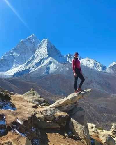
The walk passes through the village of Kyangjuma, crosses the river on a suspension bridge, and ascends through rhododendron forest (spectacular in spring) to the open plateau at Tengboche. The monastery at Tengboche is the spiritual heart of the Khumbu Sherpa community — it is the largest monastery in the Everest region and is perched on a natural balcony with views of Everest, Lhotse, and Ama Dablam (4am Dablam’s elegant peak visible to the south is particularly striking from Tengboche).
Evening prayers at the monastery are open to visitors and provide a different kind of perspective on this landscape — the deep chanting and the smell of juniper incense against the backdrop of the mountains is one of those experiences that stays with you.
Trekking time: 5 to 6 hours Accommodation: Teahouse in Tengboche Elevation at end: 3,860m
Day 6: Tengboche to Dingboche (3,860m to 4,410m)
Day six continues into the upper Khumbu, passing through the village of Pangboche (one of the oldest Sherpa villages in the region, with a monastery reportedly housing a yeti hand relic), descending to the Imja Khola river, and then ascending the lateral valley to Dingboche.
Dingboche sits on a plateau at 4,410 metres surrounded by walls of stone that partition the fields — a traditional Sherpa agricultural method for protecting crops from wind and yak. Above the village, the peaks of Lhotse, Island Peak, and Makalu are visible. This is noticeably high-altitude terrain — the landscape is open and exposed in a way that feels different from the forested lower sections.
Many trekkers feel altitude more distinctly at Dingboche than anywhere earlier on the route. Appetite decreases. Sleep is disrupted. This is normal and is your body signalling that acclimatisation is actively underway.
Trekking time: 5 to 6 hours Accommodation: Teahouse in Dingboche Elevation at end: 4,410m
Day 7: Dingboche Acclimatisation Day (4,410m)
The second acclimatisation day, in Dingboche, mirrors the structure of the Namche rest day. You hike to a higher elevation and return. The standard options are:
Nangkartshang Peak (5,083m): A 3 to 4-hour hike up the ridge behind Dingboche with panoramic views of the upper Khumbu and the peaks surrounding Island Peak.
Chhukung Ri (5,550m): A longer and more demanding option that reaches the same altitude as Kala Patthar. This is a good choice for trekkers who want more altitude stimulus or are planning an extended route.
The hike to Nangkartshang is the more common choice. It is harder than the Namche acclimatisation hike — the altitude is higher and the terrain more exposed. Most trekkers describe this as the day they understood what altitude really means. Coming back down to Dingboche for the second night is always a relief.
Trekking time: 4 to 5 hours (acclimatisation hike) Accommodation: Teahouse in Dingboche (second night) Elevation reached: 5,083m (return to sleep at 4,410m)
Day 8: Dingboche to Lobuche (4,410m to 4,910m)
Day eight leaves the relative shelter of the Dingboche valley and enters the upper Khumbu in earnest. The trail climbs steadily through increasingly stark landscape to the Thukla pass (4,620m), where there is a memorial ridge dedicated to climbers who have died on Everest. The stone cairns and prayer flags on this ridge, with the names of many famous mountaineers among them, are a sombre and moving reminder of what lies above.
From Thukla, the trail follows the eastern lateral moraine of the Khumbu Glacier up to Lobuche at 4,910 metres. Lobuche is a small cluster of teahouses in an exposed position — wind funnels down the valley here and temperatures drop significantly in the afternoon. There is little to do in Lobuche after dinner, and the beds are cold. Get into your sleeping bag early.
Sleep at Lobuche is often disrupted by altitude — periodic breathing, dry cough, and general difficulty at this elevation. This is normal. If you have a headache in the morning that does not respond to hydration and ibuprofen, tell your guide before setting off.
Trekking time: 5 to 6 hours Accommodation: Teahouse in Lobuche Elevation at end: 4,910m
Day 9: Lobuche to Gorak Shep, Everest Base Camp (4,910m to 5,140m to 5,364m)
This is the summit day of the trek.
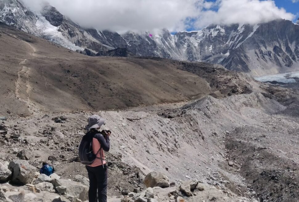
The morning walk from Lobuche to Gorak Shep (approximately 2 to 3 hours) follows the glacier moraine — rough, boulder-strewn, and demanding at altitude. Gorak Shep is the last settlement before Base Camp and the highest point on the route where teahouses operate. It is a small collection of lodges on a sandy lake bed.
After dropping your main bag at the lodge, you continue to Everest Base Camp. The trail to Base Camp from Gorak Shep takes 2 to 3 hours each way and involves crossing the lateral moraine of the Khumbu Glacier. The terrain becomes increasingly glacial — ice seracs visible above, moraine underfoot, the sound of the glacier shifting occasionally audible.
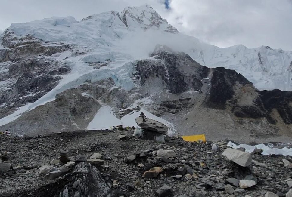
Arriving at Everest Base Camp is a complicated feeling. The camp itself is not particularly dramatic visually in autumn — without the expedition teams and their coloured tents that fill it in spring, Base Camp is a rocky plateau of glacial moraine. But what you feel there is less about what you see and more about what you have done to reach it. The weight of what this place means — the mountain above, the history below, the distance travelled — tends to arrive with some force.
Return to Gorak Shep for the night.
Trekking time: 8 to 9 hours total Accommodation: Teahouse in Gorak Shep Highest elevation: Everest Base Camp, 5,364m
Day 10: Kala Patthar, then Descend to Pheriche (5,550m to 3,820m)
The day begins at 3am to 4am. Layering up in the dark in a cold lodge, drinking hot tea by headlamp, and beginning the ascent of Kala Patthar before dawn is the hardest morning of the entire trek.
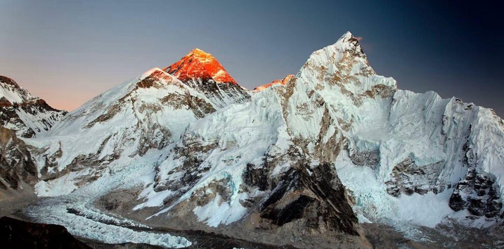
Kala Patthar (5,550 metres) is not the summit of anything famous, but it provides the finest view of Mount Everest available to non-climbers — the entire south face, the Western Cwm, the Khumbu Icefall, and the summit pyramid are visible without obstruction. In the pre-dawn darkness, as you climb the loose scree in the cold, the effort demands everything your altitude-adjusted body has. As the sky lightens, the summit of Everest turns gold, then orange, then white. This is why people come.
After returning to Gorak Shep for breakfast, you begin the long descent. The descent from 5,140 metres to Pheriche (3,820m) covers 1,320 metres of elevation loss over 5 to 6 hours. Descending after the highest point of the trek, when your body is most fatigued, requires attention. Trekking poles are particularly valuable here. The descent is fast compared to the ascent but the sustained downhill puts pressure on knees over several hours.
Arriving in Pheriche (or nearby Dingboche) at around 3,820 metres feels like a dramatic physical relief. You are breathing noticeably more easily. Appetite returns. Food tastes better. This is one of the small miracles of the Everest trail.
Trekking time: 9 to 10 hours total Accommodation: Teahouse in Pheriche or Dingboche Highest elevation: Kala Patthar, 5,550m
Day 11: Pheriche to Namche Bazaar (3,820m to 3,440m)
Day eleven is the long descent through familiar landscape. The trail retraces the route from earlier days — Tengboche, the river crossing, the forest, and back to Namche. Descending is physically faster than ascending but can be hard on the knees. Trekking poles and a porter carrying your main bag are both particularly valuable here.
Namche feels like a different place on the return journey. You are breathing easily at 3,440 metres. The bakeries are open. You may find yourself ordering coffee and cake with genuine enthusiasm for the first time in days. For some trekkers, the descent from Gorak Shep to Namche is the day they feel physically best on the entire trip — the altitude relief is rapid and pronounced.
Trekking time: 6 to 7 hours Accommodation: Teahouse in Namche Bazaar
Day 12: Namche Bazaar to Lukla (3,440m to 2,860m)
The final trekking day returns from Namche to Lukla, descending through the forests and river valleys of the lower Khumbu. The route is familiar but the mood is different — a combination of physical tiredness, satisfaction, and the particular bittersweetness of leaving somewhere that has demanded something from you.
Lukla feels like a genuine town after the teahouse settlements of the upper route. There are restaurants, bakeries, and shops. This is the night where trekkers traditionally celebrate with their guide and porter team — a good dinner, some local chang (barley beer) if you drink, and the exchange of tips and genuine gratitude.
Trekking time: 6 to 7 hours Accommodation: Teahouse in Lukla
Day 13: Fly Lukla to Kathmandu
Morning flights from Lukla typically depart between 6am and 9am. The flight back to Kathmandu takes 35 to 40 minutes and is generally even more dramatic than the outbound — you can see the mountains clearly as you descend away from them toward the Kathmandu Valley.
In Kathmandu, a shower, a proper meal, and a comfortable bed feel like extraordinary luxuries. Most clients spend this evening somewhere good in Thamel. We celebrate your completion at dinner.
Note on delays: Lukla flights can be delayed or cancelled due to weather. We always recommend arriving back in Kathmandu at least 2 days before any international flight.
Day 14: Departure Day or Extra Kathmandu Exploration
Depending on your international flight, day 14 is either a travel day or an exploration day in Kathmandu. If you have time, the Kathmandu Valley has extraordinary heritage sites — Boudhanath Stupa, Pashupatinath Temple, Swayambhunath (the Monkey Temple), and the medieval city of Bhaktapur are all within an hour of the city centre.
Planning Your Everest Trek?
Get local expert advice on cost, itinerary and the best time to go.
Optional Extensions and Alternative Routes
Kala Patthar Sunrise and Gokyo Lakes (20 to 21 Days)
Adding the Gokyo Lakes — a series of glacial lakes on the Ngozumpa Glacier at around 4,700 to 5,000 metres — extends the trek by 5 to 6 days and provides an alternative perspective on the Everest massif from Gokyo Ri (5,357m). This is one of the finest extended options in the Khumbu.
Three Passes Trek (18 to 22 Days)
Crossing Kongma La (5,535m), Cho La (5,420m), and Renjo La (5,360m) connects Everest Base Camp, Gokyo Lakes, and the Rolwaling valley in a high-altitude circuit. This is a challenging but exceptional route for experienced trekkers.
Island Peak with EBC (18 to 21 Days)
Island Peak (Imja Tse, 6,189m) is a popular trekking peak that can be combined with EBC. No previous technical climbing experience is required, but you will need crampons, ice axes, and guidance on the fixed ropes on summit day.
The 12-Day EBC Itinerary: When Is It Appropriate?
A 12-day itinerary compresses the schedule by combining some stages. It is sometimes offered by agencies as a budget or time-saving option. Here is my honest view:
For trekkers who have been to similar altitudes before (Kilimanjaro summit, Annapurna Base Camp at 4,130m, or similar) and did not experience significant AMS, a 12-day itinerary with proper acclimatisation days built in can work. For trekkers with no prior altitude experience, I do not recommend it. The risk of having to turn around — or worse, requiring evacuation — is meaningfully higher on a compressed timeline.
The extra cost of a 14-day versus 12-day itinerary is 2 days of accommodation and meals on the trail — perhaps $80 to $120 per person. Compared to the cost of a helicopter evacuation or a wasted trip, this is trivial.
Frequently Asked Questions About the EBC Trek Itinerary
How many days does the Everest Base Camp trek take?
The standard itinerary is 14 trekking days from Lukla back to Lukla, with most clients spending 16 to 18 days in Nepal including Kathmandu days and buffer time for flight delays.
What is the best Everest Base Camp trek itinerary?
The 14-day itinerary with two acclimatisation days (Namche and Dingboche) is the most appropriate for most trekkers. It allows sufficient altitude adjustment, includes a Kala Patthar sunrise, and provides buffer for weather delays.
Can you do the EBC trek in 12 days?
A 12-day itinerary is possible but riskier, particularly for first-time high-altitude trekkers. It reduces the acclimatisation window and increases AMS risk. We recommend 14 days.
Which day is the hardest on the Everest Base Camp trek?
Day 9 (Lobuche to Gorak Shep to Base Camp) is the longest and most demanding in terms of distance and altitude. Day 10 (Kala Patthar pre-dawn ascent followed by long descent to Pheriche) is arguably the most physically taxing in total.
What is Kala Patthar and why is it on the itinerary?
Kala Patthar (5,550m) is a peak adjacent to the EBC route that provides the finest unobstructed view of Everest’s south face available to non-climbers. The pre-dawn ascent for sunrise is the culminating experience of the trek for most trekkers.
Conclusion: An Itinerary Built Around Safety and Experience
The Everest Base Camp itinerary is not a fixed thing — it is a framework that needs to flex around weather, individual fitness, and altitude response. The 14-day structure I have described is what we use because it works. It gets people to Base Camp and back safely at a pace that respects the altitude.
If you want to discuss adjusting any aspect of the itinerary — extending to include Gokyo, adding Island Peak, or customising rest days — we will build the plan with you. At Everest Trekking Company, all our EBC itineraries are private, so the pace, the stops, and the schedule belong to you.
Kiran Basnet is a government-licensed trekking guide based in Kathmandu, Nepal, with nearly a decade of experience guiding trekkers in the Himalayan region.
Teahouse Options at Each Major Stop
One question trekkers often have before departure is where specifically they will be staying along the route. While I will not guarantee specific lodges because availability and quality change from year to year, here is what the accommodation landscape looks like at each major stop.
Phakding (2,640m) — Day 1
Phakding has multiple teahouses ranging from very basic to reasonably comfortable by trail standards. This is the lowest overnight stop on the route and the teahouses here are generally well-maintained with warm dining rooms, basic meals, and rooms with 2 to 3 beds. Attached bathrooms are available at some lodges. This is your last night at relatively low altitude and the most comfortable sleep of the trek.
Namche Bazaar (3,440m) — Days 2 and 3
Namche has the widest range of accommodation on the entire route. There are lodges here that would be described as boutique by any standard — clean rooms, proper beds with mattresses, hot showers, good food, and even Wi-Fi. There are also basic teahouses at the budget end. For most trekkers, Namche is a good opportunity to have a proper shower, charge everything, and eat well before heading higher.
We spend two nights in Namche, which means you have the chance to explore the town on the acclimatisation day — the Saturday market, the bakeries, the small Everest Museum at the park headquarters, the gompa above town.
Tengboche (3,860m) — Day 4
Tengboche has a handful of lodges clustered around the famous monastery. The options are fewer than in Namche and more basic, but the location — a ridge clearing with direct views of Ama Dablam and Everest on a clear morning — makes it one of the finest overnight spots on the route. The monastery gompa allows visitors to attend evening prayers, which most trekkers find a genuinely moving experience.
Dingboche (4,410m) — Days 5 and 6
Dingboche is a larger settlement than it appears from the main trail and has a good selection of teahouses along the main lane. Some lodges here have recently upgraded facilities — solar-powered electric blankets and better insulation than older teahouses. After the exposure of the acclimatisation hike, a warm dining room with a yak dung stove and hot dal bhat is genuinely welcome.
Lobuche (4,910m) — Day 7
Lobuche is a stark, windswept settlement in a high valley. The teahouses here are functional rather than comfortable. They are cold, the rooms are small, and the wind is audible at night. This is part of the experience. The dining rooms are warm from the stoves and trekkers from different groups usually end up sharing tables and conversation in the evening. By the time you reach Lobuche, there is a strong camaraderie among the people who have walked the same route.
Gorak Shep (5,140m) — Day 8
Gorak Shep has two or three lodges and is the last settlement on the route. Rooms here are the most basic of the entire trek — cold, simple, with minimal insulation. The altitude makes sleep difficult. This is expected and normal. The lodges serve warm food and hot drinks throughout the night, which is genuinely helpful at 3am when you are preparing for the Kala Patthar ascent.
What to Do on Acclimatisation Rest Days
The two scheduled acclimatisation days on the EBC itinerary — at Namche (day 3) and Dingboche (day 6) — are often misunderstood. They are not rest days in the sense of staying in bed. The climb-high, sleep-low acclimatisation protocol requires an excursion to higher altitude. But beyond the required hike, there are genuinely worthwhile things to do with the hours remaining.
Namche Acclimatisation Day Activities
The standard acclimatisation hike from Namche goes to the Sagarmatha National Park Visitor Centre and continues to the Everest View Hotel ridge at approximately 3,880 metres. From here, on a clear morning, you can see Everest, Lhotse, Nuptse, Ama Dablam, Thamserku, and most of the major Khumbu peaks. The ridge is deservedly one of the finest viewpoints accessible in a morning without camping.
After the hike, back in Namche, options include visiting the Saturday Market (if your schedule aligns — the market runs on Saturday mornings and draws Sherpa traders from surrounding villages), exploring the Sherpa Museum and culture centre, eating at one of the Namche bakeries (chocolate croissants and excellent espresso are available and are genuinely special after days of trail food), and spending the afternoon with a book or simply resting.
Dingboche Acclimatisation Day Activities
The acclimatisation hike from Dingboche typically goes to Nangkartshang (5,000m) or, for stronger trekkers, Chhukung Ri (5,550m). Nangkartshang provides outstanding views of Makalu (the fifth-highest mountain in the world) and a clear visual of the route ahead. The effort at this altitude is real, and the descent back to Dingboche takes on a restorative quality.
After the hike, Dingboche has a few teahouses that serve reasonable food, and the afternoon is a good opportunity to attend an HRA altitude talk at Pheriche (a 30-minute walk from Dingboche if you have energy) or simply to eat well and rest. The Dingboche evening sky above the treeline is exceptional on clear nights.
Side Trips and Optional Routes During EBC
The standard 14-day itinerary is designed to get you to Base Camp and back efficiently, but the Khumbu offers several side trips that can be added if time and fitness allow.
Chhukung Village and Chhukung Ri (5,550m)
Chhukung is a small settlement at 4,730 metres in a side valley east of Dingboche, accessible in 2 to 3 hours. From Chhukung, Chhukung Ri can be climbed in a further 2 to 3 hours. The 360-degree view from Chhukung Ri — which reaches the same elevation as Kala Patthar — includes the south face of Lhotse (the world’s fourth-highest mountain), Island Peak, and the upper Imja valley. This is a worthwhile side excursion on the Dingboche acclimatisation day for fit trekkers who want more altitude work.
Gokyo Lakes via Cho La (5,420m)
Adding the Gokyo Lakes by crossing the Cho La pass adds 5 to 7 days to the standard EBC itinerary. The Cho La is a glacier pass at 5,420 metres with some exposure on its western side. It requires crampons and basic glacier awareness and should only be attempted with an experienced guide. The Gokyo Lakes are a series of glacial lakes at around 4,700 to 5,000 metres, and Gokyo Ri (5,357m) provides arguably the finest panoramic view of the Everest massif available to non-climbers — Everest, Cho Oyu, Lhotse, and Makalu all visible simultaneously.
Everest Base Camp to Kalapatthar via Lobuche East
This optional variation goes from Gorak Shep to Kala Patthar and continues along the ridge before returning to the standard route. It adds minimal time but gives an extended period at high altitude with views across the entire southern Khumbu.
Weather Variability and How It Affects Your Itinerary
No EBC itinerary is completely rigid because Himalayan weather does not follow a fixed schedule. Part of guiding in the Khumbu is building flexibility into the plan so that weather events do not derail the entire trek.
Morning Cloud and Afternoon Storms
The most common weather pattern in the Khumbu during autumn is: clear mornings followed by cloud buildup in the afternoon, occasional light snow above 4,500 metres in the late afternoon or evening, and clear skies returning overnight. This is a benign pattern — it means getting above camp for views needs to happen before noon, which is already the right approach for safety reasons.
The pre-dawn Kala Patthar ascent exploits this pattern deliberately. By climbing at 3am to 5am, you are at the summit for the most photogenic and clearest period of the day — the cold clear pre-dawn air and the golden hour light on Everest’s south face — before the afternoon clouds build.
Major Weather Events
Significant snowfall events can close sections of the trail temporarily, particularly the higher routes above Lobuche. In rare cases, a cold front can pin trekkers in a teahouse for 24 to 48 hours. Our itineraries include 1 to 2 buffer days to account for this, which is why we advise building extra days into your Nepal schedule rather than flying out of Kathmandu the morning after your expected Lukla return.
In spring, the weather window for summit attempts on Everest drives a particular pattern at higher elevations. When the jet stream shifts north in May, a brief high-pressure window opens and dozens of expeditions make simultaneous summit bids. This creates unusual helicopter and weather monitoring activity that is interesting to observe but does not typically affect trekkers below Gorak Shep.
The 14-Day vs 16-Day Itinerary: Is Longer Better?
For most trekkers, the 14-day standard itinerary is the right choice. The two acclimatisation days are well-placed and the pace is manageable. But some trekkers benefit from a slightly extended itinerary — 16 days — that adds one extra night and day at Dingboche and adjusts the upper route schedule.
The 16-day itinerary makes sense for trekkers who are older (65+), who have shown higher than average altitude sensitivity on previous treks, or who have a specific medical reason to acclimatise more slowly. It also provides more comfortable pacing for the days from Dingboche upward — splitting the Dingboche to Lobuche section with an intermediate night at Thukla (4,620m) rather than pushing straight to Lobuche.
The additional days add accommodation and guide/porter costs — approximately USD 100 to USD 150 per person for the extra nights. This is a small cost relative to the benefit for trekkers who need the extra time.
At the other end of the spectrum, experienced altitude trekkers sometimes ask about a 12-day itinerary. As covered earlier in this guide, I recommend 14 days as the minimum for first-time high-altitude trekkers. For returning trekkers who have done EBC or a comparable altitude route before and are confident in their acclimatisation response, a 12-day itinerary with modified rest days is possible but should be discussed thoroughly before commitment.
Daily Food and Lodge Reality: What the Itinerary Feels Like on the Ground
Trekking itineraries are easy to understand as a list of destinations. What is harder to convey is the texture of what each day actually feels like — the food, the social environment, the physical experience of each section.
Mornings on the Trail
Most teahouses serve breakfast between 6am and 7:30am. A typical breakfast on the trail: porridge or fried noodles, an egg preparation (boiled, scrambled, or fried), toast with butter and jam, and your choice of hot drinks. The dining rooms are cold first thing and warm up from the stove within 30 minutes of the kitchen firing up.
Departure after breakfast is usually around 7:30am to 8:30am. Starting early is important for two reasons: it captures the best clear weather of the day, and it means arriving at the next camp before the afternoon cloud and wind builds.
On the Trail
Most trekking days involve a natural lunch stop at a teahouse midway through the day — usually between 10:30am and 12:30pm depending on the day’s distance. Lunch options on the trail are primarily noodle soup, fried rice, or dal bhat. A good hot lunch midday refuels the afternoon section.
The trail between most EBC stops has enough teahouses with hot drinks and snacks that you can supplement your energy throughout the day. Tibetan bread, Mars bars, local tea, and instant noodles are available at most trail stops. Prices increase with altitude.
Evenings
You arrive at the next camp typically between 1pm and 3pm. Afternoons above Namche are cold once the sun drops behind the ridge, which happens early in the high-sided Khumbu valley. The teahouse dining room is where everyone gathers in the early afternoon — guides, porters, and trekkers from different agencies sitting around the central stove with tea and conversation.
Dinner is typically served from 6pm. Dal bhat remains the most calorie-dense option and the most commonly ordered meal. Above Dingboche, appetites decrease due to altitude, so the emphasis shifts to eating what you can rather than what you feel like.
Bedtime by 8pm to 9pm is normal above 4,000 metres. There is little light pollution above Namche, and the stars on a clear night at altitude are extraordinary. Millions of stars visible without any equipment, the Milky Way clearly defined — this is something many trekkers mention as one of the unexpected pleasures of the upper route.
Planning Your Everest Trek?
Get local expert advice on cost, itinerary and the best time to go.