- Season: Spring 2026 (March to May) and Autumn 2026 (September to November)
- Price: From USD 1,750 per person (includes jeep transfer Kathmandu to Jiri)
- Maximum group size: 12 trekkers
- Route start: Jiri at 1,905m, Hillary and Tenzing’s original 1953 starting point
- Advantage: 4 extra low-altitude days for acclimatisation, far fewer trekkers on trail
- Lead guide: Nakul Khadka, Trek Guide, 20 plus EBC completions
- Permits included: Sagarmatha National Park, Khumbu Pasang Lhamu fee, TIMS card
- Book or enquire: Contact our Kathmandu office
When Tenzing Norgay and the 1953 British expedition team set out for Everest, they walked from Jiri. There was no airport at Lukla. There were no helicopters. There was only this trail through the Solu Khumbu hills, the rhododendron forests, the Sherpa villages of Junbesi and Nunthala, and the long ridge crossings that eventually deposited climbers at the doorstep of the Khumbu. Sixty years later, most trekkers on the standard Everest Base Camp Trek fly over all of it in 35 minutes. We think that is a significant loss. The EBC Trek from Jiri with Jeep covers 20 days and follows the original approach route, starting with a 4.5-hour jeep drive from Kathmandu to Jiri at 1,905 m and then walking the same trail that carried every major Everest expedition before 1964. The payoff is substantial: better acclimatization, fewer crowds below Namche, and a complete picture of the Khumbu that the Lukla route simply cannot provide.
Why Start from Jiri Instead of Flying to Lukla?
The standard fly-to-Lukla route places trekkers at 2,860 m in 35 minutes. Within 72 hours they are pushing toward Namche at 3,440 m. The altitude gain is fast, and we routinely see trekkers struggling at Namche who had no symptoms below because they had no time to develop them. The Jiri route solves this structurally. By Day 8, when you reach Namche, you have walked through elevations ranging from 1,905 m to 3,530 m (Lamjura Pass) and back down multiple times. Your body has had seven walking days to adapt before hitting the serious altitude of the Khumbu. Our guide Susam Suywal, who has been leading this route since 2012, notes that in his experience trekkers arriving via Jiri have a measurably smoother acclimatization above Namche than those who flew in. He has observed that the repetitive ascend-descend pattern of the Jiri section, crossing three major ridges before reaching the Khumbu, acts as natural altitude training.
There is also the question of what you see. The lower Solu Khumbu region, the stretch between Jiri and Phakding, is populated by a mix of Rai, Sherpa, Magar, and Tamang communities and bears almost no resemblance to the busy teahouse corridor above Namche. The terraced farmland is farmed with buckwheat and millet. Yak cheese is produced at small cooperatives in Junbesi. Thubten Choling Monastery, founded in 1959 by the Tibetan Buddhist master Chatral Rinpoche and housing over 500 monks and nuns, sits above the valley at 3,040 m and is one of the largest active monasteries in the Khumbu region. None of this is accessible on the standard Lukla route.
The Solu Khumbu Section: Jiri to Phakding
The first six walking days of this trip are unlike anything on the standard EBC route. From Jiri you climb through deciduous forest to the ridge at Deurali (2,705 m) on Day 3, then descend to Sete at 2,575 m, a small village with basic teahouses and a population accustomed to seeing the occasional trekker who is willing to walk the old route. Day 4 is the most demanding of the Jiri section: the ascent of Lamjura Pass at 3,530 m. This is the highest point of the entire pre-Khumbu approach and the first time on the trip you are above 3,500 m. The view from the pass is extensive, south toward the hills of the Solu district, north toward what will eventually become the white giants of the Khumbu. The descent from Lamjura to Junbesi at 2,675 m takes about three hours through dense rhododendron forest.
Junbesi is one of the most significant Sherpa villages outside the Khumbu proper. It is the birthplace of Ang Rita Sherpa, who summited Everest 10 times between 1983 and 1996 without supplemental oxygen. The village has a central monastery, a cheese cooperative, and teahouses that are noticeably warmer and more welcoming than the high-altitude lodges above Namche simply because they are built for a different climate. Days 5 and 6 continue through Sallung, Ringmo, Nunthala, and Khari Khola, descending and reascending river valleys and ridge systems that leave no doubt about why this section of the trail was considered the hardest part of the approach in the pre-Lukla era. By Day 7 you arrive at Phakding at 2,610 m, where you join the standard Lukla-to-EBC trail, and the character of the trek changes: the teahouses get bigger, the trail gets busier, and the mountains begin to appear in earnest.
The Khumbu Section: Namche to Everest Base Camp
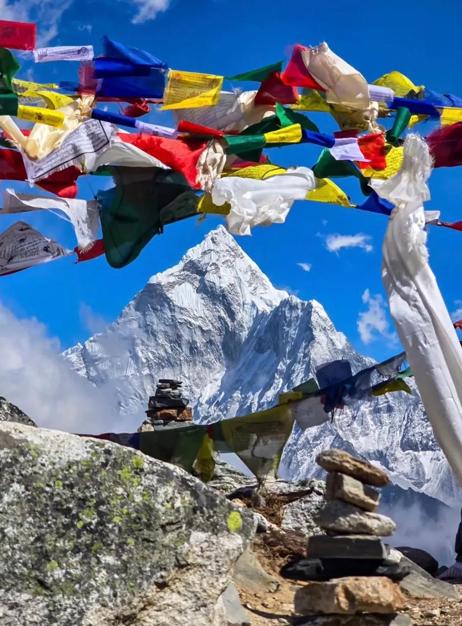
From Namche Bazaar at 3,440 m the route follows the standard EBC trail through Tengboche, Dingboche, Lobuche, and Gorak Shep to Everest Base Camp at 5,364 m. We include a full acclimatization day at Namche with a hike to the Everest View Hotel at 3,880 m, and a second acclimatization day at Dingboche with a hike to Nangkartshang Peak at 5,083 m. This is the highest acclimatization hike on the route and puts you briefly above 5,000 m three days before you visit EBC. The Khumbu Icefall comes into view on the approach to Gorak Shep: a tumbling cascade of seracs and ice blocks that has been the technical crux of every Everest expedition since 1953. EBC itself sits at the base of the icefall, a field of prayer flags and stone cairns at 5,364 m, with the sound of the glacier moving beneath the rock.
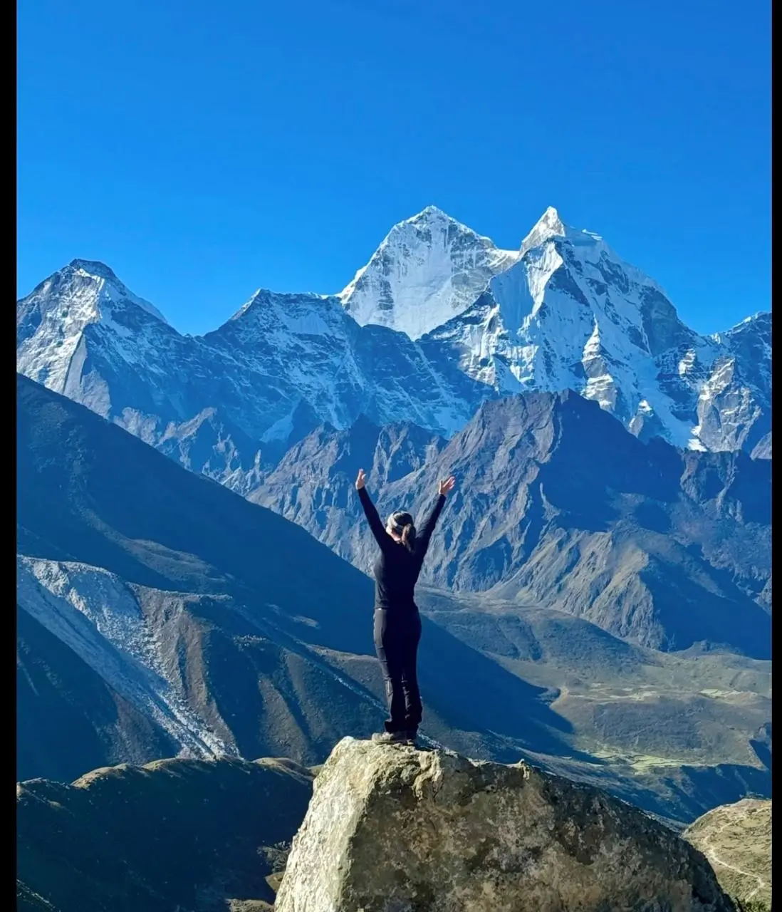
We schedule Kala Patthar at 5,545 m for the morning of Day 15, departing Gorak Shep at 4:30 a.m. to reach the summit for sunrise. Kala Patthar is the highest point of this trek and gives the most complete view of the South Face and Southwest Ridge of Everest (8,849 m) available without a climbing permit. Lhotse (8,516 m), Nuptse (7,861 m), Changtse (7,583 m), and the full sweep of the upper Khumbu glacier are visible from the summit rock on a clear October or April morning. We descend from Kala Patthar to Pheriche the same day and begin the return to Lukla over the following three days, flying back to Kathmandu on Day 19.
Best Season and What to Expect
October is the best month for this trip. Post-monsoon conditions deliver stable weather, clear skies, and firm trail surfaces between Jiri and the Khumbu that make the lower-altitude forest sections genuinely enjoyable rather than muddy. The October temperature in Junbesi at 2,675 m is typically 8 to 15°C in the day, dropping to 2 to 4°C at night. At Gorak Shep it will be minus 5 to minus 15°C at night in mid-October. April is the second season: warmer in the lower sections, with rhododendron flowers in bloom on the Lamjura Pass slopes, but with more cloud buildup in the afternoons at high altitude.
Accommodation on the Jiri section is simpler than on the standard EBC route. Teahouses in Sete and Nunthala have basic rooms with shared outdoor facilities. Hot water for washing is available on request at most places. Above Namche, accommodation returns to the standard Khumbu teahouse quality: heated common rooms, relatively comfortable beds, and improving food quality at Namche and Dingboche. We recommend budgeting NPR 200 to 400 per hot shower and NPR 100 to 300 per device charge above Namche.
Permits, Fees, and Logistics
This trek requires two permits: the Sagarmatha National Park entry permit (USD 30, issued at the park gate at Monjo) and the TIMS card (USD 10, issued in Kathmandu). The Khumbu Pasang Lhamu Rural Municipality entry fee (NPR 2,000) is collected at a checkpoint near Monjo. All three are included in our package price. There are no additional permits required for the Jiri section of the route. TIMS registration must be done in Kathmandu before departure, which we handle on Day 1 during the pre-trip briefing.
The jeep from Kathmandu to Jiri departs at approximately 6:00 a.m. The road to Jiri is a mountain highway that was built with Swiss development funding in 1985. It is paved in sections and unpaved in others. Journey time is 4 to 5 hours depending on road conditions. Jiri sits at 1,905 m in Dolakha District and has several basic guesthouses, a weekly market, and a government hospital. We spend the first night in Jiri and begin walking on Day 3.
About Our Team on This Route
Susam Suywal has been leading the Jiri to EBC route since 2012 and has completed it 18 times. He grew up in Solu Khumbu and has personal connections in several of the villages on the lower section of the trail, which means our groups get genuine hospitality rather than transactional teahouse stays. He holds a government-issued senior trekking guide license, wilderness first-aid certification, and speaks fluent English and Nepali. On this specific route, Susam’s knowledge of the lower Solu Khumbu trail conditions is a genuine logistical asset: the path between Khari Khola and Surke has two seasonal bridge crossings that require route adjustments depending on water levels, and he knows the alternative crossings from direct experience rather than map reading.
All Everest Trekking Company staff on this route are registered with the Nepal Tourism Board, insured under Nepal government regulations, and paid at rates that meet or exceed the Trekking Agencies Association of Nepal (TAAN) recommended minimums. We do not use unlicensed guides or unregistered porters on any itinerary.
2026 Update: Lukla Flights and Permit Fees
Trekkers joining Everest Trekking Company in spring 2026 (March to May) should note that Lukla flights during the peak spring season often depart from Ramechhap airport rather than Kathmandu’s Tribhuvan International Airport. Ramechhap is approximately 3 hours by road from Kathmandu. We arrange shared jeep transfers for all groups departing from Ramechhap. Autumn departures (September to November) typically fly directly from Kathmandu.
Permit fees for 2026 remain: Sagarmatha National Park entry at NPR 3,000 (approximately USD 22) per person, and the Khumbu Pasang Lhamu Rural Municipality fee at NPR 3,000 (approximately USD 22) per person. Both are included in your Everest Trekking Company package price. A TIMS card (Trekkers Information Management System) is also included at NPR 2,000 (approximately USD 15).
Highlights
- Trek the original 1953 Hillary expedition approach route from Jiri (1,905 m) to Everest Base Camp (5,364 m)
- Cross Lamjura Pass at 3,530 m on Day 4, the highest crossing on the Jiri section and the gateway to Solu Khumbu
- Visit Junbesi village (2,675 m), birthplace of Ang Rita Sherpa who summited Everest 10 times without supplemental oxygen
- Reach Kala Patthar (5,545 m) at sunrise for the most complete view of Everest (8,849 m) available without a climbing permit
- Stand at Everest Base Camp (5,364 m) at the foot of the Khumbu Icefall, the technical crux of every Everest expedition since 1953
- Superior acclimatization profile: seven walking days from 1,905 m to 3,530 m and back before entering the serious Khumbu altitude
- Walk through Solu Khumbu villages, Sete, Junbesi, Nunthala, Khari Khola, that see fewer than 200 trekkers per season
- Acclimatization hike to Nangkartshang Peak (5,083 m) above Dingboche, your first time above 5,000 m before EBC approach
- Tengboche Monastery (3,860 m) with unobstructed views of Ama Dablam (6,812 m) from the courtyard
- 20 days including two dedicated acclimatization days and a Kala Patthar sunrise, the most thorough EBC itinerary we offer
Our team meets you at Tribhuvan International Airport and transfers you to your hotel in Thamel. The afternoon is free for rest, gear checks, and acclimatizing to Kathmandu’s pace. In the evening we hold a pre-trip briefing covering the full 20-day route, permit check, emergency contact registration, and an introduction to the jeep departure time for Day 2. Kathmandu sits at 1,400 m and the warm lowland air is a useful contrast to what is coming. Sleep early, the jeep departs at 6:00 a.m.
We leave Kathmandu before dawn on the Arniko Highway, crossing the Bhote Kosi river gorge and climbing into the hills of Dolakha District. The road to Jiri was built in 1985 with Swiss development funding and remains one of the better maintained mountain roads in Nepal. It passes through Lamosangu, Charikot, and Jiri town, arriving at 1,905 m after approximately 4.5 hours. Jiri is a busy market town with a government hospital, a weekly bazaar, and the clear sense that you have left the tourist corridor behind. We check in to our teahouse, review tomorrow’s trail map with Susam, and sleep at 1,905 m.
The walk begins from Jiri’s main street, climbing immediately into the terraced farmland above town. The trail passes through Shivalaya, the first major village above Jiri, then crosses a ridge at Deurali Pass at 2,705 m before descending to Sete. The landscape is a mix of chir pine forest, millet fields, and small stone-walled farmsteads. Most trekkers you see today started their Everest journey here rather than at Lukla. Sete is a small settlement with basic teahouses. We sleep at 2,575 m, already above the standard EBC route’s starting point.
This is the most physically demanding day of the Jiri section. From Sete the trail climbs steeply through dense rhododendron and oak forest for approximately four hours, gaining over 950 m of elevation to reach Lamjura Pass at 3,530 m. This is the first time on the trip you are above 3,500 m. We stop for tea at the small shelter at the top and take in the view south toward Solu and north toward the first hints of the high Khumbu. The descent to Junbesi takes about three hours through forest and terraced fields. Junbesi at 2,675 m is one of the most historically significant Sherpa villages outside the Khumbu, birthplace of Ang Rita Sherpa, who summited Everest 10 times without supplemental oxygen between 1983 and 1996. The teahouses here are warm and well-run.
From Junbesi the trail continues through Sallung, a small Sherpa village with a gompa and yak herding grounds. The route drops into the Dudh Kosi valley system and then climbs back to Ringmo before a final descent to Nunthala. The elevation change today is significant, you lose and regain over 600 m across two ridges. Nunthala is a traditional Sherpa village at 2,020 m where the teahouses are family-run and food is cooked on wood-fired stoves. We sleep lower than the previous two nights, which is intentional and good for recovery before the next ridge crossing.
Today follows the Dudh Kosi river system through mixed Rai and Sherpa communities. The trail crosses the Dudh Kosi on a suspension bridge and climbs to Bupsa before descending again to Khari Khola village at 2,010 m. The river crossings on this section depend on seasonal water levels, in October the main crossings are straightforward, but Susam knows every alternative crossing from 14 years of leading this route. Khari Khola is a relaxed stopping point with comfortable teahouses. You are now one day’s walk from joining the main Lukla trail.
The trail from Khari Khola climbs steeply to the Kharikhola ridge and then drops to Surke at 2,290 m, where it meets the Lukla flight path for the first time, small aircraft pass overhead on their approach to the runway 30 minutes north. From Surke the trail continues along the Dudh Kosi valley to Phakding at 2,610 m. Phakding is the first night stop on the standard Lukla route. The teahouses are larger, the menus are longer, and there are groups of trekkers who flew in that morning. We have been walking for six days. The difference in physical readiness between those groups and ours is already visible.
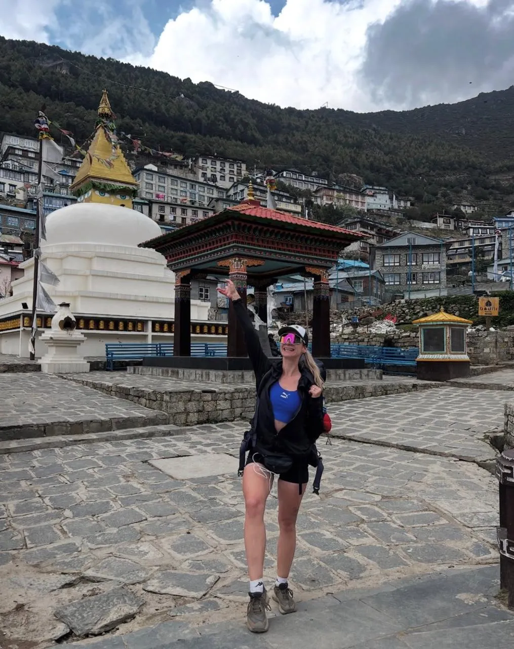
The route follows the Dudh Kosi gorge through two national park checkpoints and across a series of high suspension bridges, including the Hillary Suspension Bridge at 3,250 m. The final 45-minute climb out of the gorge to Namche is steep, but the view on arrival, Namche’s amphitheater of stone teahouses facing Kongde (6,187 m), rewards the effort. We arrive having walked for six full days from Jiri. We check in, eat a warm meal, and sleep at 3,440 m for two nights.
A full day at Namche is mandatory for safe altitude progression. We hike up to the Everest View Hotel at 3,880 m, built in 1971 and still the highest permanently staffed hotel in the world. From the terrace we get our first direct view of Everest (8,849 m), with Lhotse and Ama Dablam completing the skyline. We take tea, Susam checks SpO2 readings for everyone, and we descend to Namche for the afternoon. The Sagarmatha National Park visitor center in Namche has a strong permanent exhibition on Khumbu ecology and Everest expedition history, worth an hour in the afternoon.
The trail contours high above the Dudh Kosi valley through Sanasa and Kyangjuma with continuous views of Ama Dablam (6,812 m), Thamserku (6,618 m), and Kantega (6,685 m). We descend to the river crossing and re-ascend 400 m to Tengboche. The monastery at 3,860 m has operated since 1916, rebuilt after destruction by earthquake and fire. The late afternoon light on the courtyard with Ama Dablam directly behind it is one of the most photogenic moments on the entire EBC route.
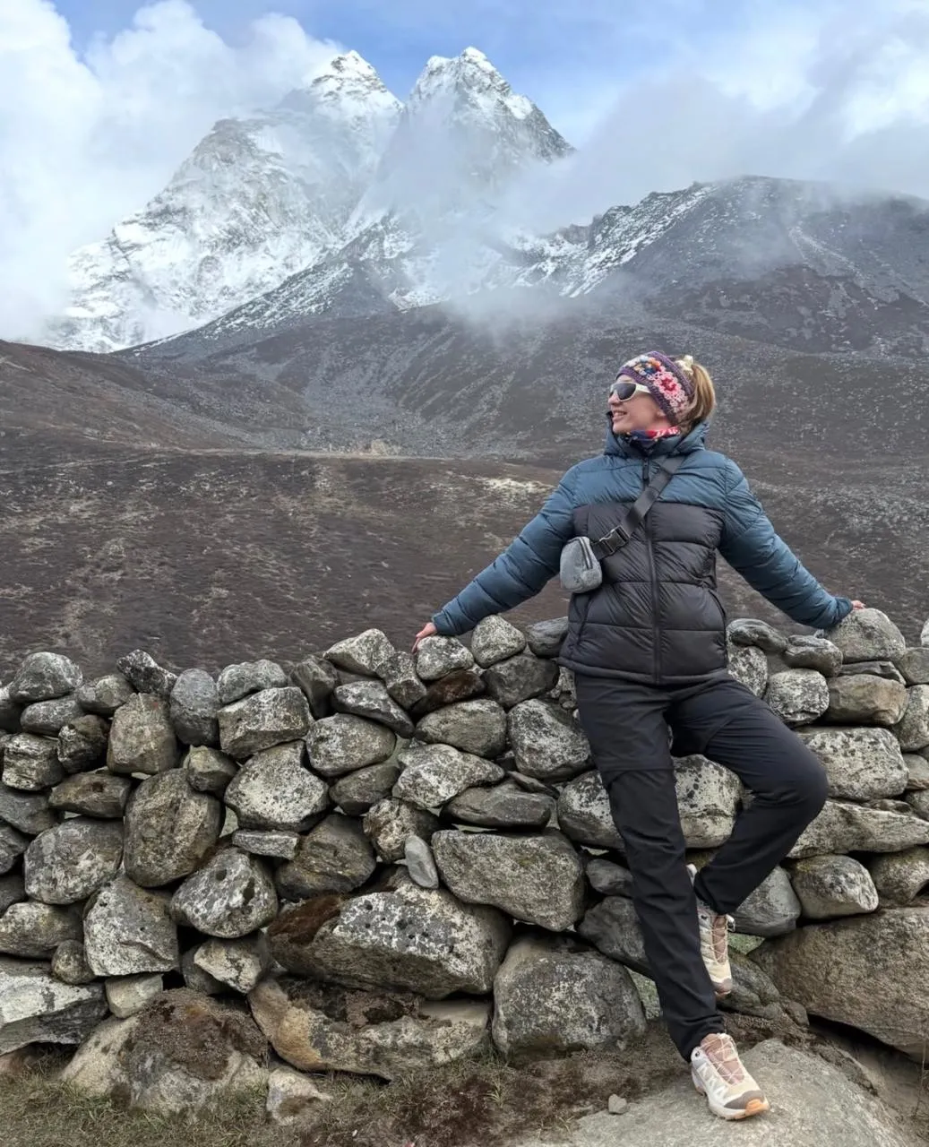
From Tengboche the trail descends to Debuche and crosses the Imja Khola before climbing through Pangboche at 3,985 m, one of the oldest inhabited Khumbu villages. The trail continues up the Imja Valley past increasingly lunar moraine terrain to Dingboche at 4,410 m. Dingboche is the last large village before the high Khumbu, with well-stocked teahouses, a medical post, and reliable solar power. We sleep here for two nights.
The hike to Nangkartshang at 5,083 m is the most important preparation day of the trip. The climb from Dingboche gains 673 m over approximately three hours, reaching a rocky summit ridge where you are above 5,000 m for the first time. The view takes in the Imja Valley, Island Peak (6,187 m), Makalu (8,485 m), and the South Face of Lhotse. The physical sensation at 5,083 m, reduced air pressure, slower breathing, the weight of altitude on your lungs, is exactly what you need to experience in a controlled setting before the EBC approach. Susam conducts SpO2 checks at the summit and again at dinner. We descend to Dingboche for a restful afternoon.
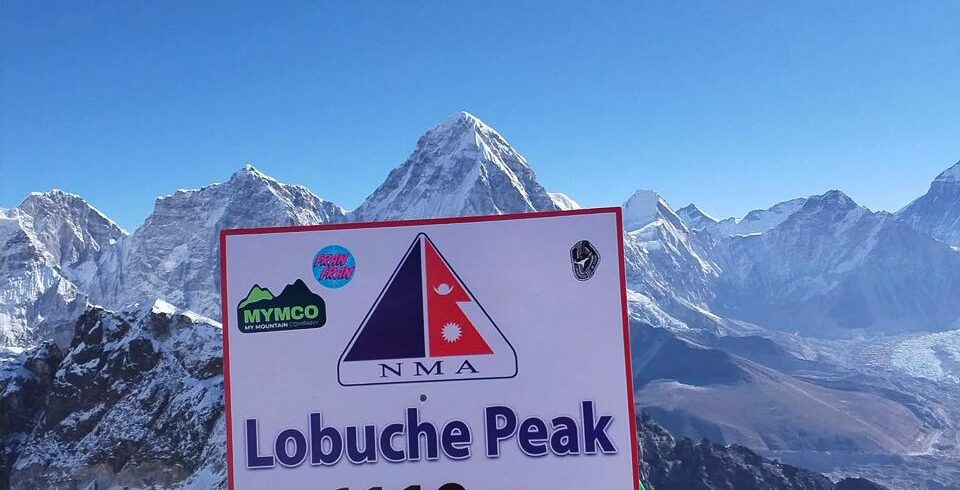
The trail crosses the lateral moraine of the Khumbu Glacier and follows the valley north to Dughla at 4,620 m. Above Dughla the path climbs steeply to the Dughla Memorial at 4,830 m, a ridge of stone cairns and prayer flags commemorating climbers who have died on Everest, including memorials for Scott Fischer, Anatoli Boukreev, and the 16 Sherpa guides killed in the 2014 Khumbu Icefall avalanche. Lobuche at 4,940 m is a cluster of teahouses on a moraine shelf facing the Lobuche Peak (6,119 m) massif. It is cold, exposed, and magnificent.
We leave Lobuche early, following the Khumbu Glacier moraine north to Gorak Shep at 5,140 m, the highest teahouse settlement on the route. We drop packs and continue across the glacier moraine for approximately 90 minutes to Everest Base Camp at 5,364 m. The route crosses glacial streams and boulder fields. Base Camp is a wide flat area of ice and rock at the foot of the Khumbu Icefall, during expedition season it holds several hundred tents, but in October it is quieter: stone cairns, sun-bleached prayer flags, and the constant low groan of the glacier moving beneath the ice. We spend 45 minutes before returning to Gorak Shep for the night.
We leave Gorak Shep at 4:30 a.m. with headlamps. The ascent of Kala Patthar gains 405 m over 90 minutes on a rocky ridge above the glacier. The air at 5,545 m holds roughly half the oxygen of sea level. We arrive at the summit cairn as the sky turns pink above the Khumbu and the first light hits the South Face of Everest (8,849 m) directly ahead. Lhotse (8,516 m), Nuptse (7,861 m), Changtse (7,583 m), and the full sweep of the Khumbu Icefall are all visible. This is the highest point of the entire trip and the finest view of Everest available without a climbing permit. We descend to Gorak Shep for breakfast, then continue down through Lobuche and Dughla to Pheriche at 4,243 m.
The descent from Pheriche back through Pangboche, Tengboche, and Debuche to Namche covers familiar trail that feels completely different on the return. The air gets noticeably richer below 4,000 m, breathing deepens and stride lengthens. We stop at Tengboche for lunch and reach Namche in the early afternoon. The bakery is open. The hot showers at Namche’s better teahouses are worth every rupee after two nights above 5,000 m.
The final walking day follows the Dudh Kosi valley south from Namche through Jorsale, Monjo, and Phakding to Lukla. The rhododendron and pine forest at lower elevations feels intensely green after 10 days above treeline. We arrive in Lukla in the late afternoon and join the informal gathering of trekkers who have all converged on this single airstrip for the morning flights out. Susam confirms the check-in time and any Lukla weather updates with our Kathmandu office.
The Lukla to Kathmandu flight is one of the most scenic 35 minutes in commercial aviation, the aircraft lifts from Lukla’s 527-metre runway and immediately enters the Dudh Kosi valley with Everest, Lhotse, and Ama Dablam visible through the right-side windows. We land at Tribhuvan Airport and transfer to the hotel. The evening is a farewell dinner with your guide and crew. This is the night to sit with what you walked: 130 kilometres from Jiri, over Lamjura Pass, through the Solu Khumbu villages, to Everest Base Camp and back.
We include a buffer day in Kathmandu for weather-related Lukla flight delays. Mountain weather in the Khumbu can ground all flights for 24 to 48 hours, particularly in October when afternoon cloud build-up closes the valley. If your Lukla flight was on schedule and you have a free day in Kathmandu, we recommend Boudhanath Stupa (15-minute taxi from Thamel), Pashupatinath Temple on the Bagmati River, or a morning visit to Bhaktapur Durbar Square. Your airport transfer for international departure is arranged for Day 20.
Our team transfers you to Tribhuvan International Airport for your international flight. The service ends at the airport drop-off. Trekkers who want to extend their time in Nepal can arrange rafting on the Trishuli River, a mountain flight for an aerial Himalayan panorama, or connections to any of our other ETC itineraries through our Kathmandu office, please let us know before Day 19 if you want to add anything after the trek.
- Airport transfers on arrival (Day 1) and departure (Day 20) in Kathmandu
- Private jeep from Kathmandu to Jiri (Day 2), approximately 4.5 hours
- 2 nights hotel accommodation in Kathmandu (3-star, twin sharing, bed and breakfast)
- Lukla to Kathmandu flight (Day 19), ticket issued in Kathmandu before departure
- 16 nights teahouse accommodation during the trek (twin sharing)
- All meals during the trek: breakfast, lunch, and dinner from Day 2 (Jiri) to Day 18 (Lukla)
- Kathmandu farewell dinner on Day 19
- Licensed government trekking guide (English-speaking, Nepal Tourism Board certified)
- One porter per two trekkers (carrying up to 25 kg per porter load)
- Sagarmatha National Park entry permit (USD 30 per person)
- TIMS card, Trekkers' Information Management System (USD 10 per person)
- Khumbu Pasang Lhamu Rural Municipality entry fee (NPR 2,000 per person)
- All government taxes and service charges
- ETC branded duffle bag (60 litres) for porter load
- First-aid kit carried by guide including altitude medication
- Pre-trip briefing in Kathmandu with route map, permit check, and emergency contact registration
- Emergency contact and helicopter evacuation coordination from our Kathmandu office
- All ETC guide and porter wages, insurance, and equipment per Nepal government regulations
- Pulse oximeter readings each morning above Namche Bazaar
- Gamow bag (portable altitude chamber) available via our Namche base for emergencies
- International flights to and from Kathmandu
- Nepal entry visa: USD 30 for 15 days, USD 50 for 30 days, available on arrival at Tribhuvan Airport
- Travel insurance: mandatory for all participants, must explicitly cover helicopter evacuation to 5,600 m
- Lunch and dinner in Kathmandu on Day 1 and Day 20
- Personal trekking gear: sleeping bag rated to minus 10°C minimum, trekking poles, headlamp
- Guide tips: recommended USD 12 to 15 per day per group; porter tips: recommended USD 8 to 10 per day per porter
- Bottled water, hot drinks, snacks, and personal purchases on trail
- Hot shower at teahouses: approximately NPR 200 to 400 per shower above Namche
- Battery and device charging at teahouses: approximately NPR 100 to 300 per charge
- Mobile data, Wi-Fi costs, and personal communication expenses on the trail
- Personal medications and altitude sickness prevention medication (Diamox if prescribed by your physician)
- Costs from early departure due to illness, personal decision, or weather-related flight cancellation
The Jiri route follows the original 1953 approach used by Hillary and Tenzing’s expedition before the Lukla airstrip existed. Practically, it gives you seven walking days before reaching Namche Bazaar, building acclimatization across multiple ridge crossings between 1,905 m and 3,530 m. Trekkers arriving via Jiri consistently have smoother altitude progression above Namche than those who flew in. You also walk through the entire Solu Khumbu region, Sete, Junbesi, Nunthala, Khari Khola, which sees fewer than 200 trekkers per season and gives a complete picture of Sherpa culture and lower Khumbu geography that the Lukla route skips entirely.
The Jiri route is significantly more demanding in total distance and duration. You walk approximately 130 kilometres over 16 walking days compared to roughly 65 kilometres over 10 to 12 walking days on the Lukla route. The Jiri section (Days 3 to 7) involves repeated ridge crossings with elevation gains and losses of 600 to 950 m per day on trails that are less maintained than the Khumbu corridor above Namche. The Lamjura Pass at 3,530 m on Day 4 is the hardest single day of the lower section. Above Namche the route is identical to the standard EBC trek. The total physical demand is higher, but the acclimatization is also significantly better, making the high-altitude section feel more manageable.
Lamjura Pass at 3,530 m is the highest point of the Jiri section and the first time on the trip you are above 3,500 m. The ascent from Sete takes approximately four hours through dense rhododendron and oak forest on a well-defined trail. It is steep and sustained but not technically difficult. In October the trail is dry and firm. In the spring season (April) the forest around the pass is in full rhododendron bloom. There is a small tea shelter at the top for a warm drink before the three-hour descent to Junbesi. Most reasonably fit trekkers find the day manageable with trekking poles and a slow, steady pace.
Below Namche, accommodation is simpler than on the standard Khumbu corridor. Teahouses in Sete and Nunthala offer basic twin rooms with shared outdoor facilities and wood-fired common rooms. Junbesi has slightly better options with attached bathrooms at some guesthouses. Khari Khola and Phakding return to standard Khumbu teahouse quality. Hot water for washing is available on request at most teahouses on the lower section. Above Namche, accommodation matches the standard EBC trek quality with heated common rooms, relatively comfortable beds, and improving food at Namche and Dingboche.
Altitude illness is always a possibility on any trek that goes above 3,000 m, but the Jiri route is specifically designed to minimize the risk through gradual elevation gain. By Day 8 when you reach Namche at 3,440 m, you have already been to 3,530 m (Lamjura Pass) and back down. This repeated ascend-descend pattern across seven days is measurably better preparation than the standard Lukla approach. We include two dedicated acclimatization days, one at Namche (with a hike to 3,880 m) and one at Dingboche (with a hike to 5,083 m), and our guide checks SpO2 readings every morning above 3,500 m. Diamox is available on prescription from your GP before departure.
You need two permits and one local fee: the TIMS card (Trekkers’ Information Management System, USD 10, processed in Kathmandu on Day 1), the Sagarmatha National Park entry permit (USD 30, issued at the park gate near Monjo on Day 8), and the Khumbu Pasang Lhamu Rural Municipality entry fee (NPR 2,000, collected at a checkpoint near Monjo). There are no additional permits for the Jiri section of the route, the lower Solu Khumbu trail is a free trekking zone. All three are included in our package price.
The jeep departs from Kathmandu at approximately 6:00 a.m. and covers approximately 188 kilometres to Jiri in 4.5 to 5 hours. The road follows the Arniko Highway east of Kathmandu through the Bhote Kosi gorge, then cuts south through Charikot in Dolakha District before the final descent to Jiri at 1,905 m. The road is a mix of paved and unpaved sections and involves significant winding mountain driving. Motion sickness tablets are recommended if you are prone to car sickness on mountain roads. The jeep is a shared vehicle, private jeep arrangements can be made at an additional cost.
October is the optimal month: stable post-monsoon weather, clear skies above Namche, and firm trail surfaces on the Jiri section that make the ridge crossings comfortable. Temperatures in Junbesi in October are 8 to 15°C during the day and 2 to 4°C at night. At Gorak Shep they drop to minus 5 to minus 15°C at night. April is the second best season with warmer lower sections and rhododendron flowers in bloom on the Lamjura Pass slopes. We avoid the monsoon season (June to August), the lower Jiri section trails become muddy and the Khumbu Glacier above Gorak Shep has elevated avalanche and rockfall risk from fresh snow loading.
This is a demanding multi-day trek requiring good cardiovascular fitness and the physical endurance to walk 5 to 7 hours per day for up to 16 consecutive days with rest days. You do not need technical climbing experience. We recommend at minimum 10 to 12 weeks of dedicated preparation before departure: hiking 3 to 4 times per week with loaded pack (8 to 10 kg), plus cardiovascular training (running, cycling, or swimming). If you have not trekked above 3,000 m before, we recommend starting with a 7 to 10 day acclimatization trek in Nepal before attempting this route. Trekkers in their 30s to 60s complete this route successfully every season, fitness level matters significantly more than age.
ETC provides one porter for every two trekkers as part of the standard package. Each porter carries a maximum of 25 kg, which includes your main duffle bag (provided by ETC, 60 litres) and the porter’s own personal gear. You carry a day pack with water, snacks, camera, rain gear, and personal items, typically 6 to 10 kg. Porters on the Jiri route are experienced on the lower section trails and work in conditions that can be significantly more demanding than the Khumbu corridor above Namche due to the steeper terrain. All ETC porters are paid at TAAN-recommended rates and are covered by government-mandated insurance.
Lukla flight cancellations due to weather are common, particularly in October when afternoon cloud build-up in the Dudh Kosi valley can close visibility. We include a buffer day (Day 19) in the Kathmandu itinerary specifically for this scenario. If your flight is delayed by one day, the buffer absorbs it with no additional cost to you. If delays extend beyond Day 19, additional Kathmandu hotel costs are at your expense, which is why travel insurance covering flight delays is strongly recommended. Our Kathmandu office maintains direct contact with the Lukla flight operators and will notify you of schedule changes in real time.
The lower Jiri section (Days 3 to 7) sees very few trekkers, estimates from Trekking Agencies Association of Nepal suggest fewer than 200 international trekkers per year complete the Jiri to Namche section compared to well over 30,000 who fly to Lukla annually. Above Namche, and particularly above Dingboche, the route merges with the standard EBC trail and encounters the same level of foot traffic. If avoiding crowds entirely is your priority, October weekdays are less congested than weekends, and the section from Lobuche to Gorak Shep is always quieter than Namche or Tengboche.
The USD 1,550 price per person includes airport transfers, jeep Kathmandu to Jiri, 2 nights hotel in Kathmandu, Lukla to Kathmandu flight, 16 nights teahouse accommodation on trek, all meals on trek (breakfast, lunch, dinner from Day 2 to Day 18), farewell dinner in Kathmandu, licensed English-speaking guide, one porter per two trekkers, all three permits (TIMS, Sagarmatha National Park, Rural Municipality fee), ETC duffle bag, first-aid kit with altitude medication, emergency evacuation coordination, and all government taxes. Not included: international flights, Nepal visa, travel insurance, personal gear, tips, and personal purchases on trail.
A licensed guide is mandatory for trekking in Sagarmatha National Park as of the Nepal government regulation effective April 2023. Beyond the legal requirement, the Jiri section of this route is genuinely more complex to navigate than the standard Khumbu trail above Lukla, there are seasonal route variations around river crossings and fewer trail signs below Phakding. All ETC groups are led by licensed senior trekking guides. Solo international trekkers who wish to join a small group departure rather than book a private trip can contact our Kathmandu office for current group departure dates and group joining rates.
Junbesi at 2,675 m is one of the most historically important Sherpa villages outside the Khumbu proper. It is the birthplace of Ang Rita Sherpa, who summited Everest 10 times without supplemental oxygen between 1983 and 1996, a record that stood for decades. The village has a central monastery, a yak cheese cooperative, and direct cultural connections to the upper Khumbu that are visible in the architecture and daily life. Nearby, at 3,040 m above the valley, sits Thubten Choling Monastery, founded in 1959 by Chatral Rinpoche and housing over 500 monks and nuns, one of the largest active Tibetan Buddhist monasteries in the Khumbu region. Neither Junbesi nor Thubten Choling is accessible on the standard Lukla route.
Essential Info for Everest Base Camp Trek from Jiri
This page covers the essential practical information for the Everest Base Camp Trek from Jiri including what makes the Jiri start different, trek difficulty, the longer fitness preparation required, permits, and briefing day information at Everest Trekking Company in Kathmandu.
Trek Difficulty and Who This Route Suits
- The EBC Trek from Jiri is rated challenging, similar to the standard EBC but with significantly greater total distance and duration at 21 to 24 days
- The Jiri to Namche section adds 7 to 10 days of walking through lower altitude terrain with daily ascents and descents across multiple ridge systems before the Khumbu section begins
- Maximum elevation is 5,645m at Kala Patthar, identical to the standard EBC route. The Jiri approach does not lower the peak altitude but significantly improves the body’s preparation for it
- This route suits experienced trekkers who want the fullest possible Himalayan experience, trekkers who are cautious about altitude sickness and want the best acclimatization profile, and trekkers with enough time (minimum 25 days including Kathmandu days) for the complete journey
- The Jiri section involves more total ascent and descent per day than the Khumbu section because the trail crosses multiple ridgelines rather than following a single valley
Group Size and Guide Ratio
- Everest Trekking Company runs the Jiri departure in groups of 2 to 10 trekkers
- A lead guide with specific Jiri route knowledge is assigned, as the lower Jiri trail has less rescue and emergency infrastructure than the Khumbu and requires a guide with strong local network connections
- One porter per 1 to 2 trekkers assigned from Jiri, with porter team adjusted at Namche if group composition changes
Physical Preparation Guide
- Begin preparation 12 to 16 weeks before departure. The Jiri route requires strong leg endurance for the repeated ascent and descent days on the lower approach section before Namche
- Train specifically for downhill sections: steep descents on the Jiri route between ridge crossings are harder on the knees than anything on the standard Khumbu trail
- Practice multi-day back-to-back hiking (minimum 5 to 6 consecutive days) before departure to build the cumulative stamina needed for a 24 day itinerary
- Upper body and core strength help significantly on the suspension bridge crossings and rocky river sections on the lower Jiri approach trail
Permits Required
- Sagarmatha National Park Entry Permit: NPR 3,000 per person, purchased at the park entry checkpoint in Monjo on the trail
- TIMS Card (Trekkers Information Management System): NPR 2,000 per person for organized group trekkers, arranged by Everest Trekking Company before departure
- Khumbu Pasang Lhamu Rural Municipality Entry Fee: NPR 2,000 per person, collected at checkpoints in the lower Khumbu
- Everest Trekking Company arranges all standard trekking permits on your behalf as part of the trip package. You do not need to visit any permit office yourself
- Passport photocopies (minimum 4 copies) are required at various checkpoints on the route. Bring printed copies from Kathmandu
Medical Requirements and Vaccinations
- No vaccinations are mandatory for entry to Nepal but Everest Trekking Company recommends being up to date on Hepatitis A, Hepatitis B, Typhoid, and Tetanus before travel
- A basic pre-trek medical check is recommended for all guests over 50 or with any history of heart, lung, or blood pressure conditions
- Inform Everest Trekking Company of any prescription medications, allergies, or medical conditions before departure so guides can be briefed and first aid kits stocked appropriately
- Travel insurance that covers helicopter evacuation above 5,000m is mandatory for all Everest Trekking Company EBC departures. Proof of insurance is checked at the pre-trek briefing
- Diabetic trekkers, trekkers with asthma, and trekkers on blood thinners should consult their doctor specifically about high altitude travel before booking
- Everest Trekking Company guides carry a first aid kit stocked with altitude medication, wound care, blister treatment, and emergency supplies on all departures
Pre-Trek Briefing Day in Kathmandu
- All Everest Trekking Company treks begin with a full briefing day in Kathmandu the day before departure
- The briefing covers the day by day itinerary, altitude sickness symptoms and protocols, equipment check, porter introduction, and permit review
- This is the day to raise any questions about gear, health, fitness, or itinerary adjustments before the trek begins
- Luggage storage at the ETC Kathmandu office is arranged on briefing day. Bring your trek bag and storage bag clearly separated and labelled
- If you need to rent or purchase any gear in Kathmandu, the briefing day allows time for a guided visit to the Thamel trekking shops with your guide
- Domestic flight or jeep transport arrangements for the following morning are confirmed and briefed on this day
Packing List for Everest Base Camp Trek from Jiri
Packing the right gear is one of the most important steps in preparing for the Everest Base Camp Trek from Jiri. Too much weight slows you down and adds unnecessary strain at altitude. Too little leaves you cold, wet, or unprepared when conditions change above 4,000m. This packing list is built from years of experience guiding trekkers through the Khumbu region and reflects exactly what Everest Trekking Company recommends every guest to carry. Items in this list are proven on the route and selected for weight, performance, and availability in Kathmandu if you prefer to buy or rent locally.
Daily Clothing
- Layered clothing system: lightweight moisture wicking base layers, thermal mid layers for warmth, and insulating outer layers for high camp nights
- Trekking pants: comfortable and quick drying synthetic fabric
- Long sleeve shirts for sun protection and short sleeve shirts for warmer lower valley sections
- Warm hat and insulated gloves for cold evenings and high altitude zones
- Waterproof hiking boots with ankle support, broken in for at least two weeks before the trek begins
- Camp shoes or light sandals for evenings inside tea houses and lodges
- Wool or synthetic hiking socks in several pairs as they dry slowly at altitude
- Neck gaiter or buff for wind protection and warmth above treeline
- Rain jacket or waterproof shell for unexpected weather at any elevation
Trekking Gear and Equipment
- Main backpack (50 to 60 liters) carried by your Everest Trekking Company porter, plus a day pack (20 to 25 liters) you carry yourself
- Trekking poles: very helpful for steep descents and river crossings throughout the Khumbu
- Sleeping bag rated to at least minus 15 degrees Celsius for cold nights at higher elevations
- Reusable insulated water bottle or hydration bladder, minimum 1 liter capacity
- Headlamp with spare batteries for early morning starts and lodge evenings with unreliable power
- Power bank with at least 20,000mAh capacity for charging camera, phone, and GPS between lodges
- Sunglasses with UV400 protection and side shields for intense high altitude sun and glacier glare
- Lightweight dry bags or waterproof pack liner to protect gear from rain and river crossings
- Gaiters for deep snow sections on the upper route above Dingboche in early or late season
Clothing and Garment Checklist
| Item | Details | Quantity |
|---|---|---|
| Underwear | Breathable synthetic, moisture wicking | 4 |
| Trekking socks | Wool or synthetic, thick hiking grade | 3 pairs |
| Liner socks | Thin synthetic liner for inside hiking socks | 2 pairs |
| Sports bra (if applicable) | Synthetic, supportive | 3 |
| Base layer pants | Merino wool or synthetic thermal | 1 |
| Base layer top | Merino wool long sleeve thermal | 2 |
| Trekking shirts | Synthetic lightweight, mix of long and short sleeve | 3 |
| Trekking pants | Synthetic quick drying, available to buy in Kathmandu | 2 |
| Rain pants | Lightweight waterproof and packable | 1 |
| Fleece or mid layer jacket | 100 to 200 weight fleece for layering under shell | 1 |
| Down jacket | 700 fill power or higher, required above 4,000m | 1 |
| Windbreaker or shell jacket | Waterproof, breathable, lightweight | 1 |
| Hiking boots | Waterproof with ankle support, broken in before trek | 1 pair |
| Camp shoes | Lightweight sandals or sneakers for lodge evenings | 1 pair |
| Thin gloves | Merino wool liner gloves | 1 pair |
| Insulated gloves | Waterproof outer shell with warm insulation inside | 1 pair |
| Sun hat or cap | Wide brim with neck protection for lower valleys | 1 |
| Warm beanie | Wool or fleece for high altitude camps | 1 |
| Neck gaiter or buff | Fleece lined for cold and wind above 4,000m | 1 |
Hygiene and Safety Items
- Biodegradable soap, shampoo, and personal hygiene products in small travel sizes
- Toothbrush and toothpaste
- High SPF sunscreen (SPF 50 or above) for intense UV exposure at altitude where sun is significantly stronger than at sea level
- Lip balm with SPF to prevent cracking in cold and dry high altitude air
- Insect repellent for the warmer lower sections of the trek below 3,000m in the monsoon adjacent seasons
- Personal first aid kit including blister treatment, antiseptic wipes, bandages, and all prescription medications
- Altitude medication if prescribed by your doctor: Diamox (Acetazolamide), ibuprofen, and paracetamol
- Water purification tablets or UV pen for treating water at remote tea houses above Namche
- Wet wipes and hand sanitizer for hygiene on days between shower access
- Small microfiber travel towel for lodges that do not provide them
Electronics and Documents
- Mobile phone with offline maps of the Khumbu region downloaded before leaving Kathmandu
- Camera and spare memory cards (most trekkers find a phone camera sufficient)
- Universal power adapter (Nepal uses Type C and Type D sockets in most tea houses)
- Power bank with at least 20,000mAh for multiple days of charging between reliable power sources
- Copies of your passport, travel insurance policy, and TIMS card and Sagarmatha National Park permit
- Emergency contact numbers including the Everest Trekking Company Kathmandu base operations number saved to your phone
- Travel insurance documents with your 24 hour emergency assistance number accessible offline
Equipment Rental and Purchase in Kathmandu
- Sleeping bags rated to minus 15 degrees Celsius are available for rent in Thamel, Kathmandu at reasonable daily rates
- Down jackets can be rented or purchased affordably from Thamel trekking shops
- Trekking poles and gaiters are available for rent or low cost purchase in Kathmandu
- Basic trekking clothing including pants, thermals, and base layers can all be found in Kathmandu at good quality and low cost
- Everest Trekking Company will help all guests source and rent any essential equipment they need during the pre-trek briefing day in Kathmandu before departure
Travel Note for Everest Base Camp Trek from Jiri
The Everest Base Camp Trek from Jiri is the original EBC approach route used by Sir Edmund Hillary and Tenzing Norgay in 1953 and offers the best natural acclimatization profile of any ETC EBC departure. This guide from Everest Trekking Company covers the unique practical requirements of this longer overland route.
What Makes the EBC Trek from Jiri Different
- This route starts from Jiri at 1,905m with an overland jeep drive from Kathmandu rather than a domestic flight to Lukla, completely eliminating Lukla weather delay risk
- The overland approach adds 7 to 10 days of gradual altitude gain before reaching Namche Bazaar, giving the body significantly more preparation time than the Lukla fly-in route
- Statistically lower rates of AMS in the first week compared to the standard route because of the gentler gradient from Jiri to Namche over multiple days
- The lower trail from Jiri to Namche passes through non-touristy hill villages including Sete, Junbesi, and Ringmo that are rarely seen by modern trekkers who fly directly to Lukla
- This is the route used by almost all serious Everest expeditions from the 1950s through to the 1980s before the Lukla airstrip was built
- The total itinerary is typically 21 to 24 days making this the longest standard EBC departure in the ETC portfolio
- Recommended for trekkers who want the most thorough and authentic Himalayan trekking experience and who have the time to do the route properly
Cultural Highlights on the EBC from Jiri Route
- Junbesi Monastery near Junbesi village is one of the most beautiful and historically significant monasteries in the entire Solu Khumbu region and is rarely visited by modern trekkers who fly to Lukla
- Thupten Choling Monastery near Junbesi is a large and active monastery community with resident monks and nuns, founded by a former abbot of Tengboche
- Salleri, Ringmo, and Junbesi are traditional Sherpa and Rai villages where life continues very much as it did before the trekking industry arrived in the Khumbu
- The Jiri to Namche section of the trail crosses multiple ridge systems with traditional stone and wood villages, terraced farming, and local market days that have nothing to do with the EBC trekking industry
- Tengboche Monastery and Namche Bazaar are both on this route in the Khumbu section and remain the cultural centrepieces of the upper part of the journey
- The Hillary School in Khumjung, founded with funds raised partly from the early Everest expeditions that departed from Jiri, connects directly to the history of this route
Things Not to Do on the EBC Trek from Jiri
- Do not rush the Jiri to Namche section trying to reach Namche faster than the itinerary allows. The slow ascent is the primary safety and acclimatization advantage of this route and using it fully is the whole point
- Do not book this route if you cannot commit to the full 21 to 24 day itinerary. Cutting the Jiri section short to save time defeats the acclimatization purpose of choosing this departure
- Do not skip visits to Junbesi Monastery and Thupten Choling on the lower section. These are the most culturally significant stops on the Jiri route and are not on any other ETC itinerary
- Do not underestimate the road drive from Kathmandu to Jiri. The 7 to 9 hour journey on mountain roads is tiring and an early night before the departure day is strongly recommended
- Do not assume the better acclimatization of the Jiri approach removes high altitude risk above Dingboche. From 4,360m upward the risks are identical to the standard EBC route
- Do not book this route in monsoon season (June to August). The Jiri road and the lower trail between Jiri and Namche are both significantly affected by rain, landslides, and leeches
- Do not ascend more than 300 to 500 meters sleeping altitude per day above 3,000m even with the better acclimatization of the approach
- Do not trek without helicopter evacuation insurance above 5,000m
Nepal Visa Information
- Nepal visa on arrival is available to citizens of most countries at Tribhuvan International Airport in Kathmandu
- Fees: USD 30 for 15 days, USD 50 for 30 days, USD 125 for 90 days, payable in cash in USD, EUR, or GBP at the airport counter
- Bring one passport size photo, a completed immigration form, and a passport with at least 6 months validity
- Pre register at nepalimmigration.gov.np before departure to save time at immigration on arrival
- Visa extensions available at the Department of Immigration in Maitighar, Kathmandu if the trek takes longer than planned
- Everest Trekking Company recommends a 30 day visa for most EBC itineraries to cover weather delay buffer time
International Flights to Kathmandu
- Kathmandu airport code is KTM (Tribhuvan International Airport), 6 kilometers from the Thamel trekking district
- From USA (New York, Los Angeles): connect via Doha on Qatar Airways, Dubai on Emirates, or Delhi on Air India, total 18 to 24 hours
- From Europe (London, Frankfurt, Amsterdam): connect via Doha, Dubai, or Istanbul where Turkish Airlines flies direct to KTM, total 12 to 16 hours
- From Australia (Sydney, Melbourne): connect via Singapore, Kuala Lumpur, or Bangkok, total 14 to 18 hours
- Book at least 6 to 8 weeks ahead for spring (March to May) and autumn (September to November) as peak season flights sell fast
- Arrive in Kathmandu at least one full day before your Everest Trekking Company pre-trek briefing to recover from long haul travel
Getting to Jiri from Kathmandu
- The Jiri route begins with a 7 to 9 hour jeep drive from Kathmandu to Jiri at 1,905m, approximately 180 kilometers east of the capital
- Everest Trekking Company arranges comfortable jeep transport directly from your Kathmandu hotel to Jiri on trek day one
- No domestic flight is needed, which eliminates Lukla weather delay risk entirely and saves the cost of two domestic flights
- The road passes through Lamosangu and Charikot with views of the Himalayan foothills throughout
- Bring snacks and water for the road journey as food stops on the Jiri highway are limited
Porter Weight Limits and Day Pack Guide
- Your Everest Trekking Company porter carries your main bag at a maximum of 20kg including the bag weight
- You carry your own day pack (5 to 8kg): water, snacks, rain jacket, camera, headlamp, sunscreen, medication, one warm layer
- All ETC porters receive proper trekking gear, rain equipment, warm jackets, and altitude insurance coverage
- Recommended porter tip: USD 8 to 10 per day, paid in cash at the end of the trek
Free Luggage Storage at Everest Trekking Company Office
- Leave your city clothes, laptop, extra shoes, and anything not needed on the trail at our Kathmandu office at no charge
- Your bags are stored securely and ready for collection on your return from the mountains
- Pack your trek bag and storage bag separately at home so handover on briefing day is quick
- Full storage instructions are given during your pre-trek briefing day in Kathmandu
Money, ATMs and Daily Budget
- ATMs available in Kathmandu (Thamel) and Namche Bazaar (3,440m) only before the high route
- Carry sufficient Nepali Rupees in cash from Namche upward. Most tea houses above Phakding do not accept cards
- Budget NPR 3,500 to 5,000 per day above Namche for accommodation, three meals, and incidentals
- Hot showers: NPR 200 to 500 extra. Wifi: NPR 200 to 500 per hour. Device charging: NPR 100 to 300 above Namche
- Lead guide tip recommendation: USD 15 to 20 per day paid in cash at trek end
Connectivity and SIM Cards
- Buy an Ncell SIM at Kathmandu airport or in Thamel. Bring your passport to register it
- 4G data works well in Kathmandu, Lukla, Namche, and Dingboche. Signal becomes patchy above Dingboche
- Download offline maps on Maps.me or Gaia GPS before leaving Kathmandu
- Tea house wifi above Namche is slow and charged separately. At Gorakshep it is satellite only and very unreliable
- Everest Trekking Company guides carry satellite phones and maintain daily contact with Kathmandu base operations
Altitude Sickness
The Everest Base Camp Trek from Jiri offers the best natural acclimatization of all ETC EBC departure options. The overland journey from Jiri at 1,905m adds 7 to 10 days of gradual altitude gain before reaching Namche Bazaar at 3,440m, compared to trekkers who fly directly to Lukla at 2,860m. This slower approach means the body is significantly better prepared when it arrives at the high altitude sections of the route. However, altitude sickness risk from Dingboche upward is identical to the standard EBC trek, and Everest Trekking Company applies the same rigorous SpO2 monitoring and AMS protocols above 4,000m on the Jiri route as it does on all nine of its EBC departures.
What Everest Trekking Company Guides Always Carry for Altitude Safety
- Portable oxygen cylinder: Every Everest Trekking Company guide carries supplemental oxygen above 4,000m and knows exactly when and how to administer it
- Calibrated pulse oximeter (SpO2 monitor): Used to measure blood oxygen saturation at every major stop and every morning and evening camp check
- Complete first aid kit: Stocked with altitude medicines, wound care, blister treatment, antiseptic, bandages, and emergency essentials
- Diamox (Acetazolamide): Carried for both prevention and treatment of acute mountain sickness and dispensed under guide supervision when indicated
- Dexamethasone: Emergency steroid for severe High Altitude Cerebral Edema (HACE), administered while rescue is being arranged
- Nifedipine: Emergency medication for High Altitude Pulmonary Edema (HAPE), reduces lung vessel pressure rapidly
- Gamow bag (portable altitude chamber): Available through Everest Trekking Company logistics network at key high altitude points, simulates a descent of 1,500m when helicopter rescue is delayed
- Satellite phone and radio: For direct contact with Everest Trekking Company Kathmandu base operations and certified helicopter rescue teams at any point on the route
What is Altitude Sickness?
- Altitude sickness, also called Acute Mountain Sickness (AMS), is the body’s reaction to reduced oxygen levels at high elevation
- At sea level, air contains about 21 percent oxygen at normal atmospheric pressure
- As you gain elevation, air pressure drops and each breath delivers less oxygen to your blood and organs
- At 3,440m (Namche Bazaar), oxygen availability is roughly 67 percent of what it is at sea level
- At 5,364m (Everest Base Camp), each breath delivers only about 50 percent of the oxygen you would get at sea level
- The human body needs time to produce more red blood cells and adapt to this lower oxygen environment
- When you ascend faster than your body can adjust, altitude sickness occurs
- Anyone can get altitude sickness regardless of fitness level, age, or previous trekking experience
- Being physically fit does not protect you from altitude sickness and does not speed up acclimatization
- Experienced trekkers who have had no issues before can be affected on a new trip
Why Does Altitude Sickness Happen?
- Lower air pressure at altitude means less oxygen enters the lungs with each breath
- Your blood carries less oxygen to vital organs including the brain, heart, and muscles
- The brain is particularly sensitive to reduced oxygen
- When oxygen levels drop too fast, blood vessels in the brain can leak fluid, causing swelling inside the skull
- Fluid can also build up inside the lungs in more severe cases, a condition called HAPE
- The body responds by breathing faster and increasing heart rate trying to compensate for the lower oxygen
- This compensation process takes days and sometimes up to two weeks to fully complete at each new altitude
- Dehydration at altitude makes the situation worse because blood becomes thicker and circulates less efficiently
- Cold, dry mountain air causes faster fluid loss through breathing than you would expect
- Poor sleep at altitude also slows the acclimatization process, which is why nights are often the hardest time
- Alcohol, strong sedatives, and sleeping pills suppress breathing and reduce blood oxygen during sleep, making acclimatization slower
When Does Altitude Sickness Start?
- Mild symptoms can begin as low as 2,500m in some people
- Most trekkers first notice symptoms around Namche Bazaar at 3,440m, usually on the evening of arrival or the following morning
- Symptoms typically appear 6 to 12 hours after arriving at a new elevation
- Symptoms often feel worse during the night and early morning hours when breathing naturally slows during sleep
- The risk increases significantly above 4,000m
- Dingboche at 4,360m and Lobuche at 4,940m are the zones where moderate to severe AMS becomes most likely on the EBC route
- On the standard itinerary, the greatest risk nights are those spent at Dingboche, Lobuche, and Gorakshep
- Even trekkers with no previous history of AMS can be affected on any given trip
- Speed of ascent is the most important factor. The faster you go up, the higher your risk
- People who have had AMS before are not necessarily more at risk, and those who have never had it are not necessarily protected
Altitude Risk Points on the Everest Base Camp Trek from Jiri
- Jiri (1,905m): Lowest starting point of any ETC trek, the body begins adjusting from day one without the altitude shock of flying to Lukla
- Sete (2,575m): First overnight above 2,500m, very low risk but acclimatization begins here
- Junbesi (2,675m): Gentle altitude progression continues through the lower Solu Khumbu region
- Ringmo (2,890m): Entering the zone where mild symptoms become possible for sensitive trekkers
- Namche Bazaar (3,440m): Reached after many more days of gradual ascent than the fly-in EBC route, most Jiri trekkers arrive here feeling noticeably better prepared
- Dingboche (4,360m): Despite the excellent approach acclimatization, the high altitude risk from this point onward is identical to the standard EBC route
- Lobuche (4,940m) and Gorakshep (5,140m): Same challenges as any other EBC route from here up
- The Jiri approach reduces but does not eliminate altitude sickness risk on the upper route
- Everest Trekking Company applies full monitoring protocols from Namche upward on the Jiri departure and the longer trek schedule allows extra rest days if any trekker needs more acclimatization time
Symptoms of Altitude Sickness: Mild AMS
- Headache, often described as a dull pressure at the front or sides of the head
- Fatigue and general tiredness not explained by the day’s walking distance or effort
- Loss of appetite, especially for heavy or oily foods
- Nausea, sometimes with mild vomiting in the evenings
- Difficulty sleeping or very light, broken sleep with frequent waking
- Dizziness when standing up or changing position quickly
- Slight shortness of breath after minor exertion such as walking up stairs or a short slope
- A feeling of general unwellness that is hard to describe specifically
- Mild swelling of fingers noticed when removing rings or tightening watch straps
Symptoms of Altitude Sickness: Moderate AMS
- Persistent and worsening headache that does not improve with paracetamol or ibuprofen
- Significant nausea and repeated vomiting making it hard to keep fluids or medication down
- Severe fatigue where basic tasks like getting dressed or walking to the toilet feel exhausting
- Difficulty walking in a straight line, similar to the feeling of being off balance
- Shortness of breath that occurs even at rest, not just during activity
- Reduced urine output and noticeably dark yellow urine despite drinking fluids
- Visible swelling of the face, hands, or feet
- Dry cough that becomes more persistent through the day and night
- Inability to concentrate or follow simple conversation
- A worsening score on the Lake Louise AMS Assessment used by our guides
Symptoms of Altitude Sickness: Severe AMS, HACE and HAPE
- High Altitude Cerebral Edema (HACE) is swelling of the brain caused by fluid leaking from blood vessels at extreme altitude
- HACE symptoms include severe confusion, disorientation, and irrational behavior
- Loss of coordination and inability to walk without support are key warning signs of HACE
- Slurred speech and extreme drowsiness are serious signs that demand immediate action
- Severe headache that does not reduce with any medication is a red flag for HACE
- Loss of consciousness can occur in advanced cases if descent is delayed
- High Altitude Pulmonary Edema (HAPE) is the buildup of fluid inside the lungs and is the leading cause of death from altitude sickness
- HAPE symptoms begin with a persistent dry cough that progresses to producing pink or frothy mucus
- Extreme breathlessness even when lying still is the hallmark symptom of HAPE
- A crackling or gurgling sound can sometimes be heard in the chest when breathing
- Rapid heart rate, blue lips, and blue fingertips (cyanosis) indicate dangerous oxygen deprivation from HAPE
- Both HACE and HAPE require immediate descent of at least 500 to 1,000 meters along with emergency medication
How to Prevent Altitude Sickness
- Ascend slowly. Never gain more than 300 to 500 meters of sleeping altitude per day above 3,000m
- Follow the climb high, sleep low rule. Hike higher during the day but return to lower elevation to sleep
- Take all acclimatization rest days on your itinerary seriously. The ETC itinerary includes mandatory rest days at Namche and Dingboche for this reason
- Stay well hydrated. Drink 3 to 4 liters of clean water per day throughout the trek, more on heavy walking days
- Avoid alcohol during the first 2 to 3 days at each new altitude zone
- Avoid sleeping pills and strong sedatives above 3,000m as they suppress breathing during sleep
- Eat well even when your appetite is low. Small, frequent meals are easier to manage than large ones
- Avoid flying directly to high altitude without a gradual approach schedule
- Monitor urine color throughout the day. Pale yellow means you are well hydrated. Dark yellow means drink more
- Walk at a slow, steady pace. You should be able to hold a normal conversation while trekking without getting out of breath
- Rest as soon as you feel any symptoms rather than pushing on hoping they will pass
Medication for Altitude Sickness Prevention and Treatment
- Diamox (Acetazolamide) is the most widely used medication for altitude sickness prevention
- It works by stimulating faster and deeper breathing, which increases blood oxygen levels throughout the day and night
- Standard preventive dose is 125mg to 250mg twice daily, starting 24 hours before ascending to a new high altitude zone
- Common side effects include tingling in the fingers and toes, increased urination, and a strange taste with carbonated drinks
- Diamox is a sulfa family drug and must be avoided by anyone with sulfa drug allergy or aspirin sensitivity
- Always consult a doctor before starting Diamox as it requires a prescription in most countries
- Diamox does not mask symptoms. It genuinely helps the body acclimatize faster, unlike pain medication alone
- Ibuprofen 400mg every 8 hours has been shown in multiple clinical studies to reduce both headache and mild AMS severity
- Dexamethasone is a steroid used for emergency treatment of severe HACE and reduces brain swelling rapidly but is not a substitute for descent
- Nifedipine is used in emergency treatment of HAPE and reduces blood pressure in the lung vessels
- Everest Trekking Company guides carry Diamox, Dexamethasone, and Nifedipine on every trek above 3,000m
How Everest Trekking Company Monitors and Manages Altitude Sickness
- Every Everest Trekking Company guide is trained and certified in Wilderness First Aid including altitude illness management protocols
- All guides carry calibrated pulse oximeters to measure blood oxygen saturation (SpO2) at every stop and campsite
- A reading above 90 percent SpO2 is generally acceptable. A reading below 85 percent triggers immediate evaluation and action
- We carry emergency Diamox, Dexamethasone, Nifedipine, and supplemental oxygen cylinders in the first aid kit on every trek
- Portable altitude chambers (Gamow bags) are available through our logistics network at key high altitude points
- Every guest is given a full briefing on AMS symptoms, warning signs, and our response plan on day one before the trek begins
- We run a formal health check and SpO2 assessment at Namche Bazaar and again at Dingboche
- Our itinerary is built with safety buffer days so no trekker is ever pressured to push on when they are not feeling well
- Guides check SpO2 readings of every trekker each morning and evening and record the results
- Any reading that drops 10 or more percent compared to a trekker’s baseline triggers immediate investigation and close monitoring
- We use the Lake Louise Scoring System to objectively assess AMS severity rather than relying only on trekker self-reporting
- Guests showing even mild symptoms receive reduced activity, extra rest, increased fluids, and hourly monitoring
- No trekker is allowed to ascend further if they have a moderate or severe AMS score until the guide is satisfied they have recovered fully
Rescue Process When Altitude Sickness Becomes Serious
- If a trekker cannot descend safely on foot, our guide contacts Everest Trekking Company base operations in Kathmandu immediately via satellite phone or radio
- We work with certified helicopter rescue operators based in Lukla and Kathmandu with proven experience in high altitude rescue
- Rescue helicopters can reach most points on the EBC route within 30 to 90 minutes depending on weather and light conditions
- Our team contacts the helicopter company directly to avoid any delay in communication or response
- The helicopter lands at the nearest safe landing zone such as Pheriche, Dingboche, Namche, or Lobuche depending on where the guest is located
- While waiting for the helicopter, the guide administers emergency medication, Dexamethasone for HACE or Nifedipine for HAPE
- Supplemental oxygen is administered immediately if available from the local lodge or our kit
- If the helicopter is delayed more than 20 minutes and conditions are severe, the Gamow bag is inflated and the trekker placed inside
- A Gamow bag simulates a descent of approximately 1,500 meters by increasing the air pressure inside the sealed bag, giving immediate relief
- The trekker is kept warm, monitored continuously, and given small sips of fluid if conscious and able to swallow safely
- A guide or porter accompanies the trekker to the helicopter and if possible all the way to the hospital in Kathmandu
- Our Kathmandu operations team meets the helicopter and coordinates handover to hospital medical staff
- Full health records from the trek including SpO2 logs, symptom timeline, and medications given are provided to the hospital team
- Everest Trekking Company contacts the trekker’s emergency contact and travel insurance company as soon as evacuation is confirmed
- We assist with all insurance documentation and stay in contact with the trekker and their family through the full recovery process
Travel Insurance and Financial Preparation for Altitude Rescue
- Every trekker joining an Everest Trekking Company trip is required to carry travel insurance that covers helicopter evacuation above 5,000m
- Rescue helicopter flights typically cost between USD 3,000 and USD 6,000 per flight depending on the pick up location and operator
- Hospital treatment costs in Kathmandu vary depending on the severity of the illness and length of stay
- Our team helps coordinate insurance claims and provides all documentation required by the insurer
- Never attempt the Everest region without verified helicopter evacuation cover in your travel insurance policy
- Check that your policy specifically states coverage above 5,000m as many standard adventure policies have elevation limits of 4,000m or 4,500m
- Save your insurance policy number and the insurer’s 24 hour emergency number in your phone before the trek begins
- Everest Trekking Company can recommend verified travel insurance providers if you need guidance before booking your trek
Accommodation and Food
Kathmandu | Hotel Options
- Hotel Moonlight
- Hotel Cozy Heaven
- Hotel Surya Heritage
- Hotel Devine Kathmandu
- Attached bathroom with hot shower
- Clean bed sheets
- Electric sockets and wifi
- Coffee machine
- Full restaurant menu: Nepali, continental, Indian, Chinese dishes
- City-quality food and service
Jiri (1,905m) | Best available guesthouse at Jiri
- Attached bathroom, upgraded facility with hot shower
- Clean bed sheets changed for each guest
- Electric sockets for charging
- Wifi available
- Coffee machine
- Enough bathrooms, well maintained
- Full food menu: dal bhat, momo, pasta, pizza, eggs, soup, hot drinks and more
- City-quality food variety and portion size
- Oxygen cylinder on site
Sete (2,575m) | Best available teahouse at Sete
- Shared bathroom facilities, hot shower available
- Clean bed sheets changed for each guest
- Electric sockets for charging
- Wifi available
- Coffee machine
- Enough bathrooms, well maintained
- Full food menu: dal bhat, soup, eggs, noodles, hot drinks
- City-quality food variety and portion size
- Oxygen cylinder on site
Junbesi (2,675m) | Junbesi Guest House
- Attached bathroom, upgraded facility with hot shower
- Clean bed sheets changed for each guest
- Electric sockets for charging
- Wifi available
- Coffee machine
- Enough bathrooms, well maintained
- Full food menu: dal bhat, momo, pasta, pizza, eggs, soup, hot drinks and more
- City-quality food variety and portion size
- Oxygen cylinder on site
Nunthala (2,020m) | Best available teahouse at Nunthala
- Shared bathroom facilities, hot shower available
- Clean bed sheets changed for each guest
- Electric sockets for charging
- Wifi available
- Coffee machine
- Enough bathrooms, well maintained
- Full food menu: dal bhat, soup, eggs, noodles, hot drinks
- City-quality food variety and portion size
- Oxygen cylinder on site
Khari Khola (2,010m) | Best available teahouse at Khari Khola
- Shared bathroom facilities, hot shower available
- Clean bed sheets changed for each guest
- Electric sockets for charging
- Wifi available
- Coffee machine
- Enough bathrooms, well maintained
- Full food menu: dal bhat, soup, eggs, noodles, hot drinks
- City-quality food variety and portion size
- Oxygen cylinder on site
Phakding (2,610m) | Hotel Pine Forest
- Attached bathroom, upgraded facility with hot shower
- Clean bed sheets changed for each guest
- Electric sockets for charging
- Wifi available
- Coffee machine
- Enough bathrooms, well maintained
- Full food menu: dal bhat, momo, pasta, pizza, eggs, soup, hot drinks and more
- City-quality food variety and portion size
- Oxygen cylinder on site
Namche Bazaar (3,440m) | Hotel 8848
- Attached bathroom, upgraded facility with hot shower
- Clean bed sheets changed for each guest
- Electric sockets for charging
- Wifi available
- Coffee machine
- Enough bathrooms, well maintained
- Full food menu: pizza, pasta, steak, yak burger, dal bhat, momo, soup, sandwich, cake, espresso coffee
- City-quality food variety and portion size
- Oxygen cylinder on site
Tengboche (3,860m) | Hotel Himalaya / Hotel Good Luck
- Attached bathroom, upgraded facility with hot shower
- Clean bed sheets changed for each guest
- Electric sockets for charging
- Wifi available
- Coffee machine
- Enough bathrooms, well maintained
- Full food menu: dal bhat, momo, pasta, pizza, eggs, soup, hot drinks and more
- City-quality food variety and portion size
- Oxygen cylinder on site
Dingboche (4,410m) | Hotel Good Luck
- Attached bathroom, upgraded facility with hot shower
- Clean bed sheets changed for each guest
- Electric sockets for charging
- Wifi available
- Coffee machine
- Enough bathrooms, well maintained
- Full food menu: dal bhat, momo, pasta, pizza, eggs, soup, hot drinks and more
- City-quality food variety and portion size
- Oxygen cylinder on site
Lobuche (4,940m) | Hotel Altitude Home
- Attached bathroom, upgraded facility with hot shower
- Clean bed sheets changed for each guest
- Electric sockets for charging
- Wifi available
- Coffee machine
- Enough bathrooms, well maintained
- Full food menu: dal bhat, momo, pasta, pizza, eggs, soup, hot drinks and more
- City-quality food variety and portion size
- Oxygen cylinder on site
Gorakshep (5,164m) | Hotel Himalaya
- Shared bathroom facilities, hot shower available
- Clean bed sheets changed for each guest
- Electric sockets for charging
- Wifi available
- Coffee machine
- Enough bathrooms, well maintained
- Full food menu: dal bhat, soup, noodles, pasta, eggs, hot drinks
- City-quality food variety and portion size
- Oxygen cylinder on site
Pheriche (4,371m) | Everest Trekkers Hotel
- Attached bathroom, upgraded facility with hot shower
- Clean bed sheets changed for each guest
- Electric sockets for charging
- Wifi available
- Coffee machine
- Enough bathrooms, well maintained
- Full food menu: soup, dal bhat, pasta, momo, noodles, egg dishes, pizza, drinks
- City-quality food variety and portion size
- Oxygen cylinder on site
Namche Bazaar (3,440m) | Hotel 8848
- Attached bathroom, upgraded facility with hot shower
- Clean bed sheets changed for each guest
- Electric sockets for charging
- Wifi available
- Coffee machine
- Enough bathrooms, well maintained
- Full food menu: pizza, pasta, steak, yak burger, dal bhat, momo, soup, sandwich, cake, espresso coffee
- City-quality food variety and portion size
- Oxygen cylinder on site
Write a Review